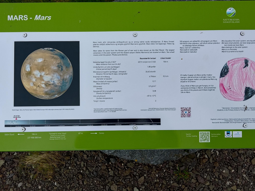
Earlier, I read a comment from my sister-in-law, Aileen Adams. She wrote: Thank you for the map. It helps to put things in perpective.
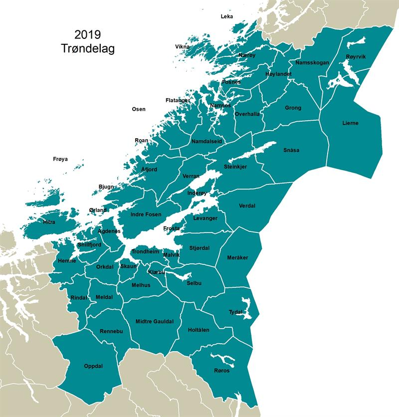
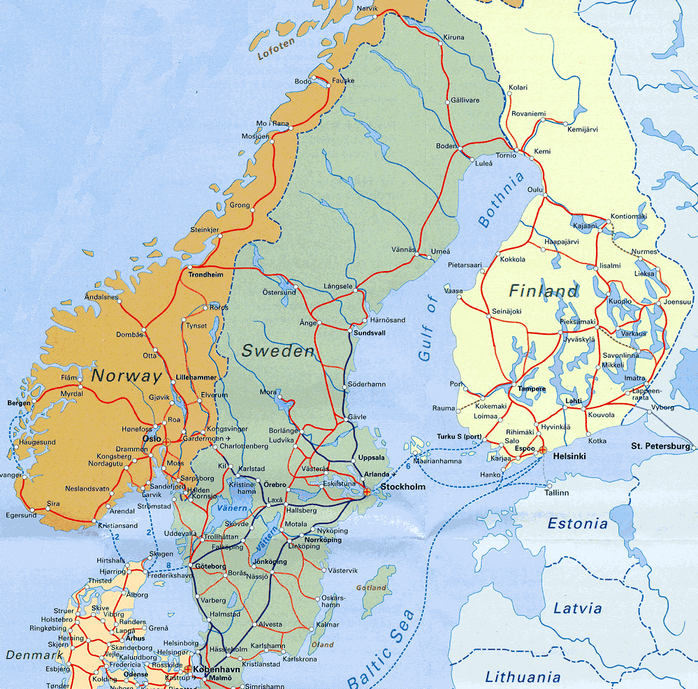
I thought I could be more informative about Nordic geography, especially related to a recent trip which should produce a total of six weblog posts, in addition to this one. Four of those posts have already been published. This weblog post uses three maps. The map above shows Trøndelag county. Below is a political map showing some of the Nordic countries. In addition, at the end of the post there is a rail map.
Trondhjems Amt (Norwegian) = Trondhjem county (English) was created in 1687. In 1804 the county was split into Nord-Trøndelag and Sør-Trøndelag by the King of Denmark-Norway. Trondheim fjord provides some of the dividing line, with Stjørdal and Meråker being the most southerly counties in North Trøndelag. The western part of Trøndelag can be more difficult to understand, as Osen, Roan, Åfjord, Bjung, Ørland and the western half of Indre Fosen, previously called Rissa, were in South Trøndelag. From the eastern half of Indre Fosen, previously called Leksvik, we used to drive north into south Trøndelag! The counties were reunited in 2018 after a vote in the two counties in 2016. We live in Inderøy which is almost in the middle of the map. There is a sound = Skarnsund, between the letters d and e in the name. We live at the extreme south-east of that sound. Previously, the area west of that sound was its own municipality, Mosvik. The two municipalities merged on 2012-01-01.
Trøndelag (together with parts of Møre og Romsdal) was briefly ceded to Sweden in 1658 in the Treaty of Roskilde. It was returned to Denmark-Norway after the Treaty of Copenhagen in 1660. During that time, the Swedes conscripted 2 000 males in Trøndelag, including boys down to 15 years of age, to fight against Poland and Brandenburg. Only about one-third of the conscripts ever returned to their homes; some of them were forced to settle in the then Swedish Duchy of Estonia, as the Swedes thought it would be easier to rule the Trønders there.
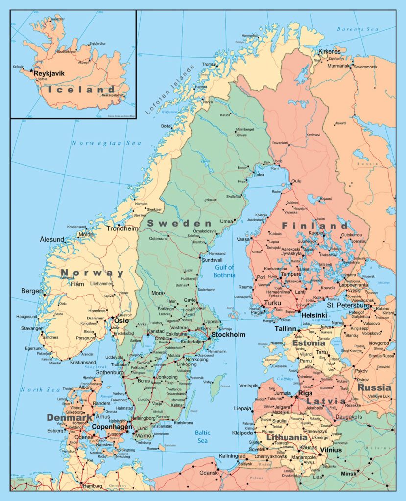
Norden = the Nordic countries, is a geographical and cultural region in Northern Europe and the North Atlantic. It consists of Denmark, Faroe Islands (Danish autonomous territory), Finland, Greenland (Danish autonomous territory), Iceland, Norway, Sweden and Åland (Finnish autonomous region). The map does not show either the Faroe Islands or Greenland. In my mind, the former Soviet, current Baltic states of Estonia, Latvia, and Lithuania are increasingly associated with the Nordic countries.
The Shetlands, Orkneys, Hebrides and the Isle of Mann were once part of Norway. For example, the Vikings arrived in Shetland around 850 AD which resulted in about 600 years of Norse rule. This period shaped culture and traditions despite the transfer of the islands to Scotland in 1469. In 2020-09, the Shetland Islands Council voted to explore replacing the council with a new system of government which controls a fairer share of the islands revenue streams and has a greater influence over their own affairs, which could include lucrative oil fields and fishing waters. In 1967, 1986 and 2022, Orkney Islands Council voted for a motion to explore greater autonomy and Nordic connections.
Northern Scandinavia
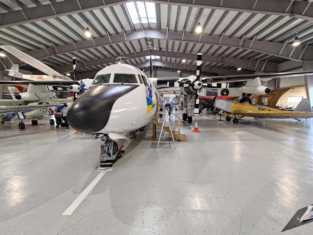
Alasdair travelled via OSL Oslo airport Gardermoen while I travelled separately from Inderøy via TRD Trondheim airport Værnes to EVE Harstad/ Narvik airport, Evenes on Wednesday, 2024-05-08 to begin an exploration of northern Scandinavia. Alasdair flew on a Norwegian Airlines Boeing 737-800, while I took a Bombardier Q400 turboprop.
We stayed in Harstad the first night. A weblog post about the art of Harstad has been published. The next day we travelled by bus to Narvik, where we spent the next night, starting 2024-05-09. Again, a weblog post about the art of Narvik has been published. Both Harstad and Narvik can be found on the map, north of Bodø but south of Tromsø.
Originally, we had planned to take the train from Narvik to Kiruna on 2024-05-10, but due to a earlier train derailment, we had to use a bus for the first part of the journey. Since Norway, Sweden and Finland are among the 29 European countries to have signed the Schengen agreement, officially abolishing border controls at their mutual borders, we did not experience any border controls on our trip.
Kiruna was uncomfortably cold, but we enjoyed looking at the old and new towns. On 2024-05-11, we continued our train journey through Gällevare and Boden to Luleå. Those locations can also be found on the railway map, below.
We continued the train journey on 2024-05-12 to Haparanda in Sweden. We had to retrace part of our journey to Boden, then took a different rail line to Haparanda. The rail line is shown on the map, but Haparanda is not. Its sister city Torneo, on the Finnish side of the border, is. From there we bussed to Kemi, where we could once again take a train.
In the weblog post about Haparanda – Torneo – Kemi, the Merenkurkku (Finnish) = throat of the sea (literal translation) = Kvarken (Swedish) = Quark Ridge (English) a narrow region separating Bothnian Bay from the rest of the Bothnian Sea. Its approximate location can be found on the map between Vaasa in Finland, and Umeå in Sweden.
We continued our journey south to Oulu, where we spent the night. A weblog post about Oulu is being prepared. The following day (2024-05-13) we took a train from Oulu to Seinäjoki, where we changed trains. This second train took us to Vaasa. Another weblog post about Vaasa is also being prepared.
On tuesday, 2024-05-14, we took a bus to the VAA, the Vaasa airport. From there we flew on a SAS (Scandinavian Airlines Systems) Canadair Regional Jet 900 to ARN Stockholm airport Arlanda in Sweden. We then flew on a Airbus A220 jet onwards to TRD.
We were met at TRD by Trish and Buzz, who drove us back to Cliff Cottage in Inderøy. TRD is located in Stjørdal municipality, in the former north Trøndelag.