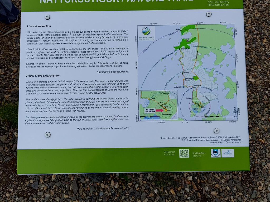
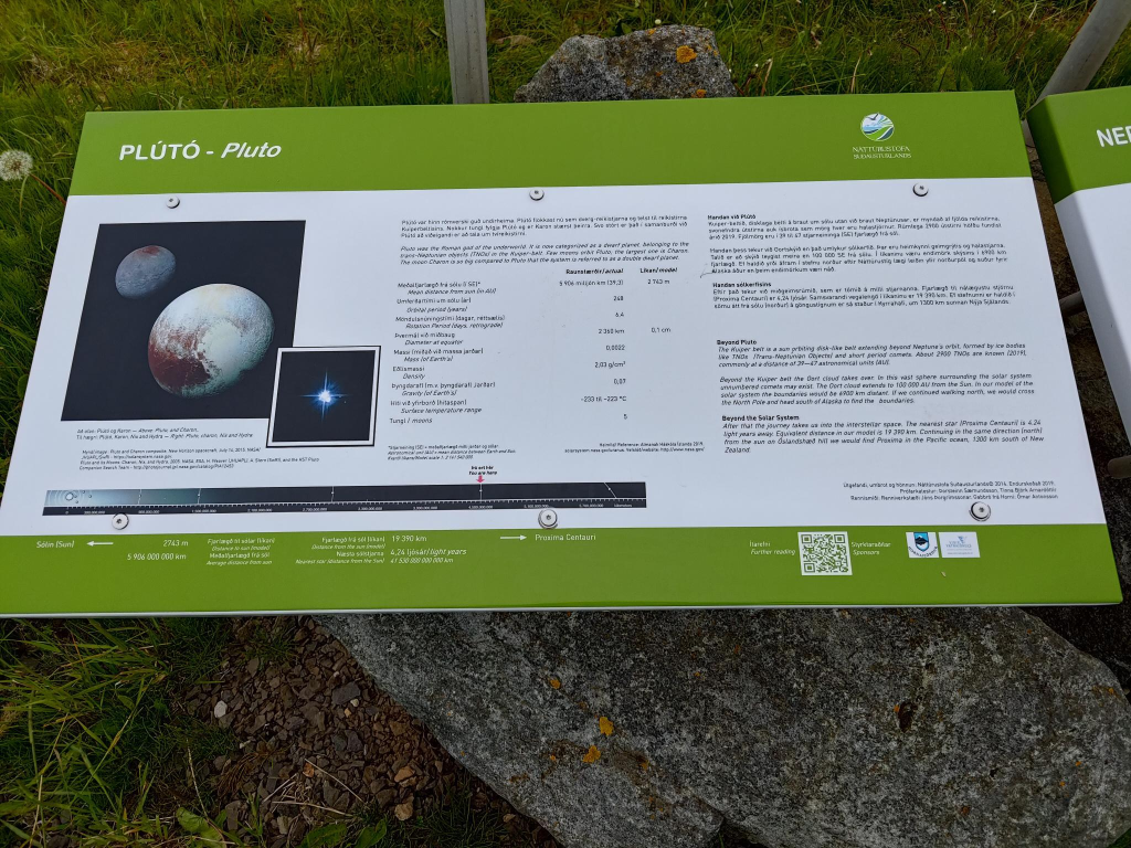
Höfn is the Icelandic term for harbour. It is also a place in the south-east of Iceland, which has a model of the solar system. This weblog post is about this model. It is fairly accurate in terms of relative distance between solar system bodies, with the exception of the location of Pluto.
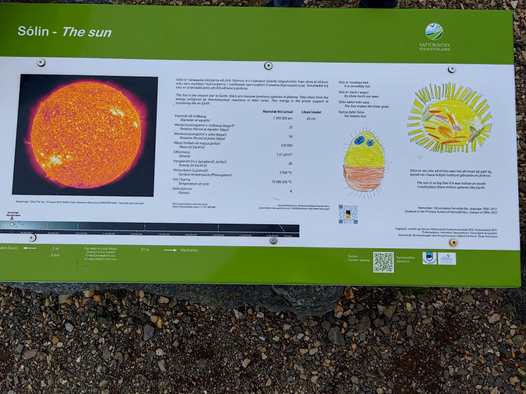
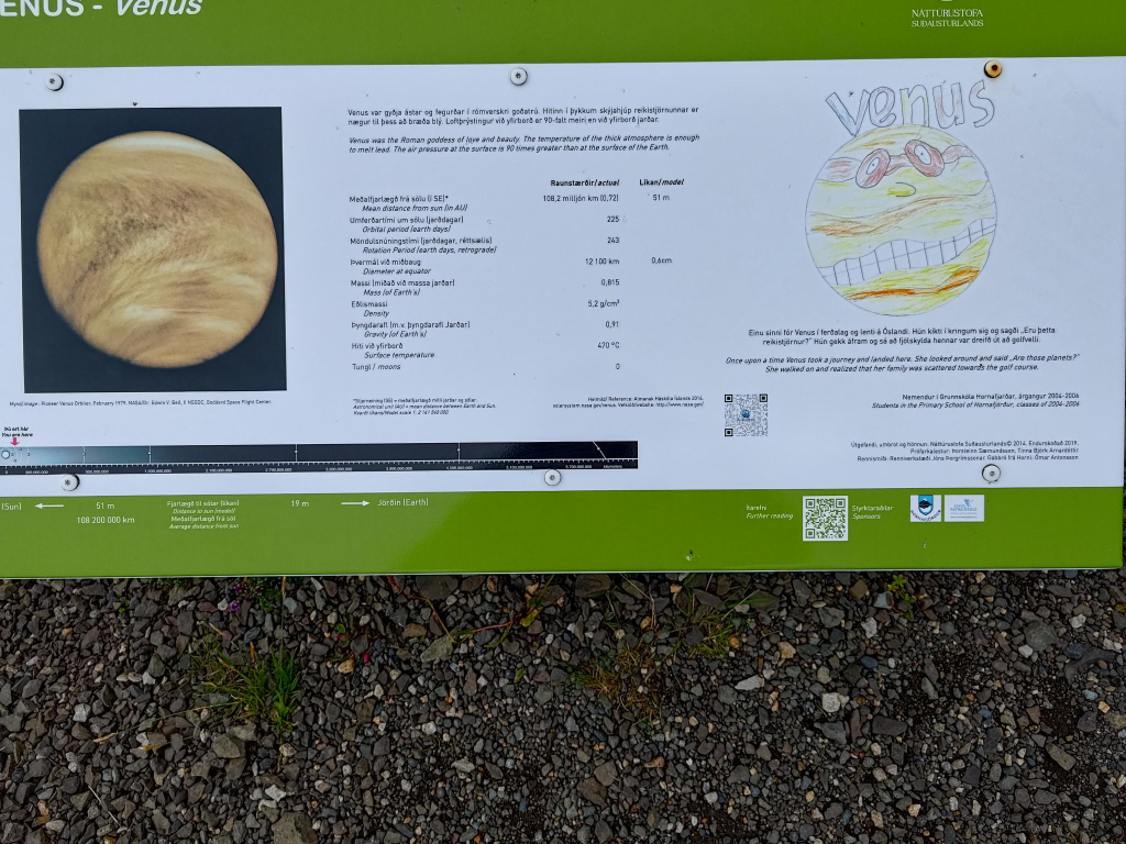
There are several characteristics to enjoy about a model like this. One of the most important is that it can be reproduced almost everywhere in the world. So, you too could create one, at a smaller scale in a room or garden, or at a larger scale across your county/ state/ province/ country. In this particular case, it is 2.8 km long. However, it could be any length desired. Then there is the data, with all sorts of interesting facts about the sun, and each planet. An example is the sun’s diameter in real life (1.4 million km = 1.4 Gm), and on the model (45 cm). The solar system model bodies are illustrated in two different ways. There is a photographic representation, as it would be seen through a telescope. There is a more naive representation, made by a pupil at the local school.
Not everyone is able to respond to scaled proportions appropriately. I remember one test to see if people understood the scale of the universe. Ask them if the moon or an elephant is larger. I thought it was a dumb question to ask, until one person seriously replied that an elephant is larger.
The Sun
Mercury

Venus
Earth

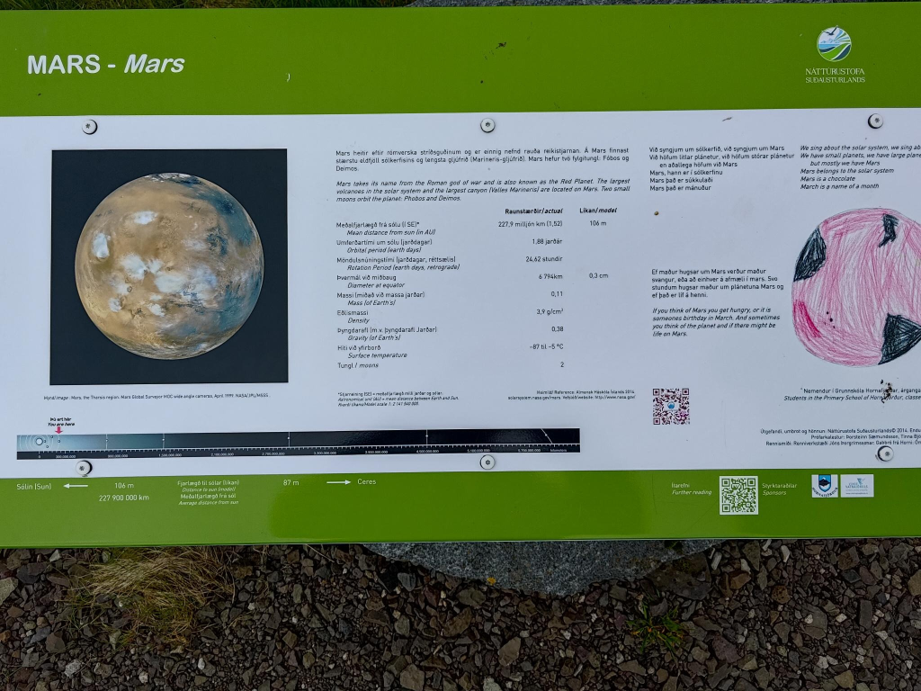
Mars
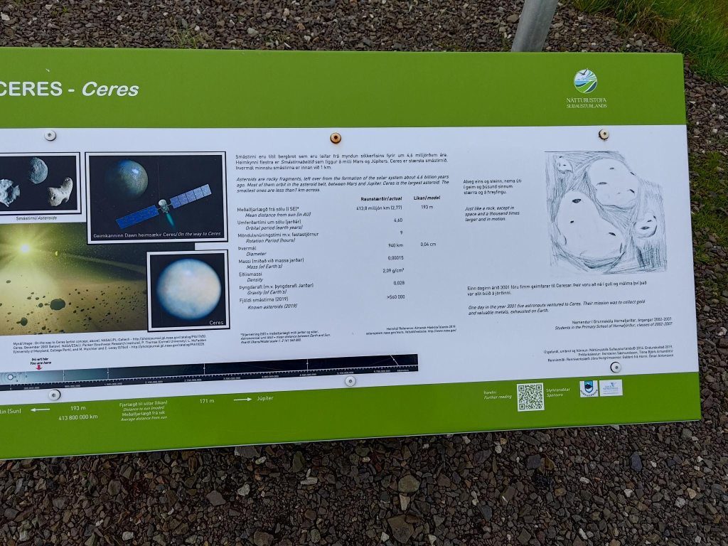
The Asteroid Belt
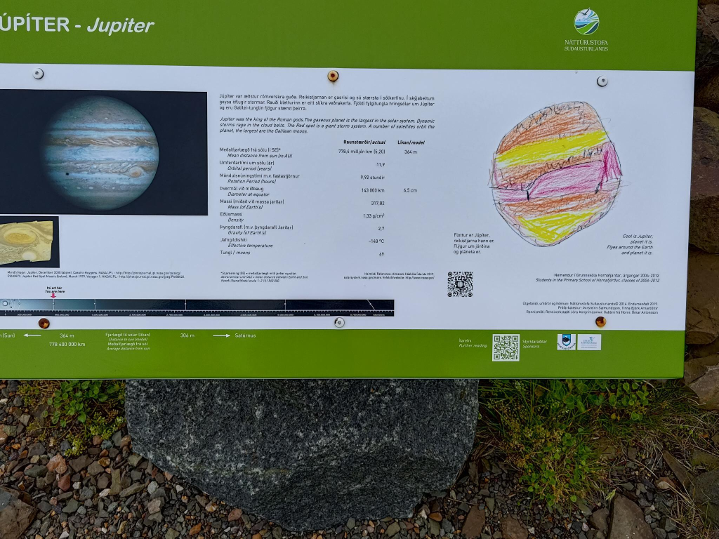
Jupiter
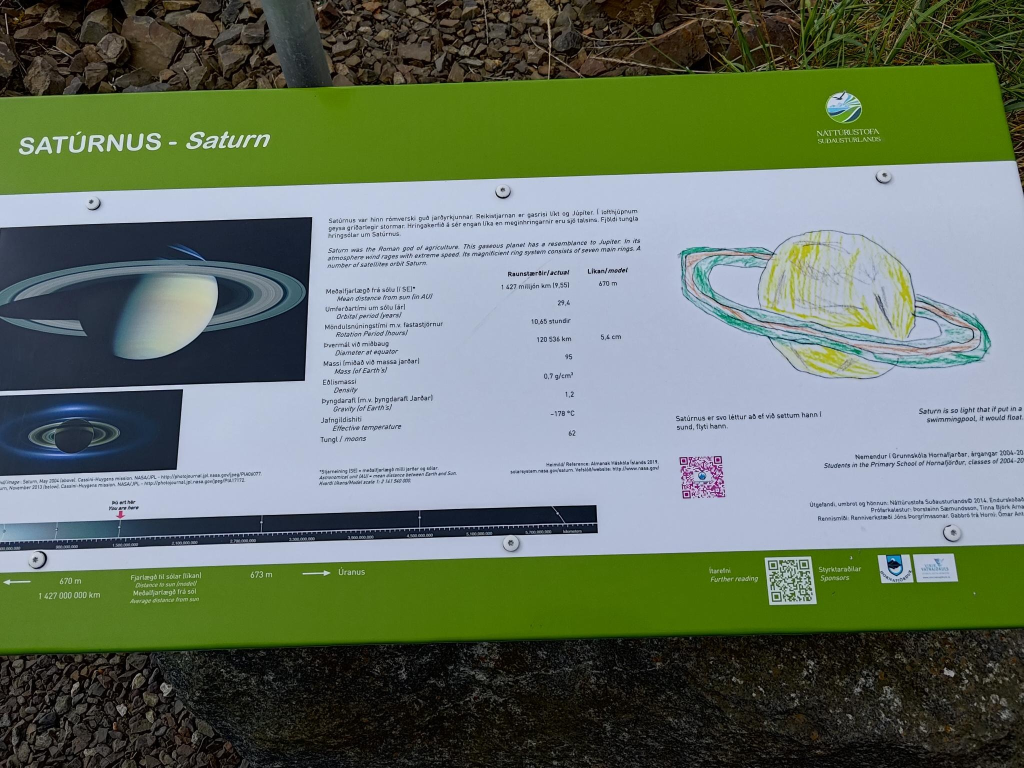
Saturn
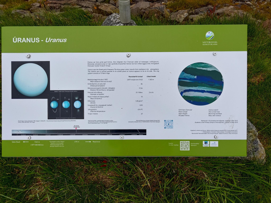
Uranus
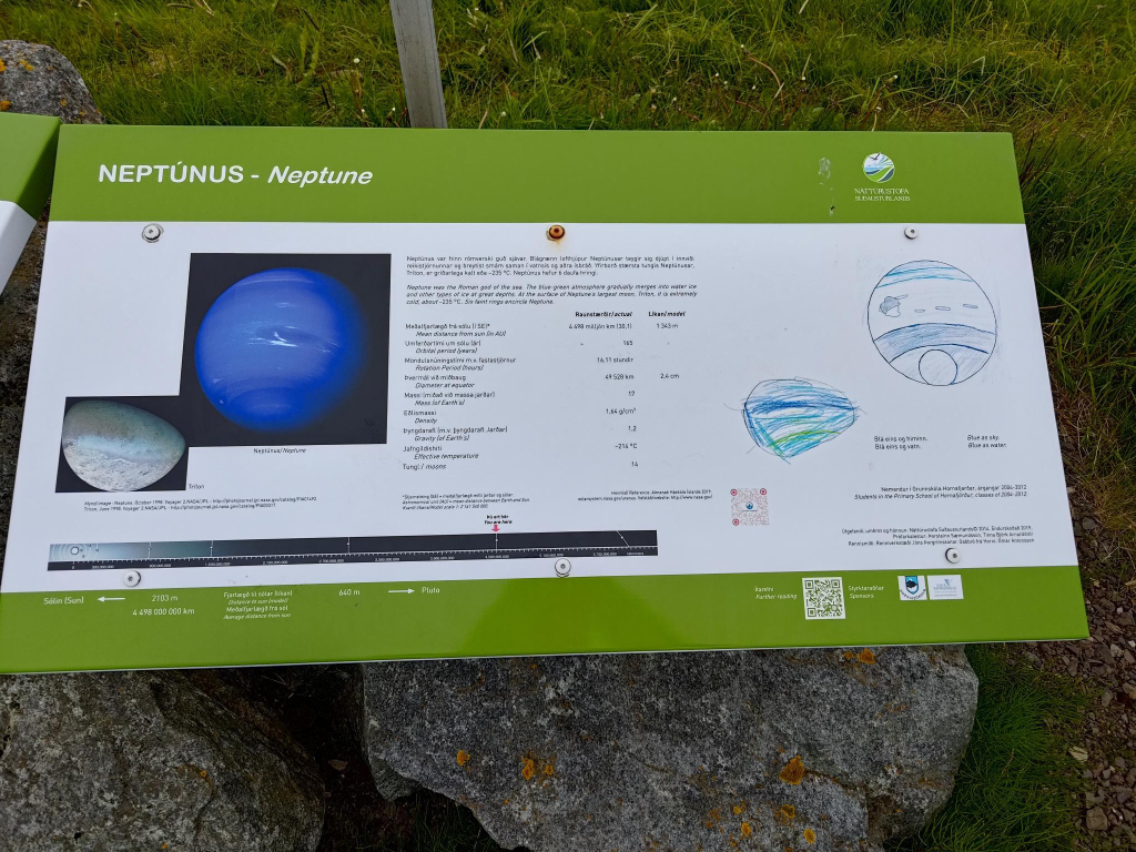
Neptune
Pluto
Weaknesses. I may criticize others for not knowing the true size of the moon. Yet, I have my own failings. No one would describe the photographs of the solar system information panels as professional. They were taken with a smart phone on a sunny day, which meant that because of my light sensitivity, I had to wear sunglasses while photographing them. Most of the time, I failed to capture the entire sign. Even when I did, it was not centred.
I explored the first part of the solar system, closest to the sun, with others, then went out on my own to explore the rest of it, some hours later. I was able to trace it, but unable to retrace the route back to our accommodation. I hadn’t recorded the accommodation address, so had no reference point to use on my smartphone map. Fortunately, I was able to give my location to Alasdair, who rescued me. It was totally undramatic. Yes, I may understand scale, but I don’t have a geographic sense of position, a fact well known to the others in my family.