War in Film

Poster for the American version of Le Roi de cœur (1966).

On 2014-02-20, Russia invaded Ukraine, and conducted a war that lasted until 2014-03-26. By 2014-03-16, Russia had succeeded in its stated aim, to annex the Crimean peninsula. Eight years later, almost to the day, on 2022-02-21 Russia officially recognized the two self-proclaimed separatist states in the Donbas, and openly sent troops into these territories. On 2022-02-24, Russia invaded Ukraine, the start of Putin’s war, or the second Russian invasion of the Ukraine this millennium.

Previously, I have written two post about this topic: In 2022 in a post titled Ukraine and in 2023, in a post about a democracy tax. This is a third weblog post that mentions Ukraine. I tried to use something resembling logic. This has proved illusive, and beyond my capabilities. My conclusion is that there can be no logical starting point, because war (and every other form of violence) is not a logical/ rational action. It cannot be understood logically.

Should I have to select one film that explains the current situation in Ukraine, I would choose Maidan (2014). It was directed by Sergei Loznitsa (1964 – ). I find Loznitsa an interesting director because of his background. He graduated from Kyiv Polytechnic Institute as a mathematician in 1987. Then he worked at the Institute of Cybernetics on expert systems. He also worked as a Japanese translator. Then he studied cinematography.

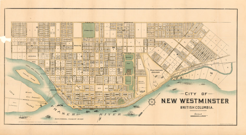
In the early 1960s, there were ample opportunities to reflect on violence. In October of 1962, there was the Cuban missile crisis. I lived about 165 km/ 103 miles from the American nuclear submarine base at Bangor, near Bremerton, in Washington State. If at the time I had known how close we lived to it, I probably would have been more worried. As it was, numerous people built bomb shelters adjacent to their houses, in New Westminster.

Perhaps I would have been more afraid if I had devoured On the Beach, either in the form of the novel (1957), written by Nevil Shute (1899 – 1960), or the film (1959), directed by Stanley Kramer (1913 – 2001). Both show the horror of nuclear war.

Discounting television comedies such as The Phil Silver’s Show aka (Sargeant) Bilko (1955 – 1959), McHale’s Navy (1962 – 1966) and Hogan’s Heroes (1965–1971), there have been few serious war series in the 1960s and 1970s. An exception was the The Gray Ghost (1957 – 1958), that portrayed the American Civil War from a Confederate perspective.

My first cinematic exposure to the violence of war, that had an impact on me, was probably Lawrence of Arabia (1962). I found it a disturbing film, not just because of the military actions it portrayed. It was morally vague, and depicted a person with psychic challenges, he is incapable of overcoming. I reflected on it, but not too much to keep my sanity. It was directed by David Lean (1908-1991), who had previously directed The Bridge on the River Kwai (1957), although I only watched that film considerably later.

Deeper reflections on violence began 58 years, 3 months, 3 days = 3 040 weeks = 21 280 days > 500 000 hours > 30 million minutes > 1.8 billion seconds earlier than the start of this second invasion of Ukraine. On 1963-11-22, the day John Fitzgerald Kennedy (1917 – 1963), the American president, was assassinated. The date is etched permanently into my brain, and marks an event that started my radicalization. Less than a month before, I had celebrated my 15th birthday, I was in grade ten, the youngest person in my class, having been born on the cut-off date that allowed me to start school in 1954.

Prior to Kennedy’s assassination, I was conventional. For example, I would fire five rounds of 0.22 caliber bullets, at the rifle range in the basement of Vincent Massey junior secondary school, after finishing band practice. Since then, I have not fired a weapon.

At the time of that assassination, people just a few years younger may not have been aware of the significance of it. People, just a few years older, may have already made a commitment to a particular world view. For me, it called into question the use of violence to resolve disputes. Gradually, I began to question the Vietnam war, war more generally, then other forms of violence. In part, it comes from examining the brutality of many other wars, notably the American Civil War, the Crimean War, the Boar War, the First World War. In part, this was aided by a fellow student, Steve Scheving, who kept meticulous statistics about casualties in the battles of the American Civil War.

Of the American Civil War films, one of the most respected is Shenandoah (1965), directed by Andrew V. McLaglen (1920 – 2014). Admittedly, it is sentimental, but it does raise a number of humanitarian themes. Some regard it as an anti-war film, which made it appealing to many draft-dodgers and others, facing the Vietnam war.

Then there are novel/film combinations that offer a means of understanding war. An understanding of the first world war can come from Im Westen nichts Neues = Nothing New in the West (literal) = All Quiet on the Western Front, English translation title (1929) more a psychological study looking at physical and mental trauma, as well as social detachment. It was written by Erich Paul (later his middle name was replaced by Maria) Remarque (1898 – 1970). Several film versions have been made, including the first one released in 1930, directed by Lewis Milestone, born in Moldova as Leib Milstein = Лейб Мильштейн in its original Russian (1895 – 1980).

The anti-war novel and film, set in the first world war, that I cannot recommend to anyone because of the horrors it contains, is Johnny Got His Gun. Blacklisted screenwriter Dalton Trumbo (1905 – 1976) wrote the novel in 1938, and directed the film version in 1971.

My timeline proceeds more cautiously through the Second World War because both of my parents served in the Royal Canadian Air Force, at that time. I find it impossible to condemn anyone fighting in a war defined by my parents as justified and necessary. I am too damaged to objectively reflect on this war, and find myself quoting, yet again, from The Go-Between (1953) by L. P. Hartley, (1895 – 1972): “The past is a foreign country; they do things differently there.”

I learned that romance and comedy could be used to hide the horrors of war. For example: James Michener (1907 – 1997) wrote a collection of short stories, Tales of the South Pacific (1947), from which the musical South Pacific (1949) theatrical production emerged, as well as the film version (1958), directed by Joshua Logan (1908 – 1988). Both of these featured music by composer Richard Rodgers (1902 – 1979) and lyricist-dramatist Oscar Hammerstein II (1895 – 1960).

I have a greater appreciation of Catch-22 (1961), the satirical novel by Joseph Heller (1923 – 1999), and the black comedy film from 1970, directed by Mikhail Igor Peschkowsky, better known as Mike Nichols (1931 – 2014).

I have allowed myself to see Schindler’s List (1993) and Saving Private Ryan (1998), both directed by Steven Spielberg (1946 – ).

Comedy also dominated the Korean war. The best example is M*A*S*H, subtitled, A novel about three army doctors (1968) by Robert Hooker, the pseudonym of Hiester Richard Hornberger Jr. (1924 – 1997), and the film (1970) directed by Robert Altman (1925 – 2006).

It is also easier to find fault with events in more distant places. It took me much longer to confront my own racism and other prejudices, and the genocide that took place in British Columbia. As an immigrant, it is easier for me to see contradictions in Norwegian society that Norwegians can’t admit to. Much of this has to do with religion. From my perspective, Norway only reluctantly allows freedom of religion, and has not fully recognized the violence sanctioned by its own state designated religion, particularly against the Sami people, but also others who did not think conventionally.

It was easier to condemn events in Algeria, Czechoslovakia, Chile and Korea, to name four countries on four continents, that people might suspect were randomly selected. They weren’t, for films have had a significant impact on my perception of the world, and of war. In these cases, respectively: The Battle of Algiers = La battaglia di Algeri, (1966) directed by Gillo Pontecorvo (1919 – 2006) ; Closely Watched Trains = Ostře sledované vlaky (1966) directed by Jiří Menzel (1938 – 2020); missing [sic](1982) directed by Costa-Gavras (1933 – ) although I am much more appreciative of Z (1969), which is about the assassination of democratic Greek politician Grigoris Lambrakis (1912 – 1963); The Manchurian Candidate (1962) described as a neo-noir psychological political thriller film, directed by John Frankenheimer (1930 – 2002).

There have been numerous films made about the Vietnam war, including: 1) Apocalypse Now (1979), directed by Francis Ford Coppola (1939 – ), loosely based on the novella Heart of Darkness (1899) by Joseph Conrad, born Józef Teodor Konrad Korzeniowski (1857 – 1924). Here, war is explored as an exercise in futility and as a catalyst for a descent into madness; 2) The Deer Hunter (1978), directed by Michael Cimino (1939 – 2016), focused on realism and the psychological destruction of individual participants. Many of these films are difficult to watch. This applies to most war films made after 1970. 3) First Blood (1982) was directed by Bulgarian-Canadian Ted Kotcheff (1932 -) and was filmed in and around Hope, British Columbia. Damaged Vietnam veteran John Rambo searches for an old friend in a small town but is harassed by the sheriff until he reaches his breaking point. Rambo reverts to his military mindset. 4) Kotcheff explored the Vietnam war very differently in Uncommon Valor (1983), with a focus on prisoners of war (POW), and people missing in action (MIA).

A Baha’i perspective on war.

A documentary about World War One, The Man Who Shot the Great War (2014), has had the greatest spiritual impact on me. I often reflect on the souls of men who have been conscripted, and ordered to kill other men. This war killed 37 million soldiers. George Hackney (? – 1977) was a Belfast sniper, and photographer. While unofficial photographs were illegal, his were allowed. George was also a Baha’i.

The Baha’i perspective is that no person is condemned to an eternity in hell or in heaven. Instead people continue their spiritual journey they began in their earthly life involving a greater spiritual understanding. I expect George found solace in this message.

In October, Baha’is celebrate the births of its twin profits, Bab (1819 – 1850) and Baha’u’llah (1817 – 1892). While its prophets may have their origins in Iran, Baha’u’llah was ultimately exiled to Akko/ Acre, in today’s Israel. This exile is why the Faith’s headquarters are located in nearby Haifa. I have been on pilgrimage to Haifa three times, but feel no need to visit a fourth time.

This month, the world has witnessed atrocities in Israel as well as the Gaza strip. Baha’u’llah has written on war, and come with recommendations for achieving world peace, in two documents, that are often quoted.

“Be united, O concourse of the sovereigns of the world, for thereby will the tempest of discord be stilled amongst you, and your peoples find rest. Should any one among you take up arms against another, rise ye all against him, for this is naught but manifest justice.” Gleanings, p. 254.

“The time must come when the imperative necessity for the holding of a vast, an all-embracing assemblage of men will be universally realized. The rulers and kings of the earth must needs attend it, and, participating in its deliberations, must consider such ways and means as will lay the foundations of the world’s Great Peace amongst men. Such a peace demandeth that the Great Powers should resolve, for the sake of the tranquillity of the peoples of the earth, to be fully reconciled among themselves. Should any king take up arms against another, all should unitedly arise and prevent him.” Epistle to the Son of the Wolf, pp. 30-1.

Needless to say, I am not impressed with the various rulers of the world uniting to further peace. As I approach 75 years of living on this planet, I reflect once again, much as I did in the late 1960s, on how countries are willing to sacrifice their most important resource, young people, in needless wars.

I further reflect on how countries, especially the United States through the Marshall Plan, were willing to invest in the reconstruction of Europe, which provided the basis for Germany, and many other countries, to prosper. The US, Israel and the many oil-rich Middle Eastern countries have been unwilling to invest in the West Bank or the Gaza strip, to ensure its Palestinian residents could prosper.

Al-Nakba (1996) is a documentary film by Benny Brunner (1954 – ) and Alexandra Jansse (1956 – ). It presents insights into past events in Palestine/ Israel that continue to shape current events. It is based on the book, The Birth of the Palestinian Refugee Problem, 1947–1949 by Benny Morris (1948 – ), an Israeli historian. The film title refers to catastrophic events in 1948 forcing, an estimated seven hundred thousand Palestinians into exile and poverty, while Israelis, could create and prosper their own state.

This Israeli perspective is portrayed in the Leon Uris (1924 – 2003) novel, Exodus (1958), which was made into a film directed by Otto Preminger (1905 – 1986) in 1960.

Perhaps the most inspiring war film remains Philippe de Broca’s (1933 – 2004) King of Hearts = Le Roi de cœur (1966). The film is set in a set in a small French town towards the end of World War I. Retreating Germans have placed a bomb in the town square, and it is up to signaller/ pigeon keeper Charles Plumpkit to defuse the bomb. While normal residents flee, inmates from an asylum take over the town, and challenge conventional values. The film also questions the very notion of sanity.

A confession: I have never served in any military, and describe myself as a pacifist. In my youth, I have known people who have served in the sea cadets, based at the New Westminster Armory. Many of them were musicians. In Norway, I have worked with teachers who choose to leave the school system temporarily, to work as soldiers in peace-keeping missions, most often in the Middle East. I have never understood the appeal of being in the military.

Note: the next weblog post is scheduled for Tuesday, 2023-10-31.

Surfing Day

On 2022-02-11 = 11 February 2022, Maya Reis Gabeira broke her own record for riding the largest wave surfed – unlimited (female). The wave had a confirmed height of 22.4 m = 73.5 feet at the Nazare Tow Surfing Challenge event in Praia do Norte, Portugal. Photo: Guniness World Records.

Today, 2023-06-17 = 17 June 2023, is the 30th anniversary of the International Surfing Day. It is held annually on the third Saturday of June. It is yet another unofficial holiday, that some environmentally conscious, sports-centered fanatics find worthy of celebrating because of an interest in surfing as a sport, as a lifestyle, as a musical genre, or simply as a manifestation of the sustainability of ocean resources. The day is the spiritual successor of World Surf Day, started by the Usenet newsgroup alt.surfing in 1993.

I attempted to read a short, online history of surfing. It was problematic. Apparently, somewhere in Polynesia there is a cave where, in the 12th century, someone painted a person on a surfboard. The location was not specified. It could be anywhere, but I suspect it exists only in the imagination of the writer. By the year given, the Polynesians had colonized Hawaii (AD 900), Rapa Nui = Easter Island (AD 900) as well as Aotearoa = New Zealand (AD 1200), if one is not too concerned about the difference between 12th century and AD 1200. Polynesia consists of about 300 – 310 000 square kilometers of land, of which New Zealand contributes 270 000 square kilometers. It is surrounded by vast quantities of ocean. How much? I have not been able to determine that metric.

If one traces the linguistic origins of Polynesia far enough back in time, one ends up in Taiwan.

An orthographic projection of Polynesia, surfing’s traditional place of origin. Source: David Eccles, 2008.

Despite various forms of evidence (linguistic, historic as well as genetic), some pseudo-scientists want to invent their own histories. Such is the case with Thor Heyerdahl (1914 – 2002). He proposed, in the mid-20th century, that the Polynesians had migrated in two waves: one by Native Americans from the northwest coast of Canada by large whale-hunting dugouts; and the other from South America on balsa-log rafts. The Kon-Tiki expedition set out to prove the possibility.

The history of Polynesia is not the same as the history of surfing. Today is not Polynesia day, but surfing day. The list below contains some names of individuals associated with surfing culture in its various forms.

Duke Paoa Kahinu Mokoe Hulikohola Kahanamoku (1890 – 1968): enthusiastic surfer, who also founded the multiracial Hui Nalu Club (Club of Waves) at Waikīkī Beach.

Hugh Bradner (1915 – 2008): inventor of the neoprene wetsuit, which revolutionized surfing (and scuba diving).

William Asher (1921 – 2012): director of Beach Party (1963), a film that shows antropologist Robert Orville Sutwell (Bob Cummings, 1910 – 1990) secretly studying the wild mating habits of Southern California teenagers who hang out at the beach and speak in strange surfing-jargon.

Dick Dale (born, Richard Anthony Monsour; 1937 – 2019): guitarist, who composed the ultimate surf song, Misirlou (1962).

Bruce Brown ( 1937 – 2017): American documentary film director, known as an early pioneer of the surf film, who made The Endless Summer (1964).

Rennie Ellis (1940 – 2003): Australian surf photographer, photo agency and gallery owner and publisher of 17 photography books.

Annette Funicello (1942 – 2013): actress, mouseketeer, particularly appreciated for her role as Dee Dee in How to Stuff a Wild Bikini (1965).

William Finnegan (1952 – ): author of Barbarian Days: A Surfing LIfe (2015), often described as a memoir of an obsession.

Joni Sternbach (1953 – ): large-format camera photographer using early photographic processes, including tintype and collodion. She takes an ethnographic approach to produce in situ portraits of women surfers and surf culture. Many of these were published in Surfland (2009).

Selema Masekela (1971 – ): enthusiastic promoter of AfroSurf (2021) a book with 200 photos, 50 essays, surfer profiles, thought pieces, poems, playlists, illustrations, ephemera, recipes, and a mini comic, intended to capture the diversity and character of the African surf. The book’s author is stated as Mami Wata, which could refer to 1) a central African water spirit; 2) a 2023 film by C. J. Fiery Obasi, about that water spirit; 3) a South African surf supply company.

Maya Reis Gabeira (1987 – ): Brazilian big wave surfer, with a world record for having surfed a 22.4 m (73 ft) high wave in Nazaré, Portugal on 2022-02-11 = 11 February 2022, the biggest wave ever surfed by a woman.

Carissa Moore (1992 – ): Hawaiian American Olympian, world champion surfer and activist.

My own interest in surfing relates to surf photography and surf culture.

Historians of British Columbia

Don Wong provided me with a photo of his grandfather’s $500 Head Tax certificate, that allowed him to become a resident of Canada, in 1912.

Hostile attitudes towards Asians in British Columbia, particularly those with Chinese origins, should vex everyone. A frequent excuse for discrimination throughout the 20th and mid to late 19th centuries, was that Chinese workers had the power to reduce wages being paid to others (read: people of European ancestry). When the Canadian Pacific Railway, along with other transcontinental railways (British)/ railroads (US), was constructed, the Chinese received minimal wages, but were assigned the most dangerous tasks. It was as if their lives were of no consequence. When the rail lines were finally completed, European immigrants expected the Chinese workers to return to China, while they themselves remained in North America.

More recently, some people have laid blame for the Covid-19 pandemic on people of Chinese origins, attacking anyone (everyone?) with a Chinese appearance – mostly verbally but aggressively – in public venues such as shopping centres. This is totally unacceptable.

Much of the current Asian hostility expresses Europhile exceptionalism, that has replaced an earlier Anglophile exceptionalism, that became codified into the history of the province as an anti-Asian consensus.

Confronting this Sinophobia is of personal importance to me. Should I ever become a grandfather, it is most likely, genetically, that my grandchildren will be 50% Chinese, and almost equally likely that they will be living somewhere in Greater Vancouver. Patricia and I will likely share these grandchildren with Louise Yeoh and Don Wong. Don Wong provided a photo of his grandfather’s $500 Head Tax certificate, that allowed him to become a resident of Canada, in 1912. Thank you, Don. Our families have roots going back more than a century to Kerrisdale, Marpole (Eburne), Steveston, Burnaby and New Westminster. Most of these communities are along Sto:lo, the Fraser River.

Much of the early history of British Columbia was researched, written and published by Hubert Howe Bancroft (1832 – 1918), born in Granville, Ohio, but who moved to San Francisco in 1852 where he started the largest bookseller, stationer and publishing house west of Chicago. His research into British Columbia’s history began on a trip to Victoria in 1878. He published a definitive history of the province in 1887, written by himself, William Nemos (Swedish), Alfred Bates (English) and Amos Bowman (1839 – 1894), from Blair, Ontario. The major challenge with this work is its emphasis on pioneer history, where settlers of European origin set the premises for the work. It is the migrants to the area that are intent on determining its history. Despite the First Nations populations far outnumbering these settlers, they were largely ignored, as were people of Asian origin. Despite this shortcoming, Bancroft did, however, manage to strike a balance between British and American perspectives on the province.

The next significant historian was Frederic Howay (1867 – 1943) born in London, Ontario, but who moved first to the Cariboo goldfields as a young child in 1871, and then to New Westminster in 1874. He studied law at Dalhousie University, graduating in 1890. He was appointed a judge in 1907, retiring in 1937. He used as much of his working day as possible writing history. Like his political opponent Richard McBride, Howay was opposed to Asian immigrants.

Walter Sage (1888 – 1963) was born in London, Ontario. He was educated at Oxford University and the University of Toronto. In 1918, he started teaching history at the University of British Columbia (UBC), from 1933 to 1953 as department head. Sage regarded himself as a teacher rather than a researcher. He specialized in the history of British Columbia, especially the personalities that had shaped the province, starting with a 1921 article on The Gold Colony of British Columbia. He was also appreciated for his sense of justice.

Henry Forbes Angus, (1891 – 1991), was born in Victoria, British Columbia. Rather than focusing on his education at McGill University in Montreal, or his prestigious law scholarship that allowed him to study law at Oxford, I will simply state that in 1919, he became an assistant professor of economics at UBC , subsequently becoming professor, department head, and dean of graduate studies.

In 1942 Walter Sage and Henry Angus, protested against the mistreatment and internment of Japanese Canadians. Geographer Kay Anderson (1958 – ) regarded Angus’ opposition as an important breakthrough in the dismantling of the anti-Asian consensus, in the province. Angus regarded Asian-Canadians as part of the “us” (Canadian citizens who regarded British Columbia as their home), and not a “them” (alien outsiders).

Margaret Ormsby (1909 – 1996) was born in Quesnel, raised in the Okanagan, educated in Vancouver and Bryn Mawr, Pennsylvania. She became a professor of history at UBC history in 1955, and department head in 1965. The first book I read written by her on the history of British Columbia was British Columbia: A History (1958). In Chapter 12, “The People’s Dick”, she writes: “The outbreak of the South African War in 1899 found British Columbia standing loyally at the side of the Mother Country: in no other section of Canada was there greater martial ardour or more enthusiastic endorsation of the British Cause.” (p. 327). I have often wondered how much the word British in the province’s name has had a (negative) behavioural influence on its citizens.

Despite the increased professionalism in history, the Canadian public often chooses to read the works of populists, such as Pierre Burton (1920 – 2004), who became editor of the Vancouver Sun, at the age of 21. To his credit, he also opposed the internment of Japanese Canadians.

Another annoying aspect of British exceptionalism, is the monarchy. Monarchies are opaque institutions. In the United Kingdom, over 1 000 laws have been vetted using a secretive procedure – The Queen’s/ now King’s Consent – where government ministers privately notify the Queen/ King of clauses in draft parliamentary bills and ask for her/ his consent to debate them. In essence, this asks her/ his permission to include clauses in legislation. This allows her/ him to change proposed bills before they are presented to elected members of parliament. According to the Guardian, the procedure has been used to conceal her/ his private wealth from the public, and to exclude her/ his estates, and those of her/ his heirs, from proposed laws relating to road safety, land and historic site policy. I do not know how much this has been done in Canada.

My political beliefs have not changed significantly in more than fifty years. At that time, there seemed to be more political understanding, if not consensus, between the left and the right. Now? Not so much. A three minute video by Robert Reich explains it. Because of the deterioration of this understanding, along with increased racism in some segments of the population, it is important to come to grips with anti-Asian sentiments.

Note 1. An inspired source for this weblog post was Chad Reimer (1963 – ), Writing British Columbia History 1784-1958 (2009).

Note 2. This is the first of three parts about British Columbia and Asian Canadians. The second part will examine the situation for Chinese immigrants to Canadians, from Chinese sources. The third part will look at the Komagata Maru.

Note 3. This is being published on the Lunar New Year, the Year of the Water Rabbit, that starts on Sunday, 2023-01-21.

Cockades & Roundels

The National Cockade of India = The National Cockade of Ireland. They are identical! Sharing a national cockade is a common occurrence. Source: Tibetan Pop Rocks, Wikimedia.

A cockade is a knot of ribbons, or other circular, sometimes oval, symbol of distinctive colours which is usually worn on a hat, cap or lapel. In addition, women traditionally had the option of wearing one in their hair. The noun, cockade, dates from 1650 – 60; It comes from French cocarde = a knot of ribbons, (from its resemblance to a cock’s crest), from Middle French cocquard = boastful, silly, cocky = the boastful behavior of a rooster, from coq = a rooster, and especially to the bird’s crête (Fr.) = comb (Eng.) = fleshy growth/ crest on the top of its head. In modern français québécois, the term cocarde is an identification badge.

Starting in the 15th century, these were originally derived from identity ribbons used by medieval knights. By the 18th and 19th centuries, these became common, and showed: the allegiance of their wearers to a political faction, their social status or rank or (by wearing colours of a particular livery) their subordinate status. Because of the confusing multiplicity of military uniforms, cockades became a de facto and cheap mechanism to show a person’s (national) identity. Colours are listed from the centre to the outside ring.

Colours

In pre-revolutionary France, the Bourbons used white cockades. Their Jabobite supporters in Scotland, also used white. Meanwhile, in the United Kingdom, the Hanoverians had taken over the monarchy, starting with George I, in 1714. They used black cockades. Periodically, after the French revolution, and since 1830, French cockades have been blue – white – red. The Hanoverian dynasty ended in the UK at the death of Victoria in 1901. Her eldest son Edward VII, was a member of the House of Saxe-Coburg and Gotha, which later changed its name to Windsor. At some time after the adoption of the Union Jack/ Union Flag in 1801, British cockades became red – white – blue, the opposite of the French. Since its independence in 1922, Ireland has used cockades of green – white – orange. India has used the same colours, in the same order, although India refers to its green as India green and its orange as saffron.

Until the Russian revolution in 1917, Russia has used cockades of black – orange – black – orange – white, featured in the Order of Saint George, originally from 1769, but with the Russian Federation revival dating from 2000. Modern Russian cockade colours are black – orange – black – orange. Ukraine uses light blue – yellow.

American Cockades

During the American revolutionary war (1775 – 1783), the Continental Army was the army of the thirteen American colonies. They had no uniforms. George Washington (1732 – 1799) attempted to use cockades to differentiate ranks: red/ pink = field officer; yellow/ buff = captain; green = subaltern. Several sources note that there was a substantial use of black cockades, identical to those used by the British. When France allied itself with the Americans, the Bourbon white cockades were added to create a black and white cockade. The French reciprocated, adding black cockades. This is generally referred to as the union cockade.

Yet, the term union can be confusing in an American context. During the American civil war (1861 – 1865) there were both confederate and union cockades. There was no single standardized design. Confederate/ southern versions tended to be one color (often red or blue). Union/ northern cockades often incorporated red, white and blue. Some designs were embellished with buttons depicting palmettos = fan-leaved palm trees, eagles, Union president Abraham Lincoln (1809 – 1865), Confederacy president Jefferson Davis (1808 – 1889). In Texas, they often incorporated a metal star.

Nordic Cockades

In Sweden, the military used yellow cockades, while civilians used blue and yellow. This contrasts with Denmark, that used red – white – red. Norway used red – white – blue – white; Iceland: blue – white – red – white – blue; Finland: white – blue – white.

Roundels

France began the first Aéronautique Militaire = Air Force, in 1909. Roundels were mandated on military planes, starting in 1912. They were based on the blue – white – red of the French national cockade. In addition, aircraft rudders were painted the same colours in vertical stripes, with the blue forwardmost. During World War I, other countries adopted national cockades and used these as roundels on their military aircraft.

Some of the more interesting roundels include Australia, Canada and New Zealand, with the centre red of the Royal Air Force replaced with a kangaroo (Family Macropodidae), sugar maple leaf (Acer saccharum) and kiwi (Apteryx sp.), respectively. In the Nordic countries, Sweden has three yellow crowns displayed on light blue background, with an outer ring of yellow.

Swedish Air Force Roundel

Corporate Roundels

Corporations/ organizations that have made use of roundels in their branding, include: Transport for London, and the London Underground specifically. It was trademarked for the London General Omnibus Company, in 1905, but was first used on the Underground in 1908.

London Underground Roundel.

Use of the BMW roundel required both the circumvention of laws, as well as the creation of myths, to become successful. The Wikipedia article section on BMW’s logo and its slogan – The Ultimate Driving Machine – tells the story.

The Tide trademark is an orange and yellow roundel, sometimes referred to as a bull’s eye. It was designed by architect and industrial designer Donald Deskey (1894 – 1989).

The Tide Roundel, dating from 1946.

The London rock band, The Who, formed in 1964, used Royal Air Force (RAF) roundels on stage. Later, this roundel symbolized British Mod culture, with its emphasis on fashion and Italian scooters.

Sabaton

This weblog post was inspired by the Sabaton music video, The Uprising, about the Warsaw Uprising = powstanie warszawskie (Polish) in the summer of 1944. It was the single largest military effort undertaken by any European resistance movement during World War II. It unsuccessfully attempted to liberate Warsaw from German occupation. It involved 63 days of fighting in the summer of 1944, and it was led by the Polish resistance Home Army = Armia Krajowa (Polish). This operation extracted a massive human cost. It is estimated that about 16 000 members of the Polish resistance were killed and about 6 000 badly wounded. In addition, between 150 000 and 200 000 Polish civilians died, mostly from mass executions. This is mentioned in part because the Allies refused to offer military assistance to Poland at this decisive moment in history. In contrast, Poland is offering massive support to Ukraine in the current war, and illegal occupation of Ukraine territory by Russia.

In the Sabaton video there are glimpses of the Polish two-finger salute, as well as of improvised red and white replacement of the cockade, shown on Polish helmets and other military headgear. These are similar to the blue and/ or yellow marking used on Ukrainian military headgear in 2022.

The rogatywka, sometimes translated as peaked cap, is an asymmetrical, peaked, four-pointed cap used by various Polish military formations. Some people see it as forming the basis for the Polish roundel, which is anything but round. Warszawo Walcz = Warsaw fight!

Polish Air Force Roundel.

Notes:

Sabaton = part of a knight’s body armor that covers the foot. The Swedish power metal band Sabaton is noted for their albums about wars and battles. It originated in 1999 in Falun, about 600 km, and 8 hours driving from Cliff Cottage (depending on the specific route). It involves an eastward journey on the E14, across the Norwegian – Swedish border, and then onwards, almost to Östersund, followed by a southern leg on highway 45 to Falun. Falun’s Great Copper Mountain area has been designated a World Heritage Site since 2002.

If anyone should wonder why I take an interest in Warsaw, and Poland more generally, it is because it keeps asserting itself into my life. Historically there is: Nicolaus Copernicus (1473 – 1543), Frédéric Chopin (1810 – 1849), Józef Teodor Konrad Korzeniowski (1857 – 1924), Marie Salomea Skłodowska–Curie (1867 – 1934), Grażyna Bacewicz (1909 – 1969), Henryk Górecki (1933 – 2010), Wayne Gretski (1961 – ), Olga Tokarczuk (1962 – ), Kinga Baranowska (1975 – ) and Agata Zubel (1978 – ). Alasdair spent six months living in Warsaw. One of our closest neighbours is from Poland. One of our friends specializes in relationships with Polish women. My only sister-in-law has Polish origins.

I have previously written about redneck(erchiefs), that have a similar function to cockades.

Ukraine

https://upload.wikimedia.org/wikipedia/commons/6/63/Physical_maps_of_Ukraine.jpg
The physical geography of the Ukraine.

Short version: In 1994, Ukraine agreed to remove/ destroy nuclear weapons from/ in its territory, and to join the Treaty on the Non-Proliferation of Nuclear Weapons. In return, Russia, Britain and USA agreed to provide Ukraine with security assurances. All parties agreed to respect the territorial integrity of Ukraine. France and China also provided Ukraine with similar, but lesser, assurances. Despite this Russia was able to re-annex Crimea in 2014, without anything more than a murmur of discontent, and attempted to annex the entire Ukraine in 2022, which has met a more violent and, from a Russian perspective, unexpected opposition.

Long version: On 1994-12-05, four parties signed what is known as the Budapest Memorandum on Security Assurances, containing a preamble and six paragraphs. It reads as follows:

The United States of America, the Russian Federation, and the United Kingdom of Great Britain and Northern Ireland,

Welcoming the accession of Ukraine to the Treaty on the Non-Proliferation of Nuclear Weapons as non-nuclear-weapon State,

Taking into account the commitment of Ukraine to eliminate all nuclear weapons from its territory within a specified period of time,

Noting the changes in the world-wide security situation, including the end of the Cold War, which have brought about conditions for deep reductions in nuclear forces.

Confirm the following:

1. The Russian Federation, the United Kingdom of Great Britain and Northern Ireland and the United States of America reaffirm their commitment to Ukraine, in accordance with the principles of the Final Act of the Conference on Security and Cooperation in Europe, to respect the independence and sovereignty and the existing borders of Ukraine.

2. The Russian Federation, the United Kingdom of Great Britain and Northern Ireland and the United States of America reaffirm their obligation to refrain from the threat or use of force against the territorial integrity or political independence of Ukraine, and that none of their weapons will ever be used against Ukraine except in self-defence or otherwise in accordance with the Charter of the United Nations.

3. The Russian Federation, the United Kingdom of Great Britain and Northern Ireland and the United States of America reaffirm their commitment to Ukraine, in accordance with the principles of the Final Act of the Conference on Security and Cooperation in Europe, to refrain from economic coercion designed to subordinate to their own interest the exercise by Ukraine of the rights inherent in its sovereignty and thus to secure advantages of any kind.

4. The Russian Federation, the United Kingdom of Great Britain and Northern Ireland and the United States of America reaffirm their commitment to seek immediate United Nations Security Council action to provide assistance to Ukraine, as a non-nuclear-weapon State party to the Treaty on the Non-Proliferation of Nuclear Weapons, if Ukraine should become a victim of an act of aggression or an object of a threat of aggression in which nuclear weapons are used.

5. The Russian Federation, the United Kingdom of Great Britain and Northern Ireland and the United States of America reaffirm, in the case of Ukraine, their commitment not to use nuclear weapons against any non-nuclear-weapon State party to the Treaty on the Non-Proliferation of Nuclear Weapons, except in the case of an attack on themselves, their territories or dependent territories, their armed forces, or their allies, by such a State in association or alliance with a nuclear-weapon State.

6. Ukraine, the Russian Federation, the United Kingdom of Great Britain and Northern Ireland and the United States of America will consult in the event a situation arises that raises a question concerning these commitments. — Memorandum on Security Assurances in Connection with Ukraine’s Accession to the Treaty on the Non-Proliferation of Nuclear Weapons.France and China’s commitments

[End of memorandum]

France gave Ukraine assurances similar to the Budapest Memorandum, but without the provisions found in paragraphs 4 and 6.

China’s pledge is dated 1994-12-04 and reads:

The Chinese Government welcomes the decision of Ukraine to destroy all nuclear weapons on its territory, and commends the approval by the Verkhovna Rada of Ukraine on November 16 of Ukraine’s accession to the Treaty on the Non-Proliferation of Nuclear Weapons as a non-nuclear-weapon State. China fully understands the desire of Ukraine for security assurance. The Chinese Government has always maintained that under no circumstances will China use or threaten to use nuclear weapons against non-nuclear-weapon States or nuclear-weapon-free zones. This principled position also applies to Ukraine. The Chinese Government urges all other nuclear-weapon States to undertake the same commitment, so as to enhance the security of all non-nuclear-weapon States, including Ukraine.

The Chinese Government has constantly opposed the practice of exerting political, economic or other pressure in international relations. It maintains that disputes and differences should be settled peacefully through consultations on an equal footing. Abiding by the spirit of the Sino-Ukrainian joint communiqué of January 4, 1992 on the establishment of diplomatic relations, the Sino-Ukrainian joint communiqué of October 31, 1992 and the Sino-Ukrainian joint statement of September 6, 1994, China recognizes and respects the independence, sovereignty and territorial integrity of Ukraine, and stands ready to further develop friendly and cooperative Sino-Ukraine relations on the basis of the Five Principles of Peaceful Coexistence.

[End of pledge]

The above documents were brought to my attention by Alasdair McLellan. It is clear from them that Russia, UK, USA, France and China have all agreed to respect the sovereignty and territorial integrity of Ukraine. Russian propaganda claims that the country it agreed to respect is not the same as today’s nazified (their term) Ukraine, invalidating the memorandum.

Crimea has a complex history. Simplified, it was Greek from 5th century BC to 47 BC; culturally Greek, politically Roman from 47 BC to 330 AD; Byzantine from 330 AD to 1204 AD; part of the Empire of Trebizond from 1204 AD to 1461 AD; part of the independent Principality of Theodoro from 1461 AD to 1475 AD. After that there was a great deal of turmoil with various groups asserting control over parts of the region, but with the Ottoman empire generally winning out until 1774, when the Ottoman Empire was defeated by Russia’s Catherine the Great (1729 – 1796). Crimea was annexed by Russia in 1783.

On 1954-02-19, the Crimean region was transferred to the Ukrainian SSR. Sixty years later, and following the Ukrainian Revolution of Dignity = Революція гідності, (Revoliutsiia hidnosti) = Maidan Revolution, Russia re-annexed Crimea on 2014-02-21. On 2014-03-24, Canadian Prime Minister Stephen Harper at a G7 Nuclear Security Summit, at The Hague, requested a partial suspension of Russian membership from the G8 due to Russia’s breach of the Budapest Memorandum, stating that Ukraine had given up its nuclear weapons “on the basis of an explicit Russian assurance of its territorial integrity.” At that time, nothing much more happened in terms of opposition to Russia’s actions.

Eight years later on 2022-02-21 Russia officially recognised the two self-proclaimed separatist states in the Donbas, and openly sent troops into these territories. On 2022-02-24, Russia invaded Ukraine.

Consequences

At the moment the world is having to contend with a war, potentially with a duration lasting years, rather than months. There is also a threat of nuclear war, although it is difficult to know how real this threat is. It is also difficult to find out what is happening in this war due to disinformation. I find that the most valuable insights come from YouTube vlogger and Australian: Perun.

Young and not so young people are dying and being maimed on the battlefield, in relatively large numbers on both sides. War crimes are being committed. Ukrainian civilians are being killed, raped, intimidated, threatened. In addition to physical injuries there is also the trauma. People are having their possessions stolen, their homes, cultural heritage, public and commercial buildings destroyed, along with Ukraine’s infrastructure. Undoubtedly, the grain-producing fields are being poisoned with toxic chemicals from armaments. Millions of refugees are fleeing. Far too many lives are being destroyed.

In Russia, sanctions are having their effects. Basic foodstuffs are becoming increasingly difficult to find. An increasing shortage of parts are making white goods, aircraft and vehicles inoperable. There are inexplicable explosions in refineries, and other chemical plants.

Mined Black Sea ports, and a Russian imposed blockade on grain shipments, are leaving the poor of the world threatened with hunger. There are numerous sanctions being placed on Russia, by the European Union (EU), other members of the North Atlantic Treaty Organization (NATO) and others. Lithuania is now blocking goods subject to EU sanctions from using the Suwalki corridor, to Kaliningrad.

Georgia, Moldova and Ukraine have applied for membership in the EU, and the European Council has given candidate status to Moldova and Ukraine on 2022-06-23. Finland and Sweden have applied to join NATO. Both Georgia and Ukraine would like to join. The Moldova constitution states that Moldova is a neutral country, and thus it has not applied nor is eligible to apply for NATO membership.

Russia has become an unreliable provider of hydrocarbons to western countries. Fuel prices are rising. This means that other sources will have to be used. There is increased use of nuclear energy, as well as increased use of coal, especially in Germany, Austria and the Netherlands. German industrialists are worried that industry production will fall, as the country may choose to heat houses, rather than provide electrical power to factories.

Currently, there is considerable talk about inflation. In the past has been caused by increased demand. The traditional cure, increased interest rates, encourages borrowers to reduce spending, in order to pay interest on their loans. This reduces demand. Now, however, inflation is not being caused by demand side challenges, but by problems with supply. After two years of Covid, and months of war, manufacturers are not able to provide the goods and services consumers want. By increasing interest rates, governments are using the wrong medicine, unfortunately. Increased interest rates will not solve the current problem with inflation.

North American and European governments have believed that globalization, and an increase in the world’s standard of living, would result in a democratization of the world. This has not happened. Instead, North American and European countries must undertake investments in their own regions, so that they are not subject to being exploited by other regions of the world. Judicious investments in production could solve many of the inflationary problems being experienced.

On a personal level

I have now vetoed the purchase of all new Russian made products. This is expressed in this way, so that we keep the 7 x 50 binoculars, that we have owned for more than forty years.

Before this latest war, Alasdair and I had considered buying a Discovery TX-500 amateur radio covering 160 to 6 meter bands, QRP = low power (10 W). At the time, it was priced at about NOK 10 000 at its Swedish distributor. It does not appear to be available, as this post is written. It is made by the Russian company, Lab 599. Instead, I bought a Red Pitaya from Alasdair, made in Slovania, for NOK 8 000. It is a simpler and less robust radio, but offers many other features for use as an electronic instrument. This sale has allowed Alasdair to buy an Elecraft KX3 radio, made in Watsonville, California, costing in excess of NOK 20 000. While the TX-500 is a good radio, it is inferior to a KX3.

On 2020-08-20, I wrote about the Zetta CM-1 EV, and even sent an email to the Russian manufacturer about obtaining such a vehicle. No reply was received. Rest assured, there will be no Russian or even Chinese EVs purchased for this household. Any future EV will be made in Europe. In fact, it has already been ordered, but details will not be released until it arrives!

There are almost 1.4 million Canadians of Ukrainian ancestry in Canada, of which 230 000 live in British Columbia. Vancouver and Odessa have been sister cities since 1944. In addition to current Canadian Minister of Foreign Affairs, Chrystia Freeland (1968 – ), other notable Canadians of Ukrainian ancestry include: musician Randy Bachman (1943 – ); austronaut/ neurologist Robert Bondar (1945 – ); painter/ writer William Kurelek (1927 – 1977); actor Seth Rogen (1982 – ); actor William Shatner (1931 – ); superman creator Joe Shuster (1914 – 1992); model Daria Werbowy (1983 – ) and an uncountable numbers of ice hockey players, including Wayne Gretzky (1961 – ).

Holy Eucharist Cathedral, Ukrainian Catholic church located at 501 – Fourth Avenue, New Westminster. Canada. Canada. There are almost 1.4 million Canadians of Ukrainian ancestry in Canada, of which 230 000 live in British Columbia.

Holy Eucharist Cathedral, owned by the Ukrainian Catholic church is located at 501 – Fourth Avenue, New Westminster. Canada. This is a six minute/ 500 meter walk away from my childhood home, on Ash Street, although the cathedral did not exist there at that time.

Roy Grønneberg (1947 – 1997)

Roy Grønneberg is perhaps best known for his contributions to the design of the Shetland flag. This weblog post commemorates the 25th anniversary of his death. His body was found in Lerwick Harbour, in the Shetland Islands of Scotland, on Thursday morning, 1997-06-12. It was assumed that he slipped and fell into the sea at Albert Wharf, some time late on Wednesday evening, 1997-06-11.

Roy Grønneberg was born in Drammen, Norway, in 1947. He was the son of Annie Davina Elizabeth (née Spence) and Nils Clausen Grønneberg who had married in Lerwick in 1945. Grønneberg was born with cerebral palsy. In 1951, the family, consisting of the parents and four sons, moved back to Lerwick to give Roy the health care that he needed. After seven years treatment in Strathcathro Hospital, Aberdeen, he attended school in Edinburgh and Lerwick then took a job in the County Treasurer’s office in Lerwick. In the late 1960s he went to Aberdeen Commercial College, then worked in Aberdeen before returning to Shetland in 1973. From the late 1970s Grønneberg owned the Hjaltland Bookshop in Lerwick. He was a director and treasurer of the Shetland Publishing Company. After the bookshop failed, Grønneberg devoted his time to supporting charities such as Oxfam and to causes such as the peace movement. In 1989 he took a job at the Shetland Archives.

Grønneberg was a member of the Scottish Nationalist Party and had a passionate interest in politics as well as in Scottish and Scandinavian affairs. During the 1970s he began to be noted as a writer and activist contributing articles to various Shetland publications. His writing were such that he was appointment to the editorial committee of the Bulletin of Scottish Politics.

Grønneberg had an active interest in Shetland’s political future and in 1968 he successfully moved a resolution on Shetland autonomy at the Scottish National Party (SNP) conference. He was particularly interested in Shetland dialect and how it compared to Scandinavian languages and his papers include several drafts of dialect dictionaries. He authored several pamphlets and articles about Shetland history and politics. Grønneberg was a member of the Shetland Council for Social Service.

The Shetland flag, designed by Roy Grønneberg and Bill Adams in 1969.

Roy Grønneberg and Bill Adams, at the time both students in Aberdeen, decided that it would be a good idea for Shetland to have its own regional flag – not to displace the Union Jack but merely as a community flag to symbolise the islands’ unique history. They decided on the Scottish national colours, blue and white, and the cross that is common to all Scandinavian countries. The resulting white cross against a blue background symbolises Shetland’s links with both Scotland and Denmark.

In 1975, after Zetland County Council (ZCC) and Lerwick Town Council merged into Shetland Islands Council (SIC), Grønneberg wrote to the director of administration pointing out that the ZCC flag was no longer valid. He enclosed the design he and Bill Adams had designed in 1969. SIC responded by forming a five member flag committee chaired by Patrick Regan. After two meetings several designs had emerged, but nothing more happened .

In 1985, Shetland’s tourist officer, Maurice Mullay, visited Sweden as part of a promotional campaign. Asked if Shetland had a regional flag, he remembered the Grønneberg/Adams design. Its Scandinavian association appealed to his Swedish hosts. Two Swedish yachts visited Lerwick in summer 1975, using the Shetland flag as a courtesy flag from their mast-heads. Later that year the flag flew, with those of other islands, to mark Shetland’s participation in the inter-island games held on the Isle of Man.

Shetland’s fishers added urgency to the flag question. They saw a need for a regional flag. This was influenced by mainland fishers, who used the Scottish Saltire as their own regional flag flown from mastheads and painted on shelterdecks.

In 1985-12, SIC decided to hold a postal referendum to choose a design. This took time to organise, and involved relatively high costs to send ballots to 15 900 voters. However, the decision on a flag did not rest with the voting public, or the SIC, but with the Court of Lord Lyon. Many at the time were enthusiastic to get an approved flag, including Scottish Tourist Board chairman, Alan Devereux, who regarded the flag as a great marketing idea.

After almost forty years of unofficial use, the flag was formally granted status by the Lord Lyon King of Arms, the heraldic authority of Scotland, on 2005-02-01. The flag commemorates the 500th anniversary of the transfer of the islands from Norway, at the time in the Kalmar Union, to Scotland and the 500 years before that, as part of Norway.

Grønneberg’s writings included: Island Governments: The Experience of Autonomous Island Groups in Northern Europe in Relation to Shetland’s Political Future (1976), a 30 page book, published by Thulepint, and edited by Grønneberg that included contributions by Magnus Magnusson, T.M.Y. Manson, Tom Nairn, Danus Skene, Allan Massie, Jo Grimond , Grace Halcrow, Michael Spens, John Godfrey, James Irvine, Morag McGill and Neal Ascherson; Island Futures: Scottish Devolution and Shetland’s Constitutional Alternatives (1978), a 79 page book, published by Thuleprint, that explored constitutional options for Shetland in the context of Scotland’s first devolution debate and The Shetland Report prepared for Shetland Islands Council by the Nevis Institute. Contributors include Tom Nairn, Neal Ascherson, T. M. Y. Manson, Morag McGill, Allan Massie, Michael Spens, Shetland Islands Council and Jo Grimond MP. A call is made for a Commission to look into the islands’ special circumstances and consideration is given to a special status similar to the Isle of Man, the Channel Islands or the Faroes; Hjaltland: Map of Shetland in the Old Norse Language of the Sagas, a map of Shetland’s Norwegian place-names (1991); Jakobsen and Shetland (1981), a biography of the eminent nineteenth-century Faroease philologist Jakob Jakobsen, the first person to apply linguistic principles to research the Scandinavian origins of the Shetland Dialect. Jakobsen compiled a dictionary of the Norn language in Shetland. Gronneberg was instrumental in arranging for a reprint of Jakobsen’s dictionary, credited with helping to rescue the islands’ distinctive dialect from oblivion.

At the time of Grønneberg’s death, Shetland author John Graham, one of Grønneberg’s former teachers, said: ”I’m shattered and saddened by this news. Roy was an extremely likeable character, utterly dedicated to anything he undertook. What everybody admired about him was his courage.”

Grønneberg was unmarried and had lived alone in an apartment in Lerwick since the death of his mother, Annie, a few years before his own. Friends said he had recently been in poor health but remained doggedly independent, struggling up a steep lane every day for lunch at the Norwegian Fishermen’s Mission in Lerwick.

The dialect database that Grønneberg had compiled at the Shetland Archives is of immense value to scholars.

Note: I had wanted to use a photograph of Roy Grønneberg with this post, possibly with the other designer of the flag, Bill Adams. Unfortunately, I have not been able to find one. If anyone has a digital version of such a photo, I would appreciate a copy to append to this document.

Cadillac Desert Interpreted

Newer Oak Ridge National Laboratory United States Hydropower maps are available, but they lack the labeling of meridians of longitude, so that for the context of this post the 2014 edition is preferred.

This short weblog post was written in response to someone who found it difficult to understand Mark Reisner’s (1948 – 2000) Cadillac Desert: The American West and its Disapearing Water (1986, revised 1993).

Rather than struggling to read Cadillac Desert, readers are encouraged to examine a hydrological map of The United States of America. The country can be divided into a wet eastern half, and a dry western half. Admittedly, there is also a strip of wetness along the Pacific coast that extends almost as far south as San Francisco Bay. The east-west dividing line is not particularly neat, and doesn’t follow state boundaries consistently. So people resort to meridians of latitude. Both 100 W and 110 W have been used as the dividing line, but often go through the middle of more states. Thus some prefer to use 95 W.

What makes this book difficult for non-Americans to read is its failure to provide context. The book is largely a history of the Bureau of Reclamation and the United States Army Corps of Engineers, both American federal government agencies, that were more concerned with settlement policies in the western half of the United States, than they were with the area’s geographical realities. It assumes that readers are sufficiently acquainted with the geography of the west that they understand these water realities, as well as how federal institutions function.

The map also shows the numerous dams that have been build on the various Western rivers. The Grand Coulee Dam on the Columbia River created Lake Roosevelt. This dam is especially destructive for assorted species of Pacific salmon. Further south, there are also many extensive dams on the Colorado River and its tributaries. The Hoover Dam created Lake Mead, close to Los Vegas, in Nevada. Further north, the Glen Canyon Dam created Lake Powell located in Utah and Arizona.

The four major deserts in the United States are the Mojave Desert, 124 000 km2 in Nevada, Arizona and California; the Sonoran Desert, 260 000 km2 from Mexico through Arizona and into southern California; the Chihuahuan Desert 360 000 km2 from Mexico through Texas, Arizona and New Mexico; the Great Basin Desert, 490 000 km2, in Arizona, California, Utah, Oregon and Idaho. The Great Basin Desert is often divided up into several different desert ecoregions (3 – 8) shown in the map below.

Cold Desert ecoregions: 1. Thompson-Okanagan Plateau; 2. Columbia Basin; 3. Northern Basin and Range; 4. Wyoming Basin; 5. Central Basin and Range; 6. Colorado Plateaus; 7. Arizona/New Mexico Plateau; 8. Snake River Plain. Hot desert ecoregions: 9. Mojave Basin and Range; 10. Sonoran Desert; 11. Baja Californian Desert; 12. Chihuahuan Desert.

The title Cadillac Desert is not the name of a specific desert. Rather it refers to a very expensive desert, in contrast to, say, a cheaper Chevrolet Desert. Should I have written a book about the same topic, my choice of title would have been Gold-plated Desert. That is, a very thin but expensive coating that hides a base material underneath.

The book, Cadillac Desert, fails to interpret and describe water realities in terms of settlement and geography, with its focus on institutional history. There are other books that discuss the lack of water in the west. Perhaps the most enjoyable of these is, The West without Water: What Past Floods, Droughts, and Other Climatic Clues Tell Us about Tomorrow (2015) by B. Lynn Ingram and Frances Malamud-Roam.

This book documents the American West’s climate over twenty thousand years, with some explanations about past droughts and floods. It also looks forward, and predicts future climate impacts regarding water resources. One central question is what is a normal climate in the West, especially if the current relatively benign climate of the past century will continue. It also provides insights into paleoclimate research. This research shows that the area is subject to substantial climatic swings. Modern human environments are essentially artificial. Civilization is un/ ill-prepared for future climate changes. They end with a warning that residents must face the realities of the past, and prepare for a future where access to fresh water may be less reliable.

Homebound

Homebound was sent as an entry in Bella Caledonia’s Scotland 2042 competition that describes Scotland in twenty years time, in 2042. In my letter accompanying the work, I asked it to be considered in the human category. This was because the organizers had wanted to distinguish three categories of writers: men, women and under 25 years of age. There was also a size limit of 1000 words. The submitted document’s word count was 998 words, 6 179 characters including spaces, 5 187 characters without spaces. That left two words to spare!

Bella Caledonia has existed an online magazine publishing social, political and cultural commentary since 2007-10, at the Radical Book Fair in Edinburgh. It was launched by Mike Small and Kevin Williamson (1961 – ). It also existed as a 24-page print magazine, at one time as a supplement to the Scottish pro-Independence newspaper, The National. This print version ended in 2017. It was named after Bella Baxter, a character in Alasdair Gray’s (1934 – 2019) novel Poor Things (1992). Gray later provided the site with a new version of his artwork.

The origins of Homebound date back to 1974. Working as a student archaeologist, I lived at one of the notorious Canadian residential schools, in Port Alberni, British Columbia. However, this school was not regarded as one of the worst! Other schools subjected First Nations children to inhumane treatment, that resulted in genocide. The Alberni Indian Residential School, as it was officially called, opened in 1890 under the Presbyterian Church. It burned down in 1917 and was closed for three years. In 1920 it was re-opened under the United Church. It officially closed in 1973. Many of the workers at the archaeological site had attended this school.

In preparation for this submission, I checked the current fertility rate in Scotland, and elsewhere. Without children, there is no future for humanity, but fertility has to be kept within bounds. In 2020, the latest date for which I could get figures (mainly from CIA produced, World Factbook), it was 1.29. The fertility rate for some other countries with name, rank and fertility-rate: Ireland, 124th, 1.94; United States, 141st, 1.84; Norway, 142nd, 1.84; China, 184th 1.60; Russia, 185th, 1.60; Canada, 193rd, 1.57; Ukraine, 194th, 1.56; Japan, 214th, 1.43; Taiwan, 226th, 1.14; and Singapore, 228th and last, 0.87. Total fertility rate (TFR) is the total number of children that would be born to each woman if she were to live to the end of her child-bearing years and give birth to children in alignment with the prevailing age-specific fertility rates. A TFR of 2.1 is regarded as a replacement rate. Thus, none of the countries mentioned here seem capable of replacing their populations. In Japan, many regard automation as the answer, in other places, it is immigration.

This submission focused on race relations, especially the negative impact of British colonization on First Nations people. Racism has also impacted many others, notably Chinese and East Asians (including British subjects from India, whose denial of entry into Canada was illegal, but supported by Canadian and British Columbia governments). With the word count limiting one’s freedom of expression, I opted to focus on First Nations. In a future post, I intend to discuss how colonial racism impacted the Chinese community.

One notable opponent to Asian immigration, from New Westminster, was former Premier, Richard McBride. He had many places named after him including a village, a mountain, a park, two schools and a boulevard. One of the schools, Richard McBride Elementary School in New Westminster was built in 1912 as a replacement for the Sapperton School. After it burned down, it was rebuilt, a task completed in 1929. In 2018, provincial funding allowed this school to be replaced.

There was, however, discussion about the name for the school. In a letter dated 2020-06-22, the Richard McBride Elementary School Parent Advisory Council writes:
During his time as premier (1903 to 1915), McBride advocated for “a white B.C.” and sought to shut out the “Asiatic hordes.” He worked hard to prevent “cheap” Japanese labour from competing in the fisheries and in “everything the white man has been used to call his own.”

McBride led the legislature in passing numerous anti-Asian measures, such as taxes on companies that hired Chinese labourers and legislation denying the vote to Asians and Indigenous people.

After the Conservatives formed the federal government in 1911, McBride urged Prime Minister Robert Borden to honour a promise to legislate against immigration from Asia.

McBride was premier at the time of the Komagata Maru incident, when the Japanese steamship carrying hundreds of Sikh passengers was prevented from docking and most of its passengers were barred from entering B.C. McBride was quoted as saying: “To admit Orientals in large numbers would mean the end, the extinction of the white people.”

As premier, McBride pursued a policy of making way for economic development and the expansion of cities by dispossessing Indigenous nations of their reserve lands.

McBride was also well-known as a leading anti-suffrage politician at a time when white women were gaining the vote across Canada. He believed extending the franchise to women would take away too much power from men.

See: https://www.newwestrecord.ca/local-news/new-west-district-gets-set-to-rename-richard-mcbride-school-3125606

Richard McBride Elementary School no longer exists. Long live, Skwo:wech Elementary School, opened at the beginning of the school year in 2021-09. The name means sturgeon in Halq’emeylem (the upriver dialect), a language understood by the local Qayqayt First Nation, but not actually in hǝn̓q̓ǝmin̓ǝm̓ (the downriver dialect). The school serves over 400 Kindergarten to Grade 5 students from the Sapperton neighbourhood in New Westminster. In promotional materials, it is stated that the school offers “diverse programs that support the social, emotional and academic enrichment of students. We feature both Montessori and regular programs, and host the StrongStart Early Learning Centre. Our Goal at Skwo:wech is to work together to foster a positive school community of socially and emotionally connected learners.

The name connects people with Sto:la = Sturgeon River = the Fraser River, central in New Westminster’s history. Sturgeon represented a primary food source for Indigenous communities, before commercial fishing in the early 1900’s overfished them for their caviar. It is a slow moving, but long-lived fish, there is a sense of resilience. The name itself also reflects a value necessary for reconciliation, with a name that honours local Indigenous practices, culture and contributions. Sturgeons are also an integral part of Coast Salish myth. Some have also pointed out similarities between schools of fish and schools of learners.

New Westminster in 1892

The above map of New Westminster, is oriented as many of its citizens perceive their city, with the west on the left and the east to the right, with the north at the top, and the south at the bottom. Streets run south to north, avenues from east to west. Even numbered addresses are on the southern and western sides, odd numbered on the northern and eastern sides. Unfortunately, even these basic facts aren’t actually true. The compass near the bottom of the map helps explain it. Most streets run from the south-east to the north-west; most avenues from the north-east to the south-west. The exception is Sapperton, on the right of the map, where streets run in their true north-south and east-west orientation.

New Westminster was founded by the Royal Engineers, led by Colonel Richard Moody (1813 – 1887), to be the capital of the Colony of British Columbia in 1858, and continued in that role until the colony’s merger with the Colony of Vancouver Island in 1866. New Westminster was the largest city on the mainland, from that year until it was passed in population by Vancouver during the first decade of the 20th century.

The most prominent street on the map of New Westminster is Fifth Street, where my sister lives. The architecture is attractive. Some patriots might even call it majestic with traffic divided by a boulevard. This was to be lined with foreign embassies, but by 1871, when British Columbia entered Canada, this dream came to an end. Victoria had become the capital of the united colonies of Vancouver Island and British Columbia.

This is the background image on all of my computers, showing Greater Vancouver and the Fraser Valley to the right of the Salish Sea, with Vancouver Island on the left.

This weblog post ends with the submitted story,

Homebound

On board the sky blue C-5M Galaxy transport plane on its daily flight, scheduled to arrive at GLA, Glasgow Airport, at 10 in the morning, were Eileen Erskine, 97, her son Jack, 65, her grandson Nathan, 40, and his wife Ivy, also 40, and their daughter, Freya, 8. They were five of yet another 200 Canadian refugees being ferried in that day, this time the weekly flight from Vancouver, part of the four million that Scotland had agreed to repatriate. Each of them had their allotted 100 kg of baggage.

During the first two years of the flights only young, fully trained construction professionals arrived. They were the fore-troop, building out the housing and infrastructure for those to come later. Eileen had been born in Glasgow towards the end of the Second World War. Her parents had immigrated with her to Vancouver, where she had grown up. As housing prices escalated, she had been forced into the interior of British Columbia. Today, housing anywhere in Canada was worth nothing. The various First Nations own everything, the result of a Canadian Supreme Court ruling.

Refugee flights also arrived from Toronto and Halifax. Most of the passengers had been living in refugee camps in Canada since the beginning of 2040. The Erskines were allowed in now because Eileen had been born in Scotland.

When Britain gave reciprocal British citizenship to Australians, Canadians and New Zealanders, the First Nations of Canada, renamed the Canadian Nation, saw their opportunity to depopulate their sovereign country.

Deciding where all of the refugees should go was complex. People could apply for a particular country and location, but it was an algorithm that decided. Many of the refugees destined for Scotland, had one ancestor from there, often a result of highland clearances. Most were ethnically mixed, commonly with English, Irish or even Welsh, but often involving more exotic combinations. Many Scots-Irish were assigned to Scotland, despite arriving in Canada from Ulster. Everyone had to be moved by 2050. At its current rate only sixty thousand people made it to Scotland, in a year. That rate would have to ramp up to six hundred thousand a year, ten flights a day, to meet the timeline.

With all of these new immigrants, Scotland finally took action against the lairds. No corporation, family or individual could own more than one hectare; houses could not exceed 500 square meters. Excess lands and buildings had to be sold to local authorities, who could then either sell them onwards, or rent them out.

Similar flights were being made to the other British republics: Cornwall, England, Mann, Northumbria and Wales. European Canadians from France, Germany and most of the other countries still in the United States of Europe (USE), were not being treated this way. USE was skilled at getting its own way, but to its disadvantage. They, too, needed new immigrants because of the fertility crisis.

In Scotland, developing a green economy and repopulating the Highlands and Islands were priorities. Silicon Glen would extend into Silicon Highlands and assorted island offshoots. People with proven connections to the Lowlands, such as Eileen and her family, moved there. Greenness involved building wooden houses out of plantation woods such as Douglas-fir and Sitka Spruce, then rewilding Scotland with native species. It also involved growing several iterations of crops a year using hydroponics, and fish using aquaponics.

Bureaucrats loved the opportunity to create exceptions. Refugees thought to have connections to the Hudson Bay Company, were sent to the Orkneys, which was prime recruitment territory for the fur trading company. Of course, not all of these descendants were required to leave Canada. Those with First Nations heritage were allowed to stay in Canada, something a DNA test could prove.

Fur traders were not the worst of immigrants to Canada, if only because of their dependency on native trappers. Gold miners were often only interested in get-rich-quick schemes. When these failed, as they most often did, the former miners took to homesteading, taking the lands already occupied by the First Nations people, and often giving them European diseases that killed them off.

The Canadian Nation dealt more harshly with Scottish descendants, in part because the first prime minister of Canada, born John Alexander McDonald in Glasgow, infuriated past and present indigenous people, because federal policies he enacted, encourage their genocide, from gold miners, settlers and the residential school system.

With the Canadian Nation owning all of the land in Canada now, it was payback time, and the descendants of British settlers suffered the most. Except it wasn’t suffering at all. Scotland needed young workers!

Immigration reinforced English. Scots and Canadians spoke the same language, although with different dialects and vocabularies. At the Canadian refugee camps they were educated in green skills that could be put to immediate use on their arrival in Scotland. They also received a social education that gave them an understanding of Scottish history, but also a history of the European exploitation of Canada, and how this negatively impacted the First Nations peoples.

One of the many concerns was how long it would take the new citizens to drive comfortably on the left side of the road. Native born Scots wondered how many lives would be lost before the new immigrants consciously looked right, first, before crossing roads. Some worried that an upcoming plebiscite would change the country to driving on the right. The new citizens were restricted to autonomous vehicles. An agreement with Stellantis, and a reconstructed Linwood auto factory resulted in a new, electric and autonomous MPV, the Hillman Husky: a brand name that united the past with the future, a model name that appealed to most Canadian refugees, and a product that looked after most transportation needs.

Eileen soon arrived at her new home, an assisted living centre, in Laurieston. The tenements she had grown up with had disappeared, as had the towers that replaced them. “Absolute luxury,” she declared, as she ate her dinner of haggis, neeps and tatties, “Its good to come home, finally.”

Joule

Logo for the Système International d’Unités created by the Bureau international des poids et mesures.

This post presents general material about SI ( Système International [d’Unités]), created by the Bureau international des poids et mesures. It started out as a presentation of the joule in particular. In addition, a number of personal prejudices about units of measurement are freely presented.

What appeals to me about SI is that fact that it is a system, not an arbitrary collection of units. Its units are the only ones with official metric status since 1960.

There are seven base units: the second (symbol s, the unit of time), metre (m, length), kilogram (kg, mass), ampere (A, electric current), kelvin (K, thermodynamic temperature), mole (mol, amount of substance), and candela (cd, luminous intensity). The system allows for an unlimited number of coherent derived units, which can always be represented as products of powers of the base units. Twenty-two coherent derived units have special names and symbols. It may not be perfect, but it is consistent, which makes it easy to use.

Since 2019, the magnitudes of all SI units have used seven defining constants to express their values. These are: the speed of light in vacuum c, the hyperfine transition frequency of caesium ΔνCs, the Planck constant h, the elementary charge e, the Boltzmann constant k, the Avogadro constant NA, and the luminous efficacy Kcd.

For most of my life, I have been trying to forget the number of feet or yards in a mile. I can’t. Yet, I cannot easily express a mile in inches. I would have to take one of those numbers I am struggling to forget, and multiply it by either 12 or 36, respectively. In contrast, there is no problem converting metric units. 1 km = 1 000 m = 1 000 000 mm.

If anyone wonders why I use a space as a separator, it is because both a comma (,) and a period/ point (.) are used to indicate the start of decimal fractions. Most of the time I use a period/ point (as is the preference in English speaking countries), while most continental Europeans, including Norwegians, use a comma. Yes, I am capable of using a comma, if required. The keys are right beside each other on my computer keyboard. On paper, the symbol I use deliberately looks like something in between – an elongated period/ point, or a truncated comma.

The so-called Imperial system is not international. In terms of liquid measure the system employs four units: 4 gills = 1 pint; 2 pints = 1 quart; 4 quarts = 1 gallon. In the American system a gallon is 3.785 litres or 231 cublic inches. This American system deviates in several areas from the one Brexiters are wanting to reimpose in England, and the one I grew up with in Canada. Here, a gallon is 4.54609 litres or 277.4194 cubic inches. The Imperial system of units was first defined in the British Weights and Measures Act 1824. It continued to be developed through a series of Weights and Measures Acts and amendments.

Of course, this only applies to liquids. Dry materials have their own system where one starting point is the dry gallon. The US fluid gallon is about 14.1% smaller than the dry gallon, while the Imperial fluid gallon is about 3.2% larger. The system involves: 2 pints = 1 quart; 4 quarts = 1 dry gallon; 2 dry gallons = 1 peck; 4 pecks = 1 bushel; 10 pecks or 2.5 bushels = 1 barrel.

For me, dry units of volume were just something to memorize. It was not until a librarian from Wisconsin described the basket I was using to transport grass clippings from a lawn to a compost heap, as a bushel basket, that I began to understand the size of that unit. Thank you, Jane.

Imperial measurements of length are equally convoluted. Here are some, and their relationship to a foot, a unit that is precisely defined as 0.3048 m. A twip = 1/ 17 280; a thou or mil = 1/ 12 000; a barleycorn = 1/ 36; an inch = 1/ 12; a hand = 1/ 3; a yard = 3; a rod = 16.5; a chain = 66; a furlong = 660; a mile = 5 280.

In surveying, much of the emphasis is in determining area, typically the acre, in the Anglosphere. Here the rod is particularly useful: 4 rods = 1 chain; 40 rods = 10 chains = 1 furlong. Whole number multiples of a rod can be used to determine area in acres. A perfect acre is 40 rods by 4 rods or 160 square rods or 10 square chains. To gain a rough understanding of area in units that I understand, I take the area in acres and divide it by 250. This gives an approximate area in square kilometers. In metric units, a prevalent standard unit of area is the hectare, which is 100 m by 100 m = 10 000 square meters. There are 100 hectares in one square kilometer.

At sea, other measurements are used that are subdivisions of the nautical mile (n.m.) = 1 852 meters. These are fathom = 1/ 1 000 n.m. = 1.852 m = 6.0761 feet (and not 6 feet, as myth would have it, although the British Admiralty allowed – some would say encouraged – this deviation); cable = 100 fathoms = 1/ 10 of a nautical mile = 185.2 m.

In the seamanship and navigation courses I have taken in Norway, a nautical mile is used extensively. In 1 degree (°) of latitude or longitude = 60 minutes (‘). 1′ = 60 seconds (“). While distances vary along parallels of latitude, that run east to west, the distances are constant along meridians of longitude that run north to south: 1’ = 1 n.m. and 1° = 60 n.m.

In an interconnected world, there is a need for a common language of measurements. Take speed, as an example. While your local meteorologist uses m/s, your local Harley-Davidson motorcyclists may be using miles/hour (refusing to use km/h, even in Europe). 1 m/s = 3.6 km/hour, exactly = about 2.237 miles per hour. Most people cannot judge speeds precisely, but rely on instruments – including speedometers – to tell them. Thus, it should be possible to set up some approximations that could help with transitions.

I survived a speed limit transition in Canada, 1977-09-01, when motor vehicle speed limits went from mph to km/h. My (imperfect) recollection of the speeds were: 10 mph = 20 km/h; 20 mph = 30 km/h; 30 mph = 50 km/h; 40 mph = 60 km/h; 50 mph = 80 km/h; 70 mph = 110 km/h. Those with better memories can contact me, and these will be corrected. The highest speed limit in Canada is 120 km/h found on British Columbia’s Coquihalla Highway.

At the time there were complaints that 30 mph was actually only 48.28 km/h. However, it was also pointed out that the average Canadian driver drove at speeds that exceeded the speed limit. It was judged more appropriate to use round numbers. The opposite problem arose with 20 mph = ca. 32.19 km/h while the new speed limit was only 30 km/h.

In terms of accident prevention, speeds in m/s gives relevant information to drivers, who know that they have to react to events within seconds. While a speed of 10 km/h is about 2.78 m/s, it can be regarded as 3 m/s. With this approach, speed limits become: 10 mph = 20 km/h = 6 m/s; 20 mph = 30 km/h = 9 or more likely 10 m/s; 30 mph = 50 km/h = 15 m/s; 40 mph = 60 km/h = 18 or more likely 20 m/s; 50 mph = 80 km/h = probably 25 m/s; 70 mph = 110 km/h = 30 m/s.

The Bureau international des poids et mesures (BIPM) is an intergovernmental organisation, with 63 member-states and 40 associate states/ economies, that sets measurement standards in four areas: chemistry, ionising radiation, physical metrology, and coordinated universal time. It is based in Saint-Cloud, on international territory located in a suburb almost 10 km west of Paris, France. It was founded 1875-05-20. This date continues to be celebrated annually as World Metrology Day.

There have been many proposals for metric base units. The first was developed by Carl Friederich Gauss (1777 – 1855), who proposed using millimetre, milligram and second in 1832. In 1873, a British Association for the Advancement of Science committee that included both James Clerk Maxwell (1831 – 1879) and William Thomson (1824 – 1907) recommended centimetre, gram and second. This became known as the cgs system, and was officially adopted in 1881. In 1881, Rudolf Clausius (1822 – 1888) proposed erg as the official energy unit, from ergon = work/ task in Greek. It was officially adopted in 1882, but lost its official status on 1978-01-01.

Wilhelm Siemens (1823 – 1883) proposed joule as a unit in 1882, to honour James Prescott Joule (1818 – 1889) for his work in thermodynamics. Originally, it was defined in terms of amperes and ohms. This tended to make it an electrical unit. However, in 1946 it was redefined in terms of newtons and meters, to make it a more generalized and acceptable unit of work. In 1948, the joule became the preferred unit of heat, effectively replacing the calorie. It can always be defined in terms of base units: kg⋅m2⋅s−2

The problem with calories. First, there are two different types of calories: large calories or kilocalories = 1 000 small calories or gram calories. These are related to the energy needed to raise either 1 kilogram or 1 gram of water, respectively, 1 Celsius = 1 Kelvin. The small calorie was included in the SI system, but it was replaced by the joule in 1948. 1 small calorie = 4.184 J; 1 large calorie = 1 kilocalorie = 4.184 kJ. These can most easily be expressed as 4 J or 4 kJ, respectively.

Adding to the confusion, there are also watt-hours. The international unit of time is the second. 1 Wh (watt-hour) = 60 x 60 = 3 600 Ws (watt-seconds) = 3.6 kWs, which is just another name for a joule. So, 1 Ws = 1J.

The size of rechargeable batteries is increasingly expressed in terms of electric charge (Ah). I regard this as a marketing ploy to increase the apparent energy capacity of a battery. People want to know how long a battery will last before it has to be recharged. The electric charge in itself is uninteresting, because it has to be multiplied by the voltage used. This varies. I have computers that use 10.8 V, radios that use 13.8 V, electric power tools that use 18 V, a lawnmower that uses 40 V. Most of the time there is a caveat on the battery, stating that this is the maximum voltage.

The 40 V electric lawnmower battery I held in my hand a few seconds ago is rated at 5.0 Ah. It also states that it provides 180 Wh of energy, not the 200 that should be expected by multiplying 5 x 40. Part of the reason for my skepticism about using Ah as a metric, is that it does not take voltage drop into account. Internal resistance, and chemical transformations in the electrolyte are two reasons for this decline in voltage. Regardless, I expect battery manufacturers to provide me with realistic values for the amount of energy I can use, before charging.

For traction batteries used in electric vehicles, kWh is the common unit, in part because many people do not know (or even care about) the battery voltage. On modern vehicles this can vary from 200 to 800 V.

What I hope is that electric battery suppliers will provide energy values in joules. The 180 Wh in the lawnmower battery noted above is 648 MJ. This is about the size of the smallest battery pack used in a scooter. The smallest battery pack for a car is currently about 20 kWh traction battery offers 72 GJ; 40 kWh = 144 GJ; 60 kWh = 216 GJ; 80 kWh = 288 GJ; 100 kWh = 360 GJ. A battery pack for a locomotive might be 2 400 kWh. However, I would appreciate more standardized batteries using preferred numbers, as developed by Charles Renard (1847–1905). If the R5 were implemented it would lead to traction batteries of 630 MJ, 1 GJ, 2.5 GJ, 4.0 GJ, 6.3 GJ, 10 GJ, 16 GJ, 25 GJ, 40 GJ, 63 GJ, 100 GJ, 160 GJ, 250 GJ, 400 GJ, 630 GJ, 1.0 TJ, 1.6 TJ, 2.5 TJ, 4.0 TJ, 6.3 TJ and 10 TJ for assorted vehicle types, covering everything from scooters to locomotives.

Metabolism refers to necessary processes to keep a body functioning. Standard metabolic rate (SMR) is the rate of energy expenditure per unit time by animals at rest. Basal metabolic rate (BMR) is a special case of SMR used with endothermic aka warm-blooded animals. In humans, BMR is the amount of energy per unit of time that a person needs to keep the body functioning at rest: breathing, blood circulation, controlling body temperature, cell growth, brain and nerve function, and contracting muscles. BMR accounts for about 60 to 75% of an individual’s energy expenditure. There are suggestions that a mean BMR could be somewhat over 6 MJ per day.

It is often suggested that the average human consumes about 2 000 – 2 500 large calories of food per day, in round numbers. This is somewhere around 8 – 10 MJ per day, in yet more round numbers.

For joules to be understood in kitchens and the heads of people on diets, there will also be a need to internalize values. On one website, a list of 45 common food products was presented, along with the calories of each. One of these was a banana, medium which offered 105 calories. Bananas vary in size, and I am uncertain exactly how big a medium banana is. I am sure that I have eaten small bananas that provide only 80 calories, and larger ones that have 120. Thus, I am going to state that on at least some days, my banana only has 100 calories. Since 1 large calorie has about 4 kJ, this item will provide me with 400 kJ of energy. I do not see using joules, instead of calories, as an insurmountable challenge.

On a personal note: One Norwegian has been director of the Bureau, Ole Jacob Broch (1818 – 1889), from 1883 (some sources say 1879) until his death. At various times he was a mathematician, physicist, economist and government minister. He was born in Fredrikstad, Norway, from where I trace my Norwegian ancestry. The spelling of his surname is precisely how Norwegians want to spell my forename, unless they know better.

Related, future posts. Prolog, provides information about the Prolog programming language. Cooksum, examines metabolism, “the sum of the physical and chemical processes in an organism by which its material substance is produced, maintained, and destroyed, and by which energy is made available.” In particular it looks at the work of Herman Pontzer. The content of these four posts, will be used in Cookbase, a nutritional knowledge base being developed as a kitchen tool. It builds, a database of ingredients and their characteristics, recipes with number of servings, ingredients and quantities, preparation instructions etc.

A Celtic Calendar

Robert Berthelier’s Pan-Celtic flag from 1950.

Happy Celtic New Year! The Winter Solstice was Tuesday, 2021-12-20 at 16:59 using Central European Time (CET), where I live in Norway. This was already past sunset, because sunset on that day in Vangshylla was at 14:17. Since, sunrise was at 10:05, this gave us only about four hours of daylight. New Year’s Day should have began for me on Wednesday, 2021-12-21 at 14:18 CET.

For those wanting to translate the time to their time zone, the Universal Time Coordinated (UTC) of the Winter Solstice was 15:59.

The Celtic calendar is not always particularly accurate. It is traditional to celebrate the start of the new year at sunset on the 22nd. I understand some people even use midnight as the starting point, with most of the celebration happening on the 23rd. This means that in 2021, everyone is already starting the year off one day late, according to the sun. Since, I publish weblog posts at 12:00 CET, this still allows me two more hours in the day to celebrate. I hope readers in Arizona, British Columbia, California, Michigan, Ontario, New Hampshire and Washington state will forgive me for my lateness in publishing this post.

While one would like to look back to the ancient Druids for the origins of the Celtic calendar, the source is more recent, Edward Davies (1756 -1831). Davies did not understand the context of the Mabinogion, which was a compilation written in Middle Welsh in the 12th and 13th centuries, but derived from earlier oral traditions, and the other documents he was reading and researching. He did not seem to understand that Gwion/ Gwydion was a mythical trickster/ magician/ hero, or that the Battle of the Trees was a mythological conflict, and not a historical event. He did not realize that he was actually inventing the Celtic calendar!

Davies is described by Robert [von Ranke] Graves (1895 – 1985) as “… a brilliant but hopelessly erratic Welsh scholar of the early nineteenth century, first noted in his Celtic Researches (1809), the battle described by Gwion is not a frivolous battle, or a battle physically fought, but a battle fought intellectually in the heads and with the tongues of the learned. Davies also noted that in all Celtic languages trees means letters; that the Druidic colleges were founded in woods or groves; that a great part of the Druidic mysteries was concerned with twigs of different sorts; and that the most ancient Irish alphabet, the Beth-Luis-Nion ( ‘ Birch – Rowan – Ash ‘ ) takes its name from the first three of a series of trees whose initials form the sequence of its letters. Davies was on the right track and though he soon went astray because, not realizing that the poems were pied, he mistranslated them into what he thought was good sense, his observations help us to restore the text of the passage referring to the hastening green things and trees.” (p. 38, in the 1961 edition)

This Celtic calendar uses 13 trees as symbols for the lunar months, along with an Ogham letter. Ogham was used primarily to write the early and old Irish languages from the 4th to 9th centuries. The year begins on December 23 (12-23), the Day of Creation, the day after the winter solstice. Each month contains 28 days, except the last one (Ruis) which only has 24 days, in order for it to fit into a solar year.

Almost all calendars have inconsistencies. In the Celtic calendar presented, it is the conflation of a lunar calendar onto a solar calendar, as shown with the shortening of Ruis. A lunation is the period of time, averaging 29 days, 12 hours, 44 minutes, and 2.8 seconds, elapsing between two successive new moons. Thus, many lunar calendar have alternating months of 29 and 30 days because of this. A lunar year consisting of 12 months is 354 days and some hours, or about 11 or 12 days shorter than a solar year. A lunar year consisting of 13 months is almost 384 days long. The Islamic calendar is a purer version of a lunar calendar. Here, there is no attempt to conflate the lunar months onto a solar year, so that the lunar months cycle through the solar year, and end up at the same relative position in 33 to 34 lunar-year cycles.

The Gregorian calendar is very similar to the Celtic calendar. It too attempts of conflate lunar months onto a solar calendar.

Below is the calendar, with the name of the month = Celtic letter, a horizontal representation of how it was written, the tree or other plant associated with it, and start and end dates, in month followed by date format. Location: ♥ = trees found on Cliff Cottage property; ☼ = trees found within 1 000 m of Cliff Cottage.

  • Biethe ( ᚁ ) = Birch/ Betula species (ssp.) 12-24 to 01-20 ♥
  • Luis ( ᚂ ) = Rowan/ Sorbus ssp. 01-21 to 02-17 ♥
  • Nion ( ᚅ ) = Ash/ Fraxinus ssp. 02-18 to 03-17 ♥
  • Fearn ( ᚃ ) = Alder/ Alnus ssp. 03-18 to 04-14 ♥
  • Saille ( ᚄ ) = Willow/ Salix ssp. 04-15 to 05-12 ♥
  • Uath ( ᚆ ) = Hawthorn/ Crataegus ssp. 05-13 to 06-09
  • Duir ( ᚇ ) = Oak/ Quercus ssp. 06-10 to 07-07 ☼
  • Tinne ( ᚈ ) = Holly/ Ilex ssp. 07-08 to 08-04
  • Coll ( ᚉ ) = Hazel/ Corylus ssp. 08-05 to 09-01 ☼
  • Muin ( ᚋ ) = Vine/ Vitis ssp. 09-02 to 09-29
  • Gort ( ᚌ ) = Ivy/ Hedera ssp. 09-30 to 10-27
  • Ngetal ( ᚍ ) = Reed/ wetland members of the order Poales 10-28 to 11-24
  • Ruis ( ᚏ ) = Elder/ Aegopodium ssp. 11-25 to 12-22 ♥

How much this calendar was used in ancient times is subject to speculation. In modern times, variations of the Celtic calendar were used by the Insular Celts, of which six Celtic languages are extant (in all cases, they can be written and spoken) in two distinct language groups: Brythonic: Breton, Cornish and Welsh; and Goidelic: Irish, Manx and Scottish Gaelic.

These people split years into two halves: the dark half and the light half. La Bealtaine, was the beginning the light half of the year. It is derived from the Old Irish bel taine = bright fire. This was held at the beginning of May. It is often informally translated as Mayday. Samhain was the beginning of the dark half of the year, at about the beginning of November. It is often informally translated as Halloween.

  • Quert ( ᚊ ) = Apple/ Malus ssp. = the light half of the year – Bealtaine to Samhain.
  • Straif ( ᚎ ) = Blackthorn/ Prunus spinosa = the dark half of the year – Samhain to Bealtaine.

Just as the day was seen as beginning at sunset, so the year was seen as beginning with the arrival of the darkness, at Calan Gaeaf / Samhain. This explanation seems in conflict with that initially proposed, where the year begins with the winter solstice. However, there can be different years for different purposes. For example, a school year typically begins towards the end of summer. The financial year at the beginning of January.

Solstices and Equinoxes.

  • Ailm ( ᚐ ) = Scots Pine, Baltic Pine/ Pinus sylvestris = 12-22, the winter solstice at the start of the year. ♥
  • Onn ( ᚑ ) = Gorse/ Ulex ssp. = 03-21, the spring equinox
  • Ur ( ᚒ ) = Heather/ Calluna ssp. = 06-21, the summer solstice ♥
  • Eadha ( ᚓ ) = Aspen/ Populus tremula – 09-21, the autumn equinox ♥
  • Ioho ( ᚔ ) = Yew/ Taxus baccata – 12-21, the winter solstice at the end of the year. The shortest day.

A Celtic Flag

Any ethnic group with respect for itself has not just a calendar, but also a flag. Robert Berthelier (? – ?), from Brittany, designed the flag at the top of this post in 1950. Its green field is charged with two yellow interlaced triskelions, a geometric shape showing triple rotational symmetry. One symbolizes the Gaelic countries of Alba = Scotland, Mannin or Mann = Man and Éire = Ireland. The other represents the Brittonic countries of Cymru = Wales, Kernow = Cornwall and Breizh = Brittany. Each of the six nations is therefore symbolized by a branch of a triskelion. The triskelion has been used since about 3 200 BC, during the Neolithic period.

The triskelions are inscribed in a yellow circle. The circle has been used by the pan-Celtic movement as a symbol of unity. Both green and yellow have been used since the start of the Celtic movements as colours, with green representing the sea linking the Celtic countries. In addition, purple is used, as the colour of heather, which has been the official emblem plant of the Celts since 1901-08-23, at the Celtic congress in Dublin.

The pan-Celtic movement started indirectly with the work of George Buchanan = Seòras Bochanan (1506 – 1582). He theorized that if the Gauls were Celtae (as described in Roman sources) then so were Britons. He concluded that the Britons and Irish Gaels once spoke one Celtic language which later diverged. The Breton scholar Paul-Yves Pezron (1639 – 1706) furthered this work in Antiquité de la Nation et de la langue celtes autrement appelez Gaulois (1703), as did the Welsh scholar Edward Lhuyd (1660 – 1709) in Archaeologia Britannica: An Account of the Languages, Histories and Customs of the Original Inhabitants of Great Britain (1707).

The pan-Celtic movement was almost mainstream from 1838 until 1939, but then went into decline. The Celtic League, an accredited non-government organization (NGO) was founded in 1961, and has since then become the prominent face of political pan-Celticism.

The Insular Celtic nations: Scotland (blue), Ireland (green), Man (brown), Wales (red), Cornwall (yellow), Breton (black).

This post was written under the assumption that there can never be enough calendars, so that people have yet another excuse for missing appointments, as in … “Oh, I thought you gave me that date according to the [select calendar of choice, or just one randomly] calendar! This Celtic calendar is undoubtedly impractical to use on a daily basis especially in this digital age, but I am attracted to it because of the trees. Impractical? Yes, because the use of a calendar depends on a community of users agreeing on a date system. If nothing else, one can also use the Celtic calender to (select one) impress/ depress/ oppress friends, or to increase one’s weirdness coefficient. Normal people in North America and Europe (and many other parts of the world) will continue to use the Gregorian calendar.