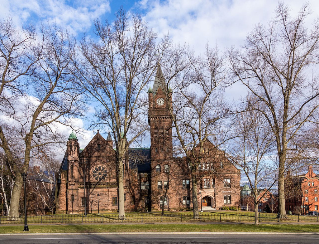
Mountain Day, has its origins at Mount Holyoke Female Seminary (now Mount Holyoke College), founded by Mary Lyon (1797 – 1849), and opened 1837-11-08, in South Hadley, Massachusetts. Every year in early fall, since 1838, its students participate in Mountain Day. On a random autumn morning, at the sound of ringing bells from Abbey Chapel, all classes are cancelled and students hike to the summit of Mount Holyoke.

There are two approaches to mountain views. One is a view of a mountain from a distant point in the lowlands. Another is a view from a mountain top. Here the artist can concentrate on that particular mountain’s characteristics. This is seen in the above work, Thomas Cole (1801 – 1848): View from Mount Holyoke, Northampton, Massachusetts, after a Thunderstorm—The Oxbow (1836).
Mount Holyoke, like much of the Metacomet Ridge, is composed of basalt. The mountain formed near the end of the Triassic Period, from about 250 – 50 million years ago, with the rifting apart of the North American continent from Africa and Eurasia. Mount Holyoke’s summit is 285 m high. It offers a variety of micro-climates, including hot, dry upper slopes; cool, moist ravines; mineral-rich ledges of basalt talus. These produce microclimate ecosystems on the mountain that support plant and animal species uncommon in the area.
Since then, many other American educational institutions have initiated their own mountain days.
The United Nations has celebrated International Mountain Day since 2003, The twentieth celebration is being held on Sunday, 2022-12-11. This year’s theme is, Women Move Mountains!
The United Nations Food and Agricultural Organization , who coordinates events, writes about this year’s theme:
“Women play a key role in environmental protection and social and economic development in mountain areas. They are often the primary managers of mountain resources, guardians of biodiversity, keepers of traditional knowledge, custodians of local culture and experts in traditional medicine.
Increasing climate variability, coupled with a lack of investment in mountain agriculture and rural development, has often pushed men to migrate elsewhere in search of alternative livelihoods. Women have therefore taken on many tasks formerly done by men, yet mountain women are often invisible due to a lack of decision-making power and unequal access to resources.
As farmers, market sellers, businesswomen, artisans, entrepreneurs and community leaders, mountain women and girls, in particular in rural areas, have the potential to be major agents of change. When rural women have access to resources, services and opportunities, they become a driving force against hunger, malnutrition and rural poverty and are active in the development of mountain economies.
To trigger real change towards sustainable development, it is important to engage in gender transformative change.
International Mountain Day 2022 is an opportunity raise awareness about the need to empower mountain women so they can participate more effectively in decision-making processes and have more control over productive resources. By sharing excellence, opportunities and capacity development in mountains, the Day can promote gender equality and therefore contribute to improve social justice, livelihoods and resilience.”
For an overview about the use of mountains, see: Martin F. Price (1957- ), Mountains: A Very Short Introduction (2015). Both Trish and I have read this book, and found it informative and entertaining.
According to Price, for a place to be defined as mountainous, the altitude had to vary by at least 300 metres over a radius of 7 kilometres.
Japan has held it own Mountain Day national holiday since 2016, based on 2014 legislation, that states that the holiday is to provide opportunities to get familiar with mountains and appreciate blessings from mountains. It is celebrated in August (the 8th month), not December (the 12th month). It is often speculated that the specific date was chosen because the kanji for the number eight “八” looks like a mountain. With eight being August in the calendar and the date 11 looking somewhat like two trees.
Inderøy
Tittinghalla, the highest point on the Inderøy peninsula, with a height of 268 m, is located 1 850 m north of Cliff Cottage. It is below the treeline, and is regarded as a hill. Tittinghalla Round is an annual walk (for some, race) that was first held in 1966. The track is 13.5 kilometers long. It is mostly by road, but with some forest path down from the trail’s highest point, Ørdalen, with a view over Skarnsund, that patriots call spectacular.
Cliff Cottage is on a cliff overlooking this sound, 35 m above sea level. Mosvik, across the sound, was its own independent municipality until 2012-01-01, when it merged with Inderøy. In the old Mosvik there are several forested landforms with peaks above the treeline. The highest peaks here are Storknuken (502 m, 16 km south-west of Cliff Cottage) and Bjørnakammen (414 m, 10 km west of Cliff Cottage).
Having seen real mountains, I call this area hilly, rather than mountainous. Terminology can cause people to have different world views. Thus, today’s Norwegian lesson tries to define concepts related to mountains. At times it can be hard to distinguish between a hill and a mountain.
Ås = hill, a land form that is characterized by being higher than the surrounding terrain, which is usually covered with trees or forest.
Fjell = fell, in some northern English dialects = mountain, is traditionally defined in Norwegian as a landform that sticks above the treeline. Treelines in Norway range from about 1 200 m in the south, to sea-level in the north. The treeline where Cliff Cottage is located, is about 380 meters above sea level. Some countries require a mountain to be a certain minimum height. This is not the case in Norway. In the United Kingdom it is 600 m = ca. 2 000 feet.
Vidde = plateau or plain or open area that is generally higher than the treeline. Because it is above the treeline, this term is sometimes translated as mountain.
Further comments on Mount Holyoke College and Mary Lyon.
It was a unique institution, founded by people of modest means and serving their daughters, rather than the children of the rich. Mary Lyon, a pioneer in education for women, was especially influenced by Joseph Emerson’s (1777 – 1833), Female Education: A Discourse (1822) that advocated for women to be trained as teachers, rather than as companions to please the other sex. Further information on Emerson, can be found here. Note: Originally, the wrong Joseph Emerson was cited as the author of a book about female information. This and the book title have now been corrected. A copy of the book can be downloaded from here.
In keeping with Lyon’s social vision, tuition fees were low, but required students to perform domestic tasks, such as preparing meals and washing floors and windows. Students were required to walk one mile = 1.6 km after breakfast, or for 45 minutes during the winter.
A comprehensive, rigorous, and innovative education was provided, with particular emphasis on the sciences where students learned science through: laboratory experiments which they performed themselves; field trips on where they collected rocks, plants, and specimens for lab work, and inspected geological formations and recently discovered dinosaur tracks.
Originally serving 200 students, in 2021 there were 2220 undergraduates and 122 post graduates. It has been ranked #1 in the list of the Top 20 Best Schools for Making an Impact. It remains an institution for women.
Update
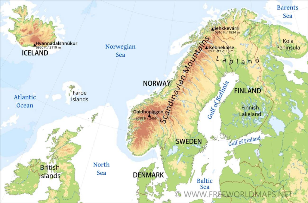
On 2022-12-11, Trish and I watched a National Geographic program in the 2019 series Wild Nordic. Kingdom in the Sky, the second episode, was about the Scandinavian mountain range, often referred to as the Keel/ Kjølen/ Kölen, in English/ Norwegian/ Swedish, respectively. Wikipedia reminds us, that the names Kjølen and Kölen are often preferentially used for the northern part, where the mountains form a narrow range near the border region of Norway and Sweden. In south Norway there is a broad scatter of mountain regions with individual names, such as Dovrefjell, Hardangervidda, Jotunheimen and Rondane.
In 2013, The Norwegian Trekking Association, and The Norwegian Geological Society, held a competition to find a new, but unofficial, name for the range. This was Nordryggen = North Back, sometimes translated as North Ridge.
The range is about 1 700 km long and 300 km wide. Examining the range from north to south, it starts in northern Norway, then forms a border area with Finland, before becoming part of the border area with Sweden. Sweden’s highest mountains are part of it: 2 104 m high Kebnekaise, with its glacier peak, and 500 m away 2 097 m high, Kebnekaise Nordtoppen which could become the highest point, if glacial melt continues.
Further south, the peaks are lower until one reaches Trøndelag, where they are only about 400 – 500 m, the low point for the range. South of Trondheim, and heading towards Stavanger, the mean altitude exceeds 1 000 m, with numerous peaks over 1 300 m. Here, one encounters Norway’s ten highest peaks, all 2 348 m or higher, with Galdhøpiggen the highest, at 2469 m. Ten of the thirty highest waterfalls in the world are found here.