As a naturalized Norwegian, one acquires a number of skills that people of other nationalities can only dream about. In today’s weblog post, the focus is a detailed insight into ferry operations. Perhaps I should start by bragging about living 300 meters from a ferry terminal, although that ferry was replaced by a bridge on 1991-12-19.
This is mentioned because our visit to Red Bay in Labrador, required the use of a ferry across the Strait of Belle Isle. The route is between terminals at St. Barbe on Newfoundland’s Great Northern Peninsula and Blanc-Sablon in Quebec. Theoretically, the crossing takes 1 hour 45 minutes, and covers 36 km. The first problem is that one has to meet up one hour ahead of the scheduled departure time, if one has a reservation. The second is that the ferry was not ready to leave at its scheduled departure time.
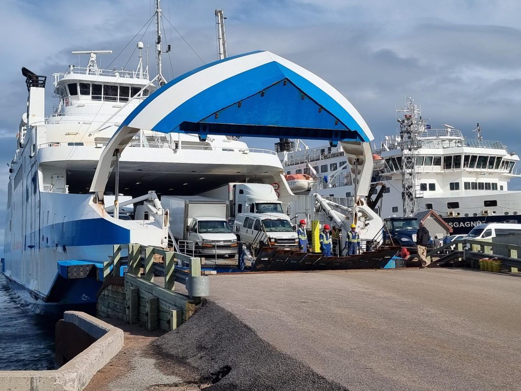
MV Qajaq W (the middle part is pronounced kayak) has been used on the route since 2019. It can carry 120 standard vehicles, including up to 8 tractor trailers, along with 300 passengers.
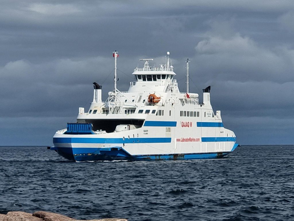
Qajaq was built in 2010, it has a length of 97.84 m, and has 5 233 gross tonnage. Working backwards from 5.6 MW of power, it is likely that it is equipped with 4 Wärtsilä BL20 engines, each providing 1 400 kW. It has an ice classification 1A, which is immediately below the best joint Finnish-Swedish ice-classification for merchant ships, 1A Super. Both bows are ice-strengthened. It was built in Norway at Fiskerstrand, outside of Ålesund, As MV Muhumaa, it sailed in the Baltic between Saaremaa island in Estonia and Ventspils in Latvia from 2011 to 2017.
This vessel replaced the 108.7 m long MV Apollo completed in 1970, that was unsuitable for the route, despite it being a Baltic ferry. The Apollo was equipped with accommodation for 1 500 people, that was never used. The Apollo had 2 x 3 400 kW MAN 9L32/36 diesel engines (altogether 6.8 MW), and 6 609 gross tonnage. At times, ice prevented it from landing at St. Barbe, and it would be redirected to Corner Brook, taking 12 hours for the crossing from Labrador. It was taken out of service in 2019, and scrapped in Turkey, in 2021.
Most Norwegian ferries simply drive into the dock (at low speed), and use their engines/ motors to keep their position as vehicles and passenger leave and enter. An even more advanced Auto-docking eliminating human input, has been a reality on some routes since 2018. Electric ferries have been used since 2015, and complete electrification is expected in 2025.
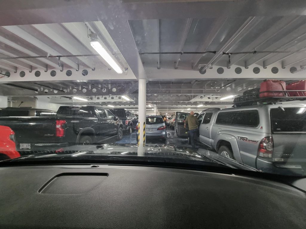
The ferry left about half-an hour late, mainly due to a design feature where, after service in the Baltic, the number of lanes of vehicles onboard the lower car deck was reduced from six to five, because north Americans prefer larger vehicles. With the middle lane being underused, because the crew spent precious loading minutes parking vehicles between support columns. We were shunted into this middle lane. Immediately ahead of us was a Mazda 5, identical to Alasdair’s. On my way to the passenger deck, I complemented the woman owner, Hélène, on her very attractive vehicle.
As for the ferry, my advice would be to just use four lanes, in an attempt to speed up loading, and in doing so, be able to make an extra trip each way, each day. I also note that some days there are an odd number of trips made, meaning that the ferry overnights on a different side of the strait.
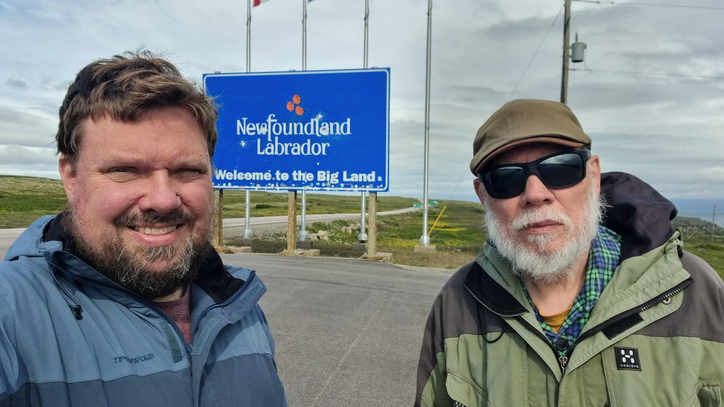
After landing in Quebec, it did not take us many minutes to drive the 6 km to the Labrador border. We continued onwards to the tourist office, to make important enquiries, such as finding places to buy a Labrador flag.
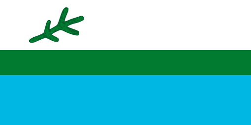
The Labrador flag was the most popular flag in Newfoundland. Yes, much more popular than the Canadian or Newfoundland flags. It was created in 1973 by a small group of Labradorians led by Michael S. Martin (1938 – ), then representative for Labrador South in the provincial legislature, to celebrate the then upcoming 25th anniversary of Newfoundland and Labrador’s entry into Canadian confederation, Many regard the creation of the Labrador flag as an act of political mischief/ vexation aimed at Premier Joey Smallwood (1909 – 1990) and his Liberal government’s perceived indifference to Labrador.
Patricia (Bryne) Martin sewed 64 flags, while her husband used a marker pen to add a spruce twig to each: 59 of the flags were given to Labrador communities, 3 to Labrador representatives in the provincial House of Representatives, One was for her husband, and another for herself.
The flag can be regarded as being 10:5 = 2:1 in proportions, with three fesses = wide horizontal bands, in flagspeak. From the top they are white, green (Pantone Green 356) and blue (Pantone Blue 306), in a proportion of 2:1:2. On the left of the white field is a stylized representation of a black spruce sprig, which is the most common tree, not just in Labrador but also in Newfoundland. Its is intended to remind viewers that Labrador is part of that province.
The flag’s colours are mirrored in the flag of Nunatsiavut = the Labrador Inuit Association. The black spruce twig was adopted for use on the Franco-Terreneuvien = French Newfoundlander flag.
Any six-year old, following a flag description, should be able to draw and colour any flag. If s/ he can’t, then the flag is too complex. We ended up buying both a Quebec and Labrador flag. Most Labrador flags (including ours) are fake/ bootleg. Michael Martin commented, “The problem stems from efforts by unscrupulous dealers and manufacturers to get around the copyright requirements by creating flags that have the wrong dimensions, wrong colours and wrong shape and size of the black spruce twig.” This is a common problem when attempting to buy flags! Justin Brake wrote about this situation ten year ago! The Labrador flag is now over 50 years old.
Red Bay
About 80 km north of Blanc-Sablon is the former whaling station at Red Bay. Starting in 1530 and lasting for almost 100 years, it was a major Basque whaling area. Several whaling ships, both large galleons and small chalupas, sank there. Their discovery led to the designation of Red Bay in 2013 as a UNESCO World Heritage Site. Data from the 2021 census shows that Red Bay had a population of 142 living in 65 of its 69 total private dwellings. That is down 16% from its 2016 population of 169. It’s land area is 2.31 km2.
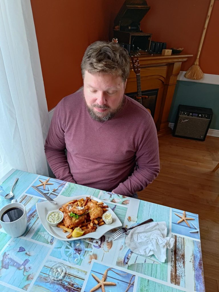
A bus load of tourists, travelling on our ferry, arrived at about the same time as us. They managed to inundate the local museum, so Alasdair and I thought the best counter move was to visit the Whaler’s Restaurant. When I asked for a meal of whale meat, I was politely told that they were sold out. Both Alasdair and I ate their fish and chips.
Return to Newfoundland
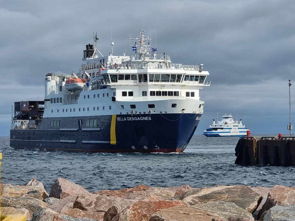
The Bella Desgagnés cargo-passenger ship arrived minutes before the Qajaq W at Blanc Sablon. Its voyage from Rimouski to Blanc Sablon and back to Rimouski takes a week. The first stop is at Sept-Îles on the north shore, then it stops at Anticosti Island, before stopping at other coastal villages. The return trip on Qajaq was considerably delayed according to its schedule. This gave us an opportunity to view the unloading of the Bella Desgagnés. Many unloaded vehicles were making their way to Newfoundland on the Qajaq.
Future Trips
I will probably not visit Labrador again, but Alasdair expressed an interest. The Trans-Labrador Highway (TLH) is the primary public road in Labrador, with a length of 1 149 km. The original western/central portion of the TLH is designated as Route 500 and measures 543 km from the Quebec – Labrador boundary through Labrador City/Wabush, Churchill Falls, and Happy Valley-Goose Bay. From there, heading southeast is Route 510 = Labrador Coastal Drive, 606 km. Centres en route include Cartwright Junction, Port Hope Simpson, Mary’s Harbour, Lodge Bay and Red Bay.
The TLH runs through dense wilderness for most of its length. Route 500 connects with Quebec Route 389, which runs 567 km through wilderness north from the Quebec – Labrador boundary to Baie-Comeau, where it connects with Quebec Route 138. At one time Quebec promised that the route would follow the entire north shore of the St. Lawrence River eastwards to Blanc-Sablon. This has not happened. However, The western terminus is in Elgin, at the border with New York State south-west of Montreal. At the Trout River Border Crossing, it connects with New York State Route 30. Route 30 leads to Schenectady County, where some of my biological relatives settled about 1660.
Back to Happy Valley
If one wants to explore the coastal communities north of Happy Valley – Goose Bay, there is a ferry service that operates each summer in the ice-free season, from roughly June to November. The Kamutik W is often described as a sister ship to the Qajaq, although it is outfitted very differently. It began life as the Hiiumaa in 2011, and sailed in Estonia.
In its new life it has a weekly schedule. It departs Happy Valley-Goose Bay and visits each community on its voyage north. At Nain (most northerly community), it turns around and revisits each community on the return trip to Happy Valley-Goose Bay.
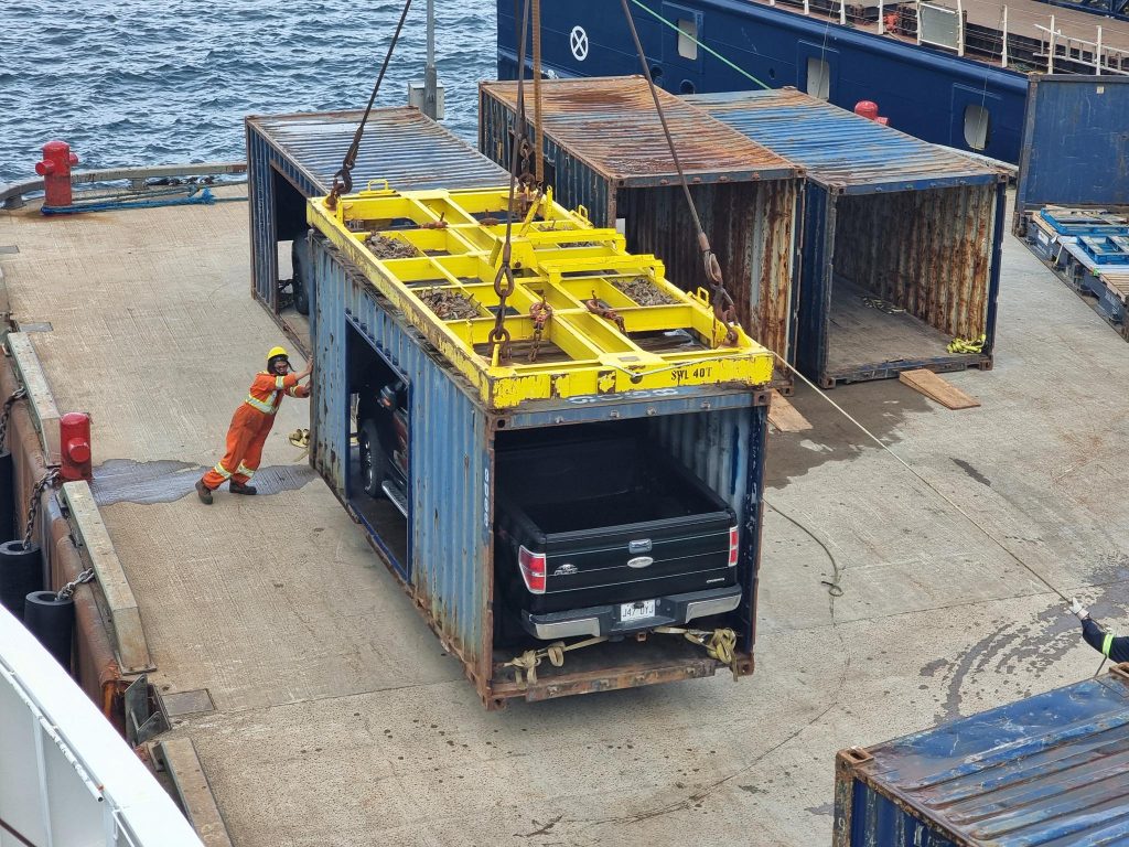
at Blanc-Sablon. Photo: Alasdair McLellan