Haparanda, Tornio and Kemi are three municipalities in Bothnia Bay, the northernmost part of the Gulf of Bothnia, which is in turn the northern part of the Baltic Sea.
During winter it is possible to get around the gulf with: ice skates, sleds, skis, snowmobiles as well as by car on the ice roads over the gulf to the larger islands. There are 4 001 islands, with an island defined as a landmass surrounded by water, larger than 20 m².
Freshwater rivers mean that the bay has brackish water with extremely low salinity levels (0.2-0.3 %). This can be compared with the world’s oceans where the salinity level is around 3.5 %. Most salt-dependent sea species cannot survive in the bay. Ringed seal, grey seal, cod, herring and salmon are found here, along with freshwater species such as the pike, whitefish and perch.
Further south is Merenkurkku (Finnish) = throat of the sea (literal translation) = Kvarken (Swedish) = Quark Ridge (English) a narrow region separating Bothnian Bay from the rest of the Bothnian Sea. Here, the distance from the Swedish mainland to the Finnish mainland is around 80 km. The maximum water depth is about 25 m. Land is rising at 8 to 10 mm a year. Within 2 000 years this will create the largest lake in Scandinavia to its north. There are 5 600 islands in Kvarken.
Summers are mild for a coastal location so far north, and winters are normally not extremely cold in spite of the relative proximity to the Arctic Circle. Trish and I first visited this area ca. 1979-12-10. Alasdair and I visited it almost forty-five years later on 2024-05-12.
Haparanda 65°50′N 024°08′E
Haparanda, for historical reasons, is often still referred to as a city despite its small population, about 5 000 people in 4.43 km2. It is Sweden’s most easterly settlement.
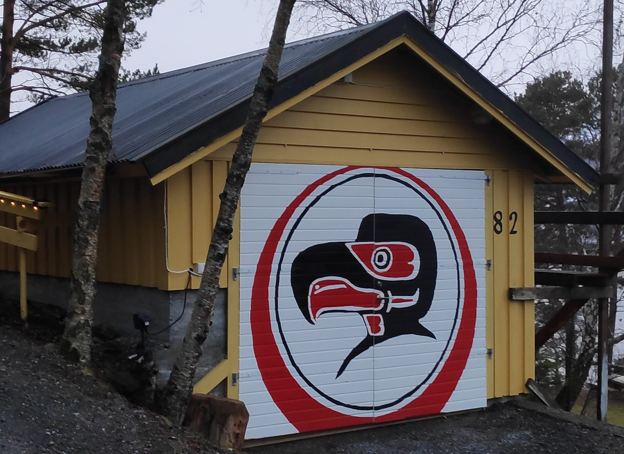
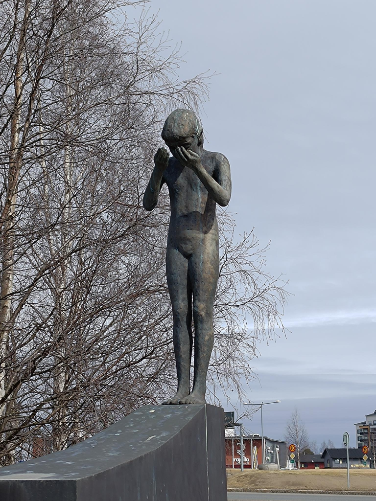
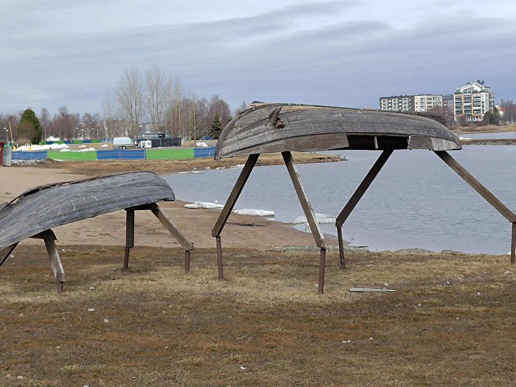
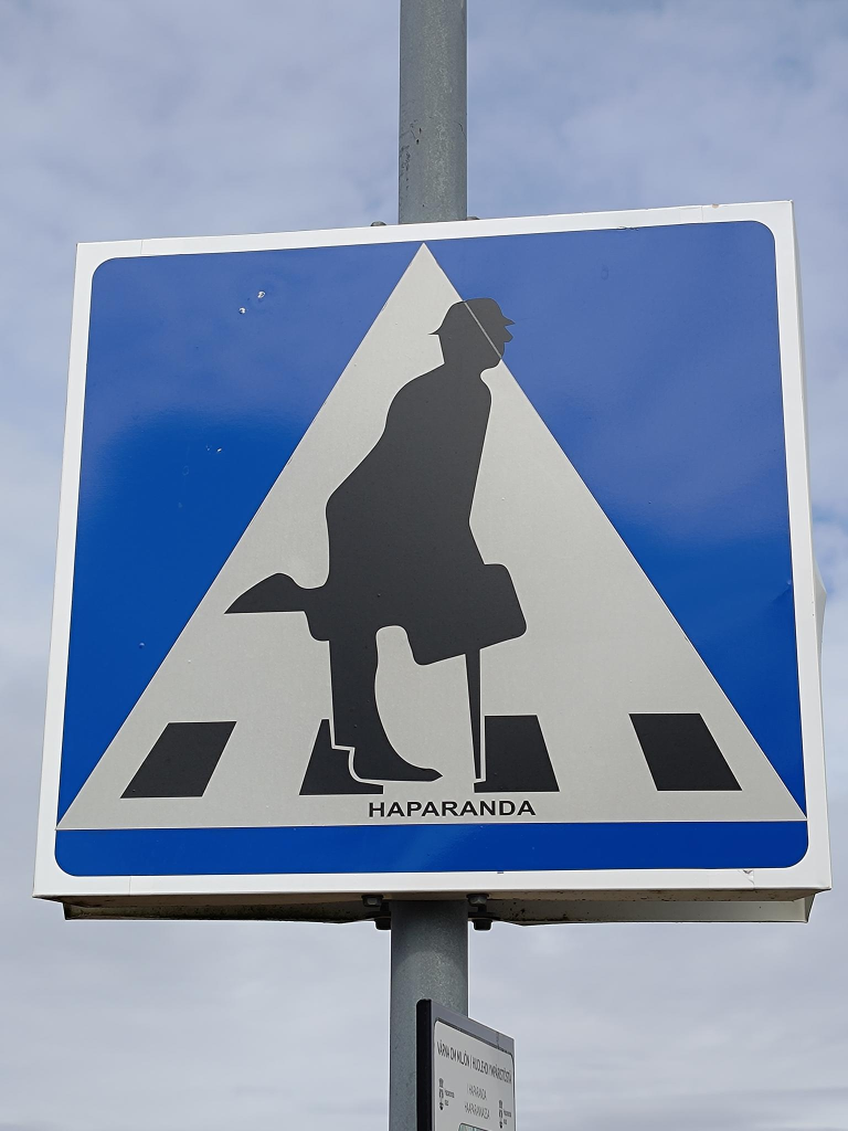
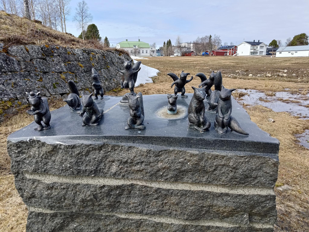
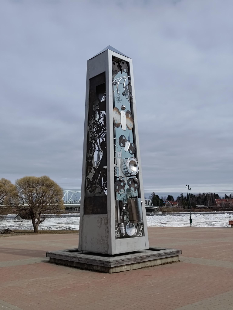
Anna Jäämeri-Ruusuvuori (1943 – ) Separation. Unveiled 2005, 60 years since the end of world war II. A memorial to the approximately 80 000 Finnish children who were sent to Sweden during the war. The artist was herself one of the war children in Sweden. They were sent to Sweden to be spared the suffering that the war brought to Finland. Most war children returned to Finland after the war, but several thousand remained in Sweden.Bo Holmlund (1935 – 2013) Broar = Bridges. Located in the marketplace in Haparanda. It was erected in 1992 on Haparanda city’s 150th anniversary. Until the border was drawn in 1809, Sweden and Finland were a common country. After the Finnish war (1808 – 1809) between Sweden and Russia, Russia took over Finland. Bridges were broken and the countries went their separate ways. Sweden has had a relatively stable history, while Finland has suffered from both world wars and civil wars. Now it is a new time, the border is increasingly disappearing.Hanna Kanto (1981 – ) with Oday Shalan, Yazan Jbour, Mamoon Al, Diamond Eagle, Masoud Karimi. Strandad = Stranded (2016). The sculpture is made of old boats that have been used on the Torne River. It visualizes old traditions and contemporary events in the Torne Valley.Victoria Andersson (1971 – ) The Struve Triangle (2012). The Struve Geodetic Arc is a chain of survey triangulations stretching from Hammerfest in Norway to the Black Sea, through ten countries and 2,821.853 ± 0.012 km, which yielded the first accurate measurement of a meridian arc. The chain was established and used by the German-born Russian scientist Friedrich Georg Wilhelm von Struve (1793 – 1864) in the years 1816 to 1855 to establish the exact size and shape of the earth. The Struve Geodetic Arc was inscribed as a World Heritage site in 2005.Map of the Struve Geodetic Arc. The 34 red dots are places registered in the UNESCO World Heritage Site. Wilhelm Struve was appointed European Surveyor of the Year 2014 by the Council of European Geodetic Surveyors (CLGE). Image: Badock, Wikimedia commons.Along the Torne river one finds numerous unusual crosswalk signs (but no crosswalks). There is a person displayed, but walking does not seem to be appropriate. In the future, I intend to replace this sign with a composite that merges at least four signs. I will also attempt to find the person, or people responsible.Anja Örn (1972 – ) Transit: Brevduvor på bord = Transit: Homing pigeons on the table (2016). A small aerial lift (zipline) was built in 1916 over the river to transport mail, because during parts of the year the ice was too strong for boats and too weak or too split up for walking. This artwork celebrates the zipline. Note the culture vulture eying the pigeons from the background.Mats Wikström (1954 – ), Järnvägsbrons beskyddare = Protectors of the Railway Bridge (2012). These squirrels protect the bridge, and perform spiritual actions according to various religions.
Tornio 65°51′N 024°09′E
The delta of the Torne River has been inhabited since the end of the last ice age, 16 settlement sites have been found in the area, similar to those found in Vuollerim (c. 6 000 – 5 000 BC).
Tornio is unilingually Finnish with a negligible number of native Swedish speakers. Large numbers are bilingual, speaking Swedish as a second language, with an official target of universal working bilingualism for both border municipalities. Much of the economy is related to stainless steel products.
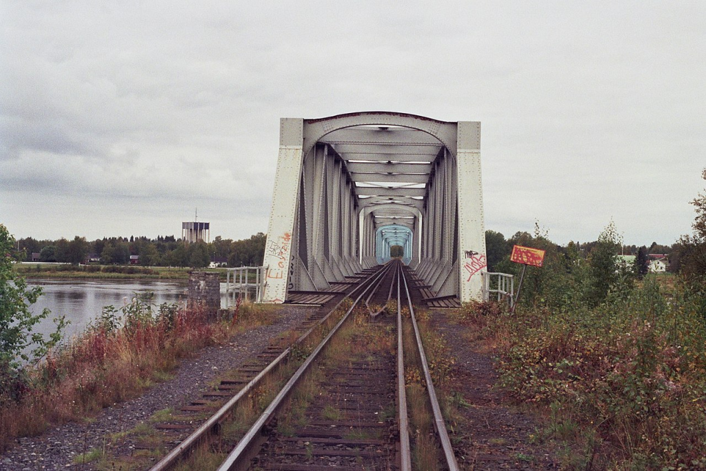
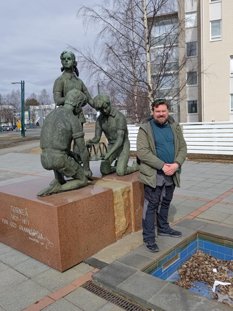
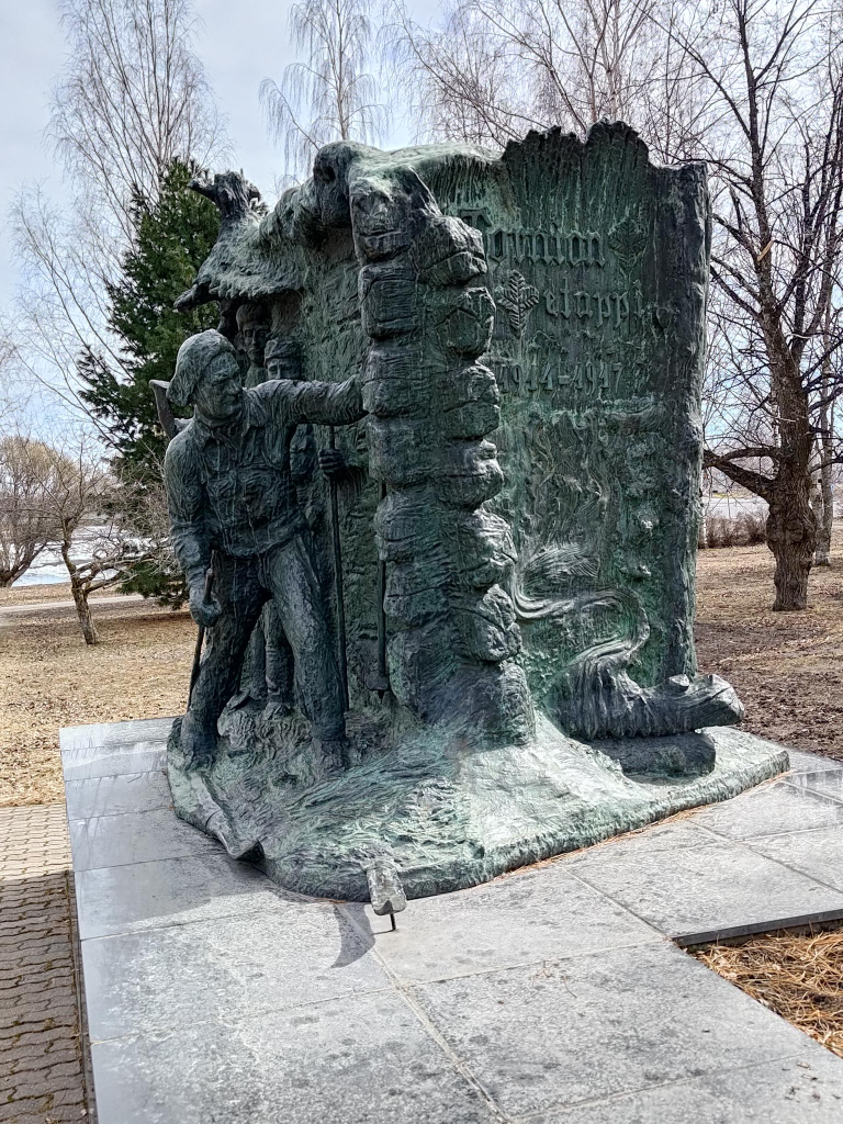
The Torne River Railway Bridge is 405 m long, and was built as a swing bridge in 1919. It was converted to a fixed structure in 1985. It is a dual gauge railway bridge between Haparanda, Sweden and Tornio, Finland; the bridge can be used by the 1524 mm broad gauge trains, usually Finnish using rails 1 and 3 counting from the left, as well the 1435 mm standard gauge trains, using rails 2 and 4. While we were visiting we could see the bridge being modified to increase its height. It will then be electrified together with the railway line from Laurila in Finland. The electric railway will be in operation by the end of 2024. The bridge is painted white from the Finnish (near) side to the international border, and is blue from there to the Swedish (far) side.Nina Sailo (1906 – 1988) The Aino statue (1959), Located in Aino park, is a belated representative of classic handicraft style. Unveiled in 1959. Alasdair is standing with his left foot (on the right of the photo) in Tornio, Finland, while his right foot (on the left) is in Haparanda, Sweden. There is no physical infrastructure at the border, showing just how free the movement is between countries. Niilo Savia (1898 – 1977) The Jaeger Monument. Unveiled in 1965. At Helsinki University, many Finnish students wanted Russia out of Finland. However, it had no army of its own. Finland pleaded with Sweden to train its troops, but Sweden used its neutrality, to deny this request. However, Germany as an opponent of Russia, agreed to train Finnish troops. The German government financed the journey of recruits to the Lockstedt training camp.Pekka Isorättyä (1980 – ) and Teija Isorättyä (1980 – ) Särkynyt Lyhty = A broken lantern, unveiled in 2013. It shows cult figures from Tornia, such as the priest of Kalkkimaa and the album cover of the band Terveet Kädet. The work uses local steel and steel objects collected from individuals and companies in the area.Pekka Isorättyä and Teija Isorättyä, Kojamo = Shed. It is a steel salmon statue commissioned for Tornio’s 400th anniversary in 2021.
Kemi
About 10 km south of Tornio is Kemi. It is a deepwater port for the north of Finland. Known for its ice and snow. Famous for its winter ice castles, rebuilt annually, and regarded as the largest in the world.
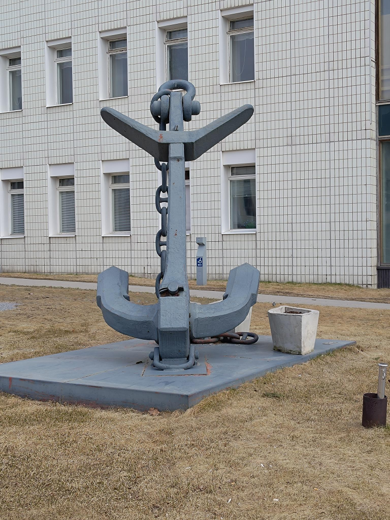
Kemi is world famous, at least in Finland, as the home of the snowman, with this concrete example living outside Kemi’s city hall. Part of the reason for this focus on snow people is that Rovaniemi, located 117 km further north and closer to the Arctic Circle in the northern interior of Finland, has become the home of Santa Claus, since 1985. The city hall was first completed in 1940, but expanded in 1965–1969. The building also serves as the water tower for Kemi.A Martin’s type anchor from the Russian cruiser Asia, left in Kemi in 1905, in front of Kemi’s City Hall. Height = 3 m, mass = 3 500 kg. It was unveiled in 1969 as a memorial to the city’s founding in 1869, by a regulation issued by Alexander II (1818 – 1881), giving it the rights of a staple town, which allowed overseas trade, the collection of tree/ merchant charges, property taxes, port, bridge and load charges, as well as port and weigh house taxes. In addition, the city had to build infrastructure for the port = a bonded warehouse, a weigh house, a storage warehouse. This privileged right was cancelled in 1995.
2 Replies to “Haparanda – Tornio – Kemi”
Thank you so much Brock for sharing your impressions with us. I really appreciate your blog.
Beste hilsen fra Jørg


Thank you so much Brock for sharing your impressions with us. I really appreciate your blog.
Beste hilsen fra Jørg
Thank you for the map. It helps to put things in perpective.