Optics 1

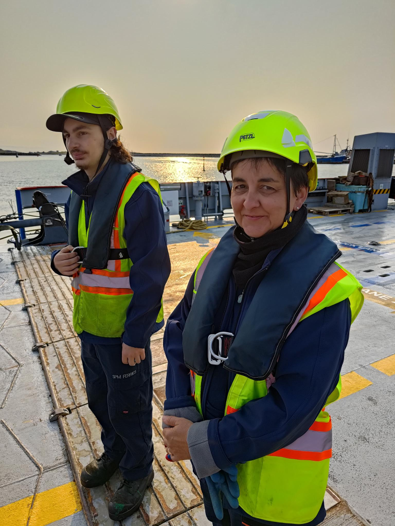
Structure of the Eye. Image: OpenStax College, 2013-06-19.

This weblog post is the first of a series of nine about optics and optical instruments. Five of these will be posted in 2024-06, and four in 2025-01. This post presents some definitions, and some elementary theory behind optics. #Optics 2 is about eyes and eye diseases; #3 is about eye prescriptions; #4 is about eyeglasses. Later topics include: #5 is about safety glasses; # 6 is about cameras; #7 is about binoculars and monoculars; # 8 is about astronomical telescopes; and, #9 is about microscopes.

There are two approaches to optics that can be taken: Here it is about visual perception, the eyes, and how they sense, rather than on the natural (or even the artificial) production of phenomena, such as light and colour, that can be observed.

Readers are advised against starting any study of optics with Greek philosophers. This will be discussed later in this weblog post. Instead, it they want a historical approach, an appropriate place to begin is The Book of Optics (1011-1021), a seven-volume treatise on optics and some other subjects by Ibn al-Haytham, (965–c. 1040) = Alhazen/ Alhacen, a medieval Arab scholar.

Ibn al-Haytham was the first to correctly explain the theory of vision, and to argue that vision occurs in the brain, noting that it is subjective and affected by personal experience. He stated the principle of least time for refraction that links ray optics and wave optics: the path taken by a ray between two given points is the path that can be traveled in the least time = Fermat’s principle. He made major contributions to catoptrics = the branch of optics dealing with the reflection of light from plane or curved mirrors, and dioptrics = refraction, especially by lenses. More generally, Ibn al-Haytham contended that a hypothesis must be supported by experiments based on confirmable procedures and/ or mathematical reasoning.

Content. Book I: theories about light, colours and vision; Book II: theory of visual perception; Book III: ideas on the errors in visual perception; Book IV and Book V provide experimental evidence for theories about reflection; Book VI: errors related to reflection; Book VII: the concept of refraction.

An appropriate next stop is the English bishop Robert Grosseteste (c. 1175–1253) who wrote on a wide range of scientific topics, that included On Light (1235), which is viewed from four different perspectives: epistemology, metaphysics/ cosmogony, etiology/ physics and theology. All of these take their inspiration from Genesis 1:3: God said, let there be light, Creation is seen as a natural physical process arising from an expanding/ contracting sphere of light.

A third stop is Roger Bacon (c. 1214–1294), an English Franciscan, who was influenced by Grosseteste’s writings. Perspectiva, Tractatus de multiplicatione specierum (<1267) = Tract on the Multiplication of Species, and De speculis comburentibus = On Burning Lenses are all writings about optics. His mathematical analysis of light/ vision was influenced by Ibn al-Haytham.

An erect image = one that appears right-side up. The opposite is an inverted image = one that appears upside down. Some telescopes and other devices including the camera obscura present an inverted image. Mirrors and compound prism elements can be used to transform an inverted image into an erect image.

Popularizations

Many times theorists have a difficult time explaining their subject so that it is understandable for a broader audience. At that point it is good to have other people around who are able to communicate ideas. Here are some of those people in the field of optics.

Peter of Limoges (1240–1306), in Tractatus Moralis de Oculo = A Moral Treatise on the Eye, popularized Bacon’s writings on optics.

John Pecham (ca. 1230 – 1292 ) wrote the most widely used optics textbook in the Middle Ages: Perspectiva communis. His book centered on the question of vision, on how we see. Pecham followed the model set forth by Ibn al-Haytham, but interpreted Ibn al-Haytham’s ideas in the manner of Roger Bacon.

Pseudoscience

When it comes to optics, early Greek philosophers are to be avoided. Empedocles (c. 494 – c. 434 BC) believed Aphrodite made the human eye out of the four elements = earth, air, fire, and water. She lit the fire in the eye which shone out from it, making sight possible. This would mean that it should be possible to see equally well in darkness as in light, which is not the case. He believed there were two different types of emanations that interacted: one from an object to the eye, another from the eye to an object.

In philosophy, William of Ockham (ca. 1287 – 1347) postulated Ockham’s razor , a problem-solving principle that recommends searching for simple explanations = the principle/ law of parsimony. It is expressed as: Entities must not be multiplied beyond necessity. It is often paraphrased as the simplest explanation is usually the best one. These Greek explanations contradict this advice.

There are few contemporary references to Euclid (c 300 BC) about optics. There are questions about the attributions of many of his works. He is believed to have written two books related to optics. Catoptrics, about the mathematical theory of mirrors, particularly images formed in plane and spherical concave mirrors. Optics is the earliest surviving Greek treatise on perspective, including an introduction to geometrical optics and basic rules of perspective.

Claudius Ptolemy (c. 100 – c. 170) of Greco-Egyptian ethnicity and Roman citizenship, flourished in Alexandria. Robert R. Newton (1918 – 1991) in The Crime of Claudius Ptolemy (1977) challenged Ptolemy’s observations and asserted that Ptolemy fabricated many of these to fit his theories. Newton accused Ptolemy of systematically inventing/ doctoring data, and called him the most successful fraud in the history of science.

Winer et al (2002) have found that up to 50% of adults in the early years of this millennium believed in emission theory. The easiest way to refute it is to note that if emission theory were true, it would be possible to observe objects in the dark equally well as objects in the daylight. I find there is a significant difference between these.

Note: In 2024-03 and 2024-04 I systematically investigated various topics related to optics. Much of it had to do with Trish having an eye examination on 2024-04-18. By 2024-04-09 at 20:11 I had decided where this series was going, and scheduled this post to be published 2024-06-01 at 12:00. We also decided that we needed new and lighter binoculars and a spotting scope so that we could be better oriented about the wildlife in our neighbourhood. In particular, I wanted to follow a pair of cranes (Grus grus), birds that live near us during the summer.

Corrections: On 2024-06-08, at about 18:40, the number of posts about optics in 2024-06 was increased from 4 to 5, while the number was decreased from 5 to 4 in 2025-01.

Vaasa

63°06′N 021°37′E

Vaasa is a city in Finland on the west coast, on the Gulf of Bothnia. Its population is almost 70 000. Vaasa is a bilingual municipality with Finnish and Swedish as its official languages. The population consists of: Finnish speakers = 65%; Swedish speakers = 23%; People with other mother tongues = 12%. Surrounding municipalities have a clear majority of Swedish speakers. Thus, Swedish maintains a strong position in Vaasa. This makes it the most significant cultural center for Swedish-Finns.

Industrial Art

Industrial art means different things to different people. I use it in a general sense to refer to products made through industrial processes that result in something attractive, not necessarily beautiful. Textures produced by industrial processes are an example. Thus, in Vaasa, I decided to document the variety in textures found on the streets.

Maintenance hole = manhole covers are another example of industrial art. These are removable lids over the opening of maintenance holes, that are access points large enough for a person to pass through. They are designed to prevent anyone or anything from falling in, rainwater excepted, in some cases. I take photographs of them, but expand my collection by collecting photographs taken by others.

A weblog post on industrial art is being prepared, for publication on 2024-09-21.

Nieminen Valimo = Nieminen foundry, was founded in 1928 by Väino Nieminen (1879 – 1958), in Harjavalta, in south-west Finland. Its location is strategic for production: on sandy ground, next to the Kokemäki river. It is the only maintenance hole and cover foundry in Finland. It is now owned by the Norwegian Cappelen group.

Sculpture

Three statues are presented, along with a comment about a fourth work not included.

Street art is not always appropriately labelled, or even labelled at all. Such is the situation in Vaasa, with the following three works. It took time, measured in hours, to find the title of each work, its constructor/ sculptor along with birth and death dates (where appropriate) year it was made, and other details about each work. This is one reason encountering street art is so much fun.

Erkki Kannosto (1945 – ), Varjoja metsässä (Finnish) = Shadows in the Forest. Unveiled 2006.
Erkki Kannosto, Syvä jano (Finnish) = Deep Thirst. Unveiled 2005.
Hannu Leimu (1969 – ), Auringon Lapsi (Finnish) = Child of the Sun. Unveiled 2010.

Political comment 1: Centaurs are mythical creatures, part human and part horse. This composition has led many to treat them as liminal = intermediate beings, caught between two natures. Like all mammals, they come in both male and female = centaurette, varieties. I see Leimu’s work as being in direct opposition to the centaurettes appearing in Disney’s film Fantasia (1940). Originally, the animated centaurettes had displayed their breasts, but that was deemed too offensive for audiences, so these were quickly covered with garlands of flowers. Finnish sauna culture means that the human form, in both of its common varieties, is frequently seen and accepted as natural.

On two occasions, and for several minutes both times, I contemplated photographing Suomen Vapaudenpatsas (Finnish) = Finlands frihetsstaty (Swedish) =The Statue of Liberty, a monumental bronze sculpture. I decided against it, but would include an appropriate link. The height of the work with its pedestals is 14 m, the bronze statue at the top is 6 m. The sculpture was designed by Yrjö Liipola (1881 – 1971) and Jussi Mäntynen (1886 – 1978). It was unveiled in 1938.

Political Comment 2: I find the celebration of war distasteful, and this statue is a tribute to the Whites in the Finnish Civil War in 1918. This work is an adulation of one person, General Carl Gustaf Emil Mannerheim (1867 – 1951), who is displayed three times life size. The Red Guards, composed of industrial and agrarian workers, controlled the cities and industrial centres of southern Finland. The White Guards, composed of land owners and those in the middle and upper classes, controlled rural, central and northern Finland. The offensive part of this work is that is fails to unite the Red and White factions after the end of the war, but focuses on one side’s victory.

Oulu

65°00′51″N 25°28′19″E

Oulu is located on the northwestern coast of Finland, at the mouth of the River Oulu. It is the largest Finnish city with a sub-arctic climate: cold and snowy winters; short and mild summers. The name Oulu derives from the Finnish dialectal word oulu, meaning floodwater, related to the southern Sami åulo = melted snow, åulot = thaw.

Oulu has a large population (215 000). It is also important as one of Europe’s living labs, where residents experiment with new technologies, such as near-field communication (NFC) tags and ubiquitous computing (ubi) screens on a community-wide scale, often involving thousands of users.

Street furniture

Yes, there are four of these units, all in a row: green, yellow, pink and blue. None of the stalls were in use, so it was not possible to know, with certainty, the intended use. One suspected use is a place for mooring/ hitching a bicycle.
Some bicycle hitching posts were in use. At the far left of the photograph, one can see Tiernapojat = Star Boys sculpture. It is discussed at the end of this weblog post.
It is suspected that these two components could provide seating, but only if some other components, including a back and seat, were installed.

Corporate Identity

Alasdair and I ate our second sushi dinner of the trip at Luckie Fun’s Sushi Buffet.
I have managed to survive the first 75 years of my life without a tattoo, and have no intention of enduring one now. However, I find tattoo parlor names and signs interesting. I collect images of the signs.

Statues

Kaarlo Mikkonen (1920 – 2001), Toripolliisi (Finnish) = The Bobby at the Market Place, Oulu. Unveiled in 1987. Photo: Tve4 (2006-05-26). The translated title is a bit too British for a north American. I would have preferred it to have the title: The policeman at the market place.
Yes, an image of birds, possibly four herons. However, I have not been able to discover the artist, or time period for its construction, or even its title.
Sanna Koivisto (1955 – ), Tiernapojat = Star Boys. Unveiled 2014, moved to its permanent location 2016.

Tiernapojat, or star boys, is a song play based mainly on the Gospel of Matthew. It tells about the journey of three wise men from the East to the baby Jesus and about King Herod, who orders his soldiers to kill all the little male children, hoping to then also kill the newborn Jesus, the King of the Jews. The performance is estimated to be a centuries-old tradition, but the first reliable written record of the Oulu tiernapoika tradition is from 1873. The song came to Oulu from Sweden.

World Goth Day #16

Sakshaug Old Church Photograph: Henny Stokseth, 2013-08-19.

Previously, three weblog posts have been published to celebrate World Goth Day. These were about art, music and clothing. In 2023, there was so much other material written, that the chosen topic, Gothic architecture, was delayed until 2024. Now, at publication it is 2024-05-22, and the sixteenth World Goth Day!
When Gothic architecture as a topic came to mind, I began to wonder about the extent of Gothic buildings in Norway. Thus, I looked up Gotisk arkitektur = Gothic architecture, in the Norwegian Wikipedia.

Translated into English, the section on Norway begins: Perhaps the earliest example of Gothic in the Nordics is a pointed arched portal at Sakshaug Old Church in Nord-Trøndelag. That church is precisely 11.0 km by road, east of Cliff Cottage. My thought then was that there was no need to describe something foreign, when I have source material almost on my doorstep.

Sakshaug Old Church was likely built from 1150 to 1180, and was consecrated in 1184. It is a place on our annual visitation list when, usually in July, we visit the graves of people we have known, who are no longer with us in this physical domain. We visit two people who are buried beside the church.

Gothic windows on the east wall of Sakshaug Old Church, Inderøy. Photograph: Morten Olsen Haugen 2017-04-24

Most churches undergo change throughout their existence. This is undoubtedly true of Sakshaug Old Church. Thus, the choir was rebuilt with Gothic windows 1220–1230. Near these Gothic windows in the choir and on the chancel arch, there are 21 unique stone masons’ marks which show that it was stone masons from the construction of Nidaros Cathedral who built this church. Over the years, both exterior and interior have changed significantly.

The Alterpiece at Sakshaug Old Church, Inderøy, with the Gothic window behind. Photograph: Morten Olsen Haugen 2017-04-24

About five hundred years after the church was originally built, a pulpit from 1646 and an altarpiece from about 1655 were incorporated into the building. Both are carved in wood, presumably by Johan Johansen = Johan Bilthugger = Johan the wood carver. He died in 1657 in Trondheim, and was active in Trondheim and throughout Trøndelag in the middle of the 17th century. He is known for several altarpieces and pulpits.

In 1814, Sakshaug Old Church served as an election church for Inderøy Parish. Together with more than 300 other parish churches across Norway, it was a polling station for elections to the 1814 Norwegian Constituent Assembly which wrote the Constitution of Norway.

The Church Act of 1851 required church buildings have room to hold 30% of the people living in the parish. With a seating capacity of 200, the old church was too small to meet the requirements of the Church Act. It was replaced by the larger Sakshaug New Church, described below. After the new church was completed, the old church was closed. The wood roof, tower, decor and other woodwork were removed and sold. The only parts of the building that remained were the stone walls.

The pulpit was stored in the Science Museum, in Trondheim, while the altarpiece was used in Sakshaug New Church until 1957. It has now been returned to the old church. The ownership of the church was transferred to the Society for the Preservation of Ancient Norwegian Monuments in 1873. The church ruins sat for years without anything being done, but in the early 20th century, work began to restore the church. The ruins were finally enclosed by a roof in 1926. Work was completed in 1958, when it was re-consecrated.

Hustad Church in Inderøy, Trøndelag. Built in 1150. Photograph: Hans Grendahl, 2004-10-28.

A second church with Gothic elements is located at Hustad, in Sandvollan, 13.8 km NNE of Sakshaug Old Church. Historical records of the church date from 1133, but construction probably started about 1160. It was mainly built of quarry stone. This masonry is almost completely preserved. The church has an entry porch on the west end with a tower above it. There is a rectangular nave and a narrower, rectangular chancel. Dendrochronology = tree dating from the church show that the trees used to build the roof structure of the nave were cut down in 1162–1163. Based on masonry techniques and stylistic features of the portals, it has been concluded that the church was completed about 1163. The two portals to the north and south have Romanesque arches. The west tower was completed about 1180. The wooden pews are original, dating from about the same time. The cemetery, surrounding the church, is enclosed by a log fence, the only such preserved fence in Trøndelag.

In 1650, a tower, serving as the building’s main entrance, was rebuilt/ replaced, and a wooden sacristy was constructed on the north side. Baroque-style furniture was also added. The current altarpiece depicting the Crucifixion of Jesus is from 1702. The pulpit has painted carvings of the Evangelists.

The alter and choir at Hustad church, Sandvollan, Inderøy Hustad church interior Photograph: Morten Olsen Haugen 2013-05-07

Hustad church was one of 632 churches and properties sold between 1723 to 1730 by Frederik V (1671 – 1730), King of Denmark and Norway 1699 – 1730. About 100 were sold to congregations, while the rest were sold to individuals, often high ranking clergymen. Later, congregations bought back most churches, with municipal help. In retrospect, it has been argued that the King never owned these properties. The alleged reason for the sale was so that the King could pay debts from the Great Northern War. The last private owner sold the church to the people of the parish in 1838. The church was renovated and the interior painted in bright colors soon after that.

Wikipedia tells us, The Great Northern War (1700–1721) was a conflict in which a coalition led by the Tsardom of Russia successfully contested the supremacy of the Swedish Empire in Northern, Central and Eastern Europe. The initial leaders of the anti-Swedish alliance were Peter I of Russia, Frederick IV of Denmark–Norway and Augustus II the Strong of Saxony–Poland–Lithuania. Frederick IV and Augustus II were defeated by Sweden, under Charles XII, and forced out of the alliance in 1700 and 1706 respectively, but rejoined it in 1709 after the defeat of Charles XII at the Battle of Poltava. George I of Great Britain and the Electorate of Hanover joined the coalition in 1714 for Hanover and in 1717 for Britain, and Frederick William I of Brandenburg-Prussia joined it in 1715.

In 1885, permission was granted to build Heggstad Church, because Hustad did not meet the size requirements of the Church Act. It was built in 1887 using Håkon Mosling’s plans. Heggstad church seats about 250 people. After its completion, Hustad church was closed and sold to the Society for the Preservation of Ancient Norwegian Monuments who maintains the building and run it as a museum.

This is also a place we visit annually. We have two friends who are buried there.

Sakshaug New Church is the second largest church in Trøndelag, only exceeded by Nidaros Cathedral in Trondheim. The new church was built in a Neo-Gothic long church style, construction was started in 1870 and completed in 1871, the same year the church was consecrated. It was designed by Håkon Mosling. Originally, the church could accommodate 1 200 people, but fire regulations limit this now to 850 people. The reason for such a large church and excess is related to Inderøy’s position of power towards the end of the 19th century. Arguably, it was the second most important place in Trøndelag. Its power declined significantly in the 20th century, and is non-existent in the 21st century. We know many people who are buried at Sakshaug New Church, and read prayers at three of them, on our annual visit.

Note: Håkon Mosling (1840-1914) was a Norwegian builder and architect. He lived in several places, including Trondheim (1865-1873), Steinkjer (1874-1894), and Oslo (1894-1914). As part of his architectural practice, he worked as a builder and had a carpentry workshop in Steinkjer. For the last 20 years of his professional life, he was employed as a draftsman for the military at Akershus Fortress in Oslo. Due to his limited schooling, several of his designs underwent extensive proofreading and adjustments by Jacob Wilhelm Nordan (1824 – 1892) who was the architect employed by the Ministry of Church Affairs.

The system that administrates the churches is archaic. Inderøy has a population of less than 7 000 people. It also has seven churches, of which two are Gothic. Few people actually attend church services. This includes active Christians, who choose to use their chapels = bedehus (Norwegian) = prayer houses (literal translation). Residents with a non-Christian background have difficulty finding an appropriate, dignified place to celebrate sacred events, such as birth, adulthood (confirmation), marriage and death, Thus, I thought it would be more interesting to write about Norwegian religious excesses.

What I find disturbing, as a non-Christian, is that both medieval churches were re-consecrated. This effectively prevents their use by non-Christians.

Originally, in 1814, the Norwegian Constitution Article 2 read: The Evangelical-Lutheran religion remains the public religion of the State. Those inhabitants, who confess thereto, are bound to raise their children to the same. Jesuits and monastic orders are not permitted. Jews are still prohibited from entry to the Realm.The constitution has been modified many times. The prohibitions against Jews, monastic orders and Jesuits were removed by constitutional amendments in 1851, 1897 and 1953, respectively. The Quizling government reimposed the constitutional prohibitions against Jews during the second world war. The Evangelical-Lutheran church is now the Church of Norway (CoN).

In 2012-05, parliament passed a constitutional amendment, for the second time, to separate church and state. This formally made Norway a secular country with no official religion.

Article 2 of the Norwegian constitution, revised in 2014, currently reads, in its official English translation: Our values will remain our Christian and humanist heritage. This Constitution shall ensure democracy, a state based on the rule of law and human rights. Article 4 currently reads: The King shall at all times profess the Evangelical-Lutheran religion.

Article 4 was not originally intended to be included in the revision of the Constitution, and only ended up there at the insistence of the current king, Harold V (1937 -). It also shows why a country with a monarchy cannot be fully democratic. One overly influential person has the ability to disregard democratic rule. I may be a citizen of two monarchies, and have lived in them for most of my life, but I am a republican, not a monarchist.

The Norwegian state has felt an obligation to provide financial support to the CoN. Yet, by providing this support, the Norwegian state also has an obligation to provide financial support to all other religions. Since the 1980s, membership in CoN has been declining, at the rate of about 1% per year. Currently, about 63% of the Norwegian population are members of CoN. At this rate, CoN will be a minority religion in 13 years = 2037.

Not all Norwegian politicians are especially religious. Thus, there are various opinions as to the massive amount of state aid given to religious groups. If the state provides economic support to religious groups, there has to be a system of proportionality built in. Financial favoritism of one religion would not be allowed. So payments are made on the basis of membership numbers. CoN is bureaucratic, and has a lot of expenses, including old churches that need a lot of maintenance, and cost a lot to heat. Declining membership does not result in declining costs. So, once CoN costs are determined, they are divided by the number of members. This gives the per capita funding available to every other religious/ humanist organization, that meet basic requirements. The Baha’i Faith is one organization receiving such grants.

Most CoN members are passive. Few attend church services. Their participation involves a small number of important transitions: Baptism, confirmation, marriage and burial. Yet, the CoN has the right to deny non-Christians the use of church buildings, owned by municipalities. This is allegedly because, such use would require the buildings to be re-consecrated! Other Christians, including Catholics, have no such restrictions imposed on them.
20th Century Gothic

The philosopher Rolland Barthes (1915 – 1980), author of Mythologies (1957-Fr/ 1972-En), in a section titled, The New Citroen, writes: I think that cars today are almost the exact equivalent of the great Gothic cathedrals: I mean the supreme creation of an era, conceived with passion by unknown artists, and consumed in image if not in usage by a whole population which appropriates them as a purely magical object. (p. 88)

A Citroën DS = Déesse = Goddess, on the Danish island of Bornholm, 2012. Photo: Klugschnacker

Personal note: I have also written to the Inderøy graveyard authorities on behalf of Trish and myself, requesting to be buried, when the time comes, at the graveyard immediately across the road from Sakshaug Old Church. Alasdair has one friend who is buried there. It has a number of tall old trees, so it is the closest we come in Inderøy to a forest graveyard, with an aura of tranquil beauty. I also requested that we be buried in accord with Baha’i burial practices, which means that the graves have to be alligned with the Baha’i qibla = the tomb of Baha’u’llah, at Acca, in today’s Israel, north of Haifa. The graveyard authorities have a responsibility to accommodate everyone, not just members of the Church of Norway.

World Goth Day #17 will look at Gothic history. It will be published on Thursday, 2025-05-22.

Nordic Geography

Earlier, I read a comment from my sister-in-law, Aileen Adams. She wrote: Thank you for the map. It helps to put things in perpective.

I thought I could be more informative about Nordic geography, especially related to a recent trip which should produce a total of six weblog posts, in addition to this one. Four of those posts have already been published. This weblog post uses three maps. The map above shows Trøndelag county. Below is a political map showing some of the Nordic countries. In addition, at the end of the post there is a rail map.

Trondhjems Amt (Norwegian) = Trondhjem county (English) was created in 1687. In 1804 the county was split into Nord-Trøndelag and Sør-Trøndelag by the King of Denmark-Norway. Trondheim fjord provides some of the dividing line, with Stjørdal and Meråker being the most southerly counties in North Trøndelag. The western part of Trøndelag can be more difficult to understand, as Osen, Roan, Åfjord, Bjung, Ørland and the western half of Indre Fosen, previously called Rissa, were in South Trøndelag. From the eastern half of Indre Fosen, previously called Leksvik, we used to drive north into south Trøndelag! The counties were reunited in 2018 after a vote in the two counties in 2016. We live in Inderøy which is almost in the middle of the map. There is a sound = Skarnsund, between the letters d and e in the name. We live at the extreme south-east of that sound. Previously, the area west of that sound was its own municipality, Mosvik. The two municipalities merged on 2012-01-01.

Trøndelag (together with parts of Møre og Romsdal) was briefly ceded to Sweden in 1658 in the Treaty of Roskilde. It was returned to Denmark-Norway after the Treaty of Copenhagen in 1660. During that time, the Swedes conscripted 2 000 males in Trøndelag, including boys down to 15 years of age, to fight against Poland and Brandenburg. Only about one-third of the conscripts ever returned to their homes; some of them were forced to settle in the then Swedish Duchy of Estonia, as the Swedes thought it would be easier to rule the Trønders there.

Norden = the Nordic countries, is a geographical and cultural region in Northern Europe and the North Atlantic. It consists of Denmark, Faroe Islands (Danish autonomous territory), Finland, Greenland (Danish autonomous territory), Iceland, Norway, Sweden and Åland (Finnish autonomous region). The map does not show either the Faroe Islands or Greenland. In my mind, the former Soviet, current Baltic states of Estonia, Latvia, and Lithuania are increasingly associated with the Nordic countries.

The Shetlands, Orkneys, Hebrides and the Isle of Mann were once part of Norway. For example, the Vikings arrived in Shetland around 850 AD which resulted in about 600 years of Norse rule. This period shaped culture and traditions despite the transfer of the islands to Scotland in 1469. In 2020-09, the Shetland Islands Council voted to explore replacing the council with a new system of government which controls a fairer share of the islands revenue streams and has a greater influence over their own affairs, which could include lucrative oil fields and fishing waters. In 1967, 1986 and 2022, Orkney Islands Council voted for a motion to explore greater autonomy and Nordic connections.

Northern Scandinavia

Alasdair travelled via OSL Oslo airport Gardermoen while I travelled separately from Inderøy via TRD Trondheim airport Værnes to EVE Harstad/ Narvik airport, Evenes on Wednesday, 2024-05-08 to begin an exploration of northern Scandinavia. Alasdair flew on a Norwegian Airlines Boeing 737-800, while I took a Bombardier Q400 turboprop.

We stayed in Harstad the first night. A weblog post about the art of Harstad has been published. The next day we travelled by bus to Narvik, where we spent the next night, starting 2024-05-09. Again, a weblog post about the art of Narvik has been published. Both Harstad and Narvik can be found on the map, north of Bodø but south of Tromsø.

Originally, we had planned to take the train from Narvik to Kiruna on 2024-05-10, but due to a earlier train derailment, we had to use a bus for the first part of the journey. Since Norway, Sweden and Finland are among the 29 European countries to have signed the Schengen agreement, officially abolishing border controls at their mutual borders, we did not experience any border controls on our trip.

Kiruna was uncomfortably cold, but we enjoyed looking at the old and new towns. On 2024-05-11, we continued our train journey through Gällevare and Boden to Luleå. Those locations can also be found on the railway map, below.

We continued the train journey on 2024-05-12 to Haparanda in Sweden. We had to retrace part of our journey to Boden, then took a different rail line to Haparanda. The rail line is shown on the map, but Haparanda is not. Its sister city Torneo, on the Finnish side of the border, is. From there we bussed to Kemi, where we could once again take a train.

In the weblog post about Haparanda – Torneo – Kemi, the Merenkurkku (Finnish) = throat of the sea (literal translation) = Kvarken (Swedish) = Quark Ridge (English) a narrow region separating Bothnian Bay from the rest of the Bothnian Sea. Its approximate location can be found on the map between Vaasa in Finland, and Umeå in Sweden.

We continued our journey south to Oulu, where we spent the night. A weblog post about Oulu is being prepared. The following day (2024-05-13) we took a train from Oulu to Seinäjoki, where we changed trains. This second train took us to Vaasa. Another weblog post about Vaasa is also being prepared.

On tuesday, 2024-05-14, we took a bus to the VAA, the Vaasa airport. From there we flew on a SAS (Scandinavian Airlines Systems) Canadair Regional Jet 900 to ARN Stockholm airport Arlanda in Sweden. We then flew on a Airbus A220 jet onwards to TRD.

We were met at TRD by Trish and Buzz, who drove us back to Cliff Cottage in Inderøy. TRD is located in Stjørdal municipality, in the former north Trøndelag.

CB Radio: 21st century

A Midland Alan 48 Pro CB radio currently produced in Italy and sold on the European market.

The purpose of this weblog post is to provide some insights into how citizen’s band radio, and its descendants, have changed in this millennium.

Personal Radio Services

A Personal Radio Service (PRS) is any system that allows individual to operate radio transmitters and receivers for personal purposes with minimal or no special license or individual authorization. These services exist around the world where power output, antenna size, and technical characteristics of the equipment are set by regulations in each country. However, most are very similar. They offer low power operation in the UHF (or upper VHF) band using frequency modulation (FM), with simplified or no end-user licenses.

Technical information

In terms of PRS, the new millennium began in 1987 when USA’s Citizen’s band Class A became the General Mobile Radio Service (GMRS). Because of channel congestion in larger metropolitan areas licensing of business users was discontinued, and Business Radio Service (BRS) channels developed. Citizen’s band Class B ultimately became the Family Radio Service (FRS).

In 2019-09, it became unlawful in the USA to provide hybrid radio equipment capable of operating under both GMRS and FRS. They had to be separate radios.

GMRS

In the USA, a person may apply for a GMRS license if they are 18 years or older and not a representative of a foreign government. If they receive a license, any family member, regardless of age, can operate GMRS stations and units within the licensed system.

Personal Radio Service is any system that allows individual to operate radio transmitters and receivers for personal purposes with minimal or no special license or individual authorization. These services exist around the world where power output, antenna size, and technical characteristics of the equipment are set by regulations in each country. Many regions, such as the European Union, have standardized regulations to allow travelers to use their equipment throughout the region.

Examples of standardized services include PMR446 and FM Citizens Band Radio (CB) in the EU and several other countries/regions.

GMRS and FRS both use narrow-band frequency modulation (NBFM) with a maximum deviation of 2.5 kilohertz. The channels are spaced at 12.5 kilohertz intervals. There are 30 channels, 16 main and 14 interstitial (read: inferior channels located between the main channels) divided equally around 462 and 467 MHz in the ultra high frequency (UHF) band. The eight main 462 MHz channels can be used for simplex communication (read: a communications channel that operates in one direction at a time, but that may be reversible) or repeater outputs. A repeater is an electronic device that receives a signal and then immediately re-transmits it. Repeaters are used to extend transmissions so that the signal can cover longer distances or be received on the other side of an obstruction. The eight main 467 MHz channels may only be used as repeater inputs, with 462 MHz channels as outputs. As with other UHF radio services, reliable range is considered to be line-of-sight and the distance to the radio horizon can be estimated based on antenna height. A hand-held units is about 1.5 – 3 km. Mobile units have higher antennas and a longer range (around 8 km). A repeater can extend the range to 30 km. Obstructions usually reduce range. Increased power may not give a proportional increase in range, but improve reliability at the edge.

Transmitter power output is restricted to 50 W, on the 16 main channels, but 1 to 5 W is more common. The 462 MHz interstitial frequencies have a 5 W power limit. The 467 MHz interstitial frequencies have a 500 mW limit. Only hand-held portable units may transmit on these channels.

Canadian residents may use GMRS equipment, but do not need a license. Mobile units permanently mounted in vehicles, base stations and repeaters are not currently permitted on the GMRS channels in Canada.

In 2017, The FCC changed GMRS rules to allow short data messaging applications including text messaging and GPS location information, added channels in the 467 MHz band, revised the definition of the FRS service and permitted 2 W on the shared FRS/GMRS channels.

Family Radio Service

The Family Radio Service (FRS) was first proposed by RadioShack in 1994. It was authorized in the United States in 1996. It uses the same channels as GMRS. One reason for this, was that these channels do not suffer from interference found on citizens’ band (CB) at 27 MHz. FRS uses frequency modulation (FM) instead of amplitude modulation (AM). Initially, the FRS radios were limited to 500 mW across all channels. However, after 2017-05-18, the limit was increased to 2 W on channels 1-7 and 15–22.

FRS radios frequently have sub-audible tone squelch codes to filter out unwanted chatter/ noise from other users on the same frequency. Continuous Tone-Coded Squelch System (CTCSS) adding a low frequency audio tone to the voice. Where more than one group of users is on the same radio frequency (called co-channel users), CTCSS circuitry mutes those users who are using a different CTCSS tone or no CTCSS. Digital-Coded Squelch (DCS), was designed as the digital replacement for CTCSS. While these are often referred to as privacy or private line (PL) codes, they offer no privacy protection. All FRS equipment must be certified according to FCC regulations. This includes the use of permanently attached antennas. This restricts range, allowing optimal use of the available channels. The use of duplex radio repeaters and telephone network interconnects are also prohibited.

FRS range varies, but is less than that using GMRS radios, normally from about 0.5 to 1.5 km.

All 22 Family Radio Service (FRS) frequencies are shared with GMRS, and users of the two services may communicate with each other. With the exception of FRS channels 8 through 14, GMRS licensees may use higher power radios with detachable or external antennas.

PMR446

In 1997-04 the European Radio Communications Committee (ERC) decided on a 446 MHz frequency band for Private Mobile Radio, 446 MHz (PMR446), a license-exempt service in the UHF radio frequency band available for business and personal use throughout the European Economic Area and beyond.

In 1998-11, ERC allocated frequency band 446.0–446.1 MHz for analogue PMR446, established licence exemption and free circulation of the PMR446 equipment. In addition to analogue FM voice mode a digital voice mode is available with digital private mobile radio (dPMR446) and digital mobile radio (DMR Tier 1) standards designed by the European Telecommunications Standards Institute (ETSI). Originally 8 analogue channels were available.

In 2005-10, ECC added unlicensed band 446.1–446.2 MHz for use by digital DMR/dPMR equipment. In 2015-07, ECC doubled the number of analog channels to 16 by extending analog operation onto the 446.1–446.2 MHz band previously used by digital DMR/dPMR equipment. From 2018-01, the number of digital channels was doubled by extending onto the 446.0–446.1 MHz band used by analog FM.

PMR446 specifies 12.5 kHz channel separation, 500 mW maximum power, CTCSS, DCS and/or fixed-carrier voice inversion = an analog method of obscuring the content of a transmission, use of handheld transceivers with fixed antennas, but with some exceptions in Germany and the Netherlands, In response to this exception, from 2015-11 Midland Radio has been producing the GB1 mobile PMR446 radio for vehicular use.

There is no provision for use of repeaters on the European network.

FM Citizens Band Radio

The European Conference of Postal and Telecommunications Administrations (CEPT) adopted the FM 26–27 MHz North American channel assignments, except channels 23 to 25. CB equipment sold legally in Europe follows the North American channel designations. Some member countries permit additional modes and frequencies.

While CB radio is less popular due to the availability of other personal radio services that offer shorter antennas and better protection from noise and interference, it is the oldest and, arguably, most common personal radio service. It is used in nearly every country worldwide, who also copy the United States 40-channel frequency plan.

Overconsumption

This post, and two prior posts = Dick Tracy wristware & CB Radio: 20th century, have been written to find convincing arguments to support the acquisition of a CB radio. For the past several years, and especially after the acquisition of Buzz on 2023-02-13, I have wanted to return to those controversial years of my youth in the late 1960s and 1970s. In terms of economics, I could probably convince myself that such a radio is affordable. The mathematical equation is: 1 Midland Alan 48 Pro CB radio = 1/4 Asus Zenfone 9 (my smartphone). The main challenge is psychological. Why do I have an obsession for outdated, prehistoric tech? I can ask the same question about Drake.

Drake was my preferred brand of amateur radio equipment. It started manufacturing tube transceivers in 1943 in Springboro, Ohio. I prefer modern solid state units, with transistors and digital frequency synthesis, as found in the TR-7, first made in 1978! After that, Drake was just rebadged Japanese equipment. Currently, any attempt to reach Drake digitally results in a a redirection to Blonder Tongue Laboratories, in Old Shore, New Jersey. Should I ever do anything serious, I think I will follow my son’s example and acquire a transceiver from Elecraft founded in 1998 in Watsonville, California, a place I have even visited!

Seconds after writing the previous paragraph, on 2024-04-15, an email from the Norwegian world wide fund for nature tells me in translation: Today is Norway’s Overshot = Overconsumption Day. It is the day when we, as one of the first countries in the world, have used up our share of the earth’s renewable natural resources for 2024. This is shown by the calculations from the international think tank Global Footprint Network, which every year calculates a date for the so-called Overshot day. Norway is at the very top of the world when it comes to consumption of natural resources. Our overshot day comes a full 16 weeks before the global average. So, choose carefully what you buy, Brock! Maybe you don’t need a CB radio!

Except, a day later I investigated the WWF claims and discovered that the opposite is true. Norway’s biocapacity exceeds its ecological footprint by 29%. This makes it 46th best in the world. Not as good as: Russia (45) at 30% or Sweden (34) at 58% or Canada (27) at 84% or Australia (24) at 87% or Finland (21) at 129% or French Guiana (1) at 4 900%. However, it is better than: Ireland (92) at -49%, World average -70%, Denmark (102) at -71%, USA (130) at -110%, UK (170) at -140%, Israel (202) at -1 600%, Singapore (205) at -6 100%, or Nauru (206 and last) at – 46 000%.

A lot of people wonder how mega fossil fuel producers like Norway or Russia or Canada or Australia can be ranked so high. That portion of fossil energy that is exported, gets added on to consumption values of the importing country, and subtracted from the producing country.

I then calculated Norway’s under-consumption day for 2023. It should be 2024-04-15 (or on that same date, in leap years) or on 04-16 a year later, in other years that have only 28 days in February.

This does not mean that consumption by Norwegians is acceptable. In a previous post title Immoral Consumption, written in 2018, I presented a table showing five countries with data about them:

Eco footprintBiocapacityDeficit (-) / reserve (+)
USA8.223.76– 4.46
Canada8.1716.01+ 7.83
Ireland5.573.73– 1.83
Norway4.988.18+ 3.19
Cuba1.950.76– 1.19

These used the global hectare (gha) as a measurement unit for the ecological footprint of people or activities and the biocapacity of the Earth or its regions. One global hectare is the world’s annual amount of biological production for human use and human waste assimilation, per hectare of biologically productive land and fisheries.

It measures production and consumption of different products. It starts with the total biological production and waste assimilation in the world. Global hectares per person refers to the amount of production and waste assimilation per person on the planet. In 2012 there were approximately 12.2 billion global hectares of production and waste assimilation, averaging 1.7 global hectares per person.

Yet, consumption was 20.1 billion global hectares or 2.8 global hectares per person. This means there was a 65% over-consumption, because of natural reserves that backup food, material and energy supplies, although this is possible only for a relatively short period of time. Due to rapid population growth, these reserves are being depleted at an ever increasing tempo. The term global hectare (gha) was introduced in the early 2000s based on a similar concept from the 1970s named ghost acreage.

Having concluded that my lifestyle is excessive, in terms of the planet’s capacity, I returned to the question of buying a CB radio. I wondered if it would be ecologically more acceptable to 1) buy one used, or 2) make one? Buying used would not create more waste, but redistribute what has already been created. Making one could be ecologically acceptable, especially if it were built from recycled components. Unfortunately, a self-made radio would also occupy a considerably larger volume/ space.

I have many radios suitable for amateur/ ham purposes, but no CB radios. These include a Tennessee Technology = Ten-Tec = TT 505 Argonaut low power (QRP) transceiver, s/n 388. It is solid state from 1973, operating on the 10 – 80 meter bands with 2 watts output on 80-15 meters and 1.8 watts on 10 meter. I inherited it from a silent key = deceased member, of the Inntrøndelag radio group. I will keep it. However, I have many other radios that I want to give away to people who want to use them. The bar is set at them earning an amateur radio licence. That said, anyone with a CB radio wanting to trade it for an amateur radio of varying capabilities is invited to take contact.

Haparanda – Tornio – Kemi

Haparanda, Tornio and Kemi are three municipalities in Bothnia Bay, the northernmost part of the Gulf of Bothnia, which is in turn the northern part of the Baltic Sea.

During winter it is possible to get around the gulf with: ice skates, sleds, skis, snowmobiles as well as by car on the ice roads over the gulf to the larger islands. There are 4 001 islands, with an island defined as a landmass surrounded by water, larger than 20 m².

Freshwater rivers mean that the bay has brackish water with extremely low salinity levels (0.2-0.3 %). This can be compared with the world’s oceans where the salinity level is around 3.5 %. Most salt-dependent sea species cannot survive in the bay. Ringed seal, grey seal, cod, herring and salmon are found here, along with freshwater species such as the pike, whitefish and perch.

Further south is Merenkurkku (Finnish) = throat of the sea (literal translation) = Kvarken (Swedish) = Quark Ridge (English) a narrow region separating Bothnian Bay from the rest of the Bothnian Sea. Here, the distance from the Swedish mainland to the Finnish mainland is around 80 km. The maximum water depth is about 25 m. Land is rising at 8 to 10 mm a year. Within 2 000 years this will create the largest lake in Scandinavia to its north. There are 5 600 islands in Kvarken.

Summers are mild for a coastal location so far north, and winters are normally not extremely cold in spite of the relative proximity to the Arctic Circle. Trish and I first visited this area ca. 1979-12-10. Alasdair and I visited it almost forty-five years later on 2024-05-12.

Haparanda 65°50′N 024°08′E

Haparanda, for historical reasons, is often still referred to as a city despite its small population, about 5 000 people in 4.43 km2. It is Sweden’s most easterly settlement.

Anna Jäämeri-Ruusuvuori (1943 – ) Separation. Unveiled 2005, 60 years since the end of world war II. A memorial to the approximately 80 000 Finnish children who were sent to Sweden during the war. The artist was herself one of the war children in Sweden. They were sent to Sweden to be spared the suffering that the war brought to Finland. Most war children returned to Finland after the war, but several thousand remained in Sweden.
Bo Holmlund (1935 – 2013) Broar = Bridges. Located in the marketplace in Haparanda. It was erected in 1992 on Haparanda city’s 150th anniversary. Until the border was drawn in 1809, Sweden and Finland were a common country. After the Finnish war (1808 – 1809) between Sweden and Russia, Russia took over Finland. Bridges were broken and the countries went their separate ways. Sweden has had a relatively stable history, while Finland has suffered from both world wars and civil wars. Now it is a new time, the border is increasingly disappearing.
Hanna Kanto (1981 – ) with Oday Shalan, Yazan Jbour, Mamoon Al, Diamond Eagle, Masoud Karimi. Strandad = Stranded (2016). The sculpture is made of old boats that have been used on the Torne River. It visualizes old traditions and contemporary events in the Torne Valley.
Victoria Andersson (1971 – ) The Struve Triangle (2012). The Struve Geodetic Arc is a chain of survey triangulations stretching from Hammerfest in Norway to the Black Sea, through ten countries and 2,821.853 ± 0.012 km, which yielded the first accurate measurement of a meridian arc. The chain was established and used by the German-born Russian scientist Friedrich Georg Wilhelm von Struve (1793 – 1864) in the years 1816 to 1855 to establish the exact size and shape of the earth. The Struve Geodetic Arc was inscribed as a World Heritage site in 2005.
Map of the Struve Geodetic Arc. The 34 red dots are places registered in the UNESCO World Heritage Site.
Wilhelm Struve was appointed European Surveyor of the Year 2014 by the Council of European Geodetic Surveyors (CLGE). Image: Badock, Wikimedia commons.
Along the Torne river one finds numerous unusual crosswalk signs (but no crosswalks). There is a person displayed, but walking does not seem to be appropriate. In the future, I intend to replace this sign with a composite that merges at least four signs. I will also attempt to find the person, or people responsible.
Anja Örn (1972 – ) Transit: Brevduvor på bord = Transit: Homing pigeons on the table (2016). A small aerial lift (zipline) was built in 1916 over the river to transport mail, because during parts of the year the ice was too strong for boats and too weak or too split up for walking. This artwork celebrates the zipline. Note the culture vulture eying the pigeons from the background.
Mats Wikström (1954 – ), Järnvägsbrons beskyddare = Protectors of the Railway Bridge (2012). These squirrels protect the bridge, and perform spiritual actions according to various religions.

Tornio 65°51′N 024°09′E

The delta of the Torne River has been inhabited since the end of the last ice age, 16 settlement sites have been found in the area, similar to those found in Vuollerim (c. 6 000 – 5 000 BC).

Tornio is unilingually Finnish with a negligible number of native Swedish speakers. Large numbers are bilingual, speaking Swedish as a second language, with an official target of universal working bilingualism for both border municipalities. Much of the economy is related to stainless steel products.

The Torne River Railway Bridge is 405 m long, and was built as a swing bridge in 1919. It was converted to a fixed structure in 1985. It is a dual gauge railway bridge between Haparanda, Sweden and Tornio, Finland; the bridge can be used by the 1524 mm broad gauge trains, usually Finnish using rails 1 and 3 counting from the left, as well the 1435 mm standard gauge trains, using rails 2 and 4. While we were visiting we could see the bridge being modified to increase its height. It will then be electrified together with the railway line from Laurila in Finland. The electric railway will be in operation by the end of 2024. The bridge is painted white from the Finnish (near) side to the international border, and is blue from there to the Swedish (far) side.
Nina Sailo (1906 – 1988) The Aino statue (1959), Located in Aino park, is a belated representative of classic handicraft style. Unveiled in 1959. Alasdair is standing with his left foot (on the right of the photo) in Tornio, Finland, while his right foot (on the left) is in Haparanda, Sweden. There is no physical infrastructure at the border, showing just how free the movement is between countries.
Niilo Savia (1898 – 1977) The Jaeger Monument. Unveiled in 1965. At Helsinki University, many Finnish students wanted Russia out of Finland. However, it had no army of its own. Finland pleaded with Sweden to train its troops, but Sweden used its neutrality, to deny this request. However, Germany as an opponent of Russia, agreed to train Finnish troops. The German government financed the journey of recruits to the Lockstedt training camp.
Pekka Isorättyä (1980 – ) and Teija Isorättyä (1980 – ) Särkynyt Lyhty = A broken lantern, unveiled in 2013. It shows cult figures from Tornia, such as the priest of Kalkkimaa and the album cover of the band Terveet Kädet. The work uses local steel and steel objects collected from individuals and companies in the area.
Pekka Isorättyä and Teija Isorättyä, Kojamo = Shed. It is a steel salmon statue commissioned for Tornio’s 400th anniversary in 2021.

Kemi

About 10 km south of Tornio is Kemi. It is a deepwater port for the north of Finland. Known for its ice and snow. Famous for its winter ice castles, rebuilt annually, and regarded as the largest in the world.

Kemi is world famous, at least in Finland, as the home of the snowman, with this concrete example living outside Kemi’s city hall. Part of the reason for this focus on snow people is that Rovaniemi, located 117 km further north and closer to the Arctic Circle in the northern interior of Finland, has become the home of Santa Claus, since 1985. The city hall was first completed in 1940, but expanded in 1965–1969. The building also serves as the water tower for Kemi.
A Martin’s type anchor from the Russian cruiser Asia, left in Kemi in 1905, in front of Kemi’s City Hall. Height = 3 m, mass = 3 500 kg. It was unveiled in 1969 as a memorial to the city’s founding in 1869, by a regulation issued by Alexander II (1818 – 1881), giving it the rights of a staple town, which allowed overseas trade, the collection of tree/ merchant charges, property taxes, port, bridge and load charges, as well as port and weigh house taxes. In addition, the city had to build infrastructure for the port = a bonded warehouse, a weigh house, a storage warehouse. This privileged right was cancelled in 1995.

Luleå

65°35′4″N 22°9′14″E

Luleå is considered the world’s largest brackish water archipelago with 1 312 islands, several rivers and vast forests.

The Luleå region has become the Node Pole, because of its northern location, and its role as a data traffic hub in Europe. The region offers stable, low-cost electricity that is 100% renewable. In addition, because the region is one of the coolest in Sweden. This means it is easier and cheaper to keep server centres cool! Sweden’s long political stability is cited as another long-term benefit of the location.

Cityscape

All of the cities in Sweden resemble each other. There seems to be an architectural standard for each type of structure, that lasts about a decade, before it is replaced.

Framework.
Umeå University School of Architecture, The Waterfall that went silent (2023)
Foodora Market, delivery unavailable.
Taco Bar since 1983
Drinking water: 20th century
Drinking water: 21st century
Sculpture, repurposed as grafitti

Wildlife

Plastic seals.
Cement bears.
Playful monster.
Playground giraffe.

CB Radio: 20th century

Betty Ford’s QSL card. Because of mobility issues during Gerald Ford’s presidential campaign, Betty used CB radio to communicate with potential voters. Yes, that could actually work in 1976.

The Federal Communications Commission (FCC) is an independent agency of the United States government that regulates communications by radio, television, wire, satellite and cable across the United States.

Radio waves are often defined as electromagnetic radiation at frequencies below 300 GHz with wavelengths, greater than 1 mm. Yes, those two measurements are related to the speed of light in the equation c= λν = lambda multiplied by nu, where c = speed of light. λ = the wavelength in meters. ν = the frequency in Hertz. The fastest recorded speed of light is 299 792 458 m/s, almost 300 Mm/s = 3 x 10⁸ m/s, which is the figure used in most calculations. Wavelength and frequency are inversely proportional: the shorter the wavelength, the higher the frequency, and vice versa. All electromagnetic radiation, regardless of wavelength or frequency, travels at the speed of light. Frequency refers to the number of full wavelengths that pass by a given point in space every second.

Television also used radio waves, initially, but was called terrestrial = earth based (in Europe and Latin America) = over-the-air = broadcast (north America). This required both the TV station transmitter and receivers to be equipped with antennas.

Wire probably refer to POTS = Plain old/ ordinary telephone service/ system, but originally Post Office telephone system, a retronym for voice-grade telephone service employing analog signal transmission using copper wire, available in the U.S. from 1876 until 1988. Telegraphy initially also involves wire. Telex was originally associated with telegraphy, and is cryptically described as a switched network of teleprinters. The difference between wire and cable is probably related to bandwidth. Cable is exponentially greater, allowing it to carry multiple high-definition television channels, while telephone wires compressed the range of sound so that it was barely audible.

In 1945, the FCC developed a radio band for personal communication, that included radio-controlled model airplanes and family and business communications. By 1948, CB radios were developed for operation on the 460–470 MHz UHF band. There were two classes of CB radio. Class A had its transmitter power limited to 60 W. Initially tube based transceivers were used. At the time, it followed normal American radio usage with 50 kHz channel spacing, and frequency modulation (FM) with ±15 kHz transmitter deviation. Class B Citizens used a different set of 461 MHz channels and was limited to 5 watts output. Business users were restricted to Class B.

Some people want to name a single individual as the inventor of CB radio. They often point to Al Gross (1918 – 2000). Most CB radio characteristics had been developed separately for use in other types of radios. Thus, a CB radio incorporated a package of characteristics that initially met the frequency, modulation and power characteristics specified by the FCC. Gross patented a number of telecommunications related patents, but none of them should be described as inventing the CB radio. Sorry, Al!

In the 1960s, the UHF 450–470 MHz band was re-allocated to 25 kHz channels. This meant transmitter deviation was reduced to ±5 kHz. This doubled the number of channels available across the entire 450–470 MHz band. The previous Class B channels were re-allocated to other radio services.

Initially, CB users were required to be licensed. About 800 000 users were licensed from 1966 to 1973. It hit 12 250 000 by the end of 1977. Add an additional 10 % for unlicensed users.

The 1973 oil crisis caused by the OPEC oil embargo, followed by an American nationwide 55 mph speed limit, was designed to improve fuel consumption. CB radios were especially important to truckers, allowing them to find available fuel, and to avoid speed traps. Other people soon realized that CB radios provided economic benefits, before they were eclipsed by social benefits. CB slang soon reached new heights of popularity.

In popular culture, C. W. McCall = Billie Dale Fries (1928 – 2022), recorded Convoy, a 1975 hit song told about a group of rogue truckers. Before the release of this song, US CB sales volume was about 150 000 units a year. After its release, this increased to 7 million units a year. New companies including Cobra, Midland and Royce were formed, and rapidly increased production capacity. By 1976, General Motors was offering a factory installed CB-radio option that including an integrated tape deck. I hope anybody contemplating buying a new GMC product, will ask their dealers if that option is still available, and report their response in a comment.

In the 1970s, and later, there were many films that featured CB radios. Two of the most influential were: Smokey and the Bandit (1977) and Convoy (1978) also encouraged CB usage. These were both action films populated with anti-establishment characters. My preferred CB film is Citizen Band/ Handle with Care (1977) that looked more at the people in front of the radios. Film critic John Simon (1925 – 2019) described it as: a lovely, hilarious, semisatirical folk comedy, only needing a better ending.

In the 1970s, Class B transmission power was increased to 50 W. However, most of the 460–470 MHz band was reassigned for business and public-safety use.

From the start, Afro-American CBers engaged in informal radio experiments. CB radio was seen as a way for these radio operators to achieve distinct social and economic benefits, using methods that flouted FCC regulations. By 1959 they were ready to form the Rooster Channel Jumpers, a national network of Afro-American CB users across the US, with chapters in major cities. It had a formal governance structure, and blue and gold uniforms for members. They regularly used their equipment to engage in shooting skip. This allowed the signal to go much further than the permitted 150 mile FCC limit.

In 1978, about 10 000 Rooster Channel Jumpers met in Dallas for the club’s annual convention, to promote the use of CB channels specifically to help African-American communities benefit economically, and socially.

Hate groups, notably the Ku Klux Klan, also used CB radios to organize racial terror activities by keeping each other informed about the movement of law enforcement operatives, as well as the location of their targets, that included civil rights activists.

Afro-American CBers responded by setting up new community organizations. For example, the Deacons for Defense and Justice, in Jonesboro, Louisiana, used CBs to ensure a rapid response to any apparent or real community threat. This invisible, yet connected and mostly unsurveilled communications network created a community of voices that allowed them to respond to racist violence. They created an audible African-American geography where everything, including their slang, resulted in a shared technoculture.

Citizen’s band radio reached all levels of American society in the 1970s. It is fascinating because it was that era’s great equalizer. Gerald Ford (1913 – 2006) became vice president in 1973, when Spiro Agnew (1918 – 1996) pleaded no contest to tax evasion and resigned. Ford then became president when Richard Nixon (1913 – 1994) resigned due to the Watergate scandal in 1974, but was defeated in the election of 1976. Ford is the only American president and vice president to serve without being elected to either office.

First Lady Betty Ford = originally, Elizabeth Anne Bloomer (1918 – 2011) was an active CB user, with license KUY9532. Her QSL card, shown above, uses the handle = radio nick name, First Mama. 88 = hugs and kisses. Most operators just stick to 73 = best wishes.

Betty Ford was outspoken, and more widely admired than her husband. In 1976, there were no women in the Senate, although there had been starting in 1921. There were 19 women in the House of Representatives.

CB radio provided a communications tool to reach people who were otherwise overlooked.

Enlightening questions, embarrassing answers and a note on Marine VHF radio

Have you ever owned a CB radio, Brock? Yes, one came with a sailboat I bought in the 1990s. People who could not afford a Marine VHS radio often installed a CB radio. Since I had a Marine VHF certificate, I expected to have a Marine VHS radio installed on board. That never happened. What was the fate of the CB radio? I gave it away, to a friend, a local farmer, who died soon after. What brand and model was it? I can’t remember.

To understand why people used CB radios, it is instructive to look at something similar, Marine VHF radio. On any waterway, emergencies can happen to any vessel, and it is important for affected operators to be able to communicate their distress, to everyone.

Wikipedia tells us: Marine VHF radio is a worldwide system of two way radio transceivers on ships and watercraft used for bidirectional voice communication from ship-to-ship, ship-to-shore (for example with harbormasters), and in certain circumstances ship-to-aircraft. It uses FM channels in the very high frequency (VHF) radio band in the frequency range between 156 and 174 MHz, inclusive, designated by the International Telecommunication Union as the VHF maritime mobile band.

Channel 16 is the International distress frequency. Monitoring it is essential. It is used all over the world to report emergencies and call for help. It can also be used by appropriate agencies to issue important information and weather warnings.

Channel 9 is specifically used for the hailing of non-commercial vessels. It is optional but useful to monitor this channel. When two vessels want to communicate, they agree on another channel, then then move over there to communicate. Monitoring of channel 9 is optional.

I see a similar value with CB radio. One can find out about traffic difficulties and, if necessary, plan an alternative route. One can find the status of energy stations.

A comment on race/ ethnicity

Many terms have been used to describe people of African-American origins. These include: Negro = black in Spanish and Portuguese, Colored and Black. This last one seems to be increasing in popularity, and is found in phrases like, Black lives matter. In 1989, Jesse Jackson (1941 – ), a civil rights activist, promoted African American. I am a product of my age, and have tried to follow Jackson’s advice. The first known use of African American was found in a sermon published in Philadelphia in 1782 that was written by an unknown person, described as: an African American. American in this context can refer to USA, North America or every part of the Americas (North, Central, Caribbean, Latin or South). This is an easy way to distinguish people of varying ethnicities, such as European Americans, Asian Americans or Native Americans, but only where referencing ethnicity is not prejudicial.

Conclusion

26–27 MHz CB radio is the oldest personal radio service and is used in nearly every country worldwide, with many countries and regions copying the United States 40-channel frequency plan. In many countries, CB radio is less popular due to the availability of other personal radio services that offer shorter antennas and better protection from noise and interference.

Kiruna

67°50′56″N 20°18′10″E

Kiruna, a short, practical name that could also be pronounced by Swedish-speaking inhabitants, means rock ptarmigan (Lagopus muta), a type of grouse, in Sámi and Finnish.

The area around Kiruna has been inhabited for at least 6 000 years. For centuries the presence of iron ore at Kiirunavaara and Luossavaara had been known by the local Sámi population. Despite finding large amounts of ore, no mining was started because of the remote location and harsh climate. Some ore was extracted in the 19th century.

In the 1880s plans were made to construct a railway from Narvik to Luleå. It was built by 1903. Mining started in the early years of the 20th century. It provides 80% of Europe’s iron ore.

In 2010-06 Kiruna municipal council decided that the town would be moved eastwards (to 67°51′1″N 20°18′2″E), in the direction of Tuolluvaara, because the Kirunavaara mine undermines the existing town centre. A denser city centre with a greater focus on sustainability, green and blue infrastructure, pedestrians and public transport rather than automobiles, is being constructed. We are using this last opportunity to stay in the old town.

In the old city, abandoned buildings have their windows covered up with original works of art. Some are by unidentified artists.

God Jul! = Merry Christmas! (Jul is pronounced exactly like Yule.)

Many works are by Kena Kriström (1953 – ), born in Östersund. She is especially noted for her ice sculptures in Jukkasjärvi, 20 km east of Kiruna.

Some works are by Carina Kero Esberg (1990 – ) originally from Kiruna, now living in Luleå.

Some parts of the old city have been taken over by wild animals!

Note: Today, we had to take a train replacement bus about 72 km = 1h 10m from Narvik to Björkliden. From there we took a real train about 104 km = 1h 30m to Kiruna. On the trip Alasdair used his Blue Square app. This used his Samsung phones GPS system to tell us the speed of the train. At one time it showed 99 km/h, at another 112 km/h. We also had to wait for iron ore trains to pass.