This short weblog post was written in response to someone who found it difficult to understand Mark Reisner’s (1948 – 2000) Cadillac Desert: The American West and its Disapearing Water (1986, revised 1993).
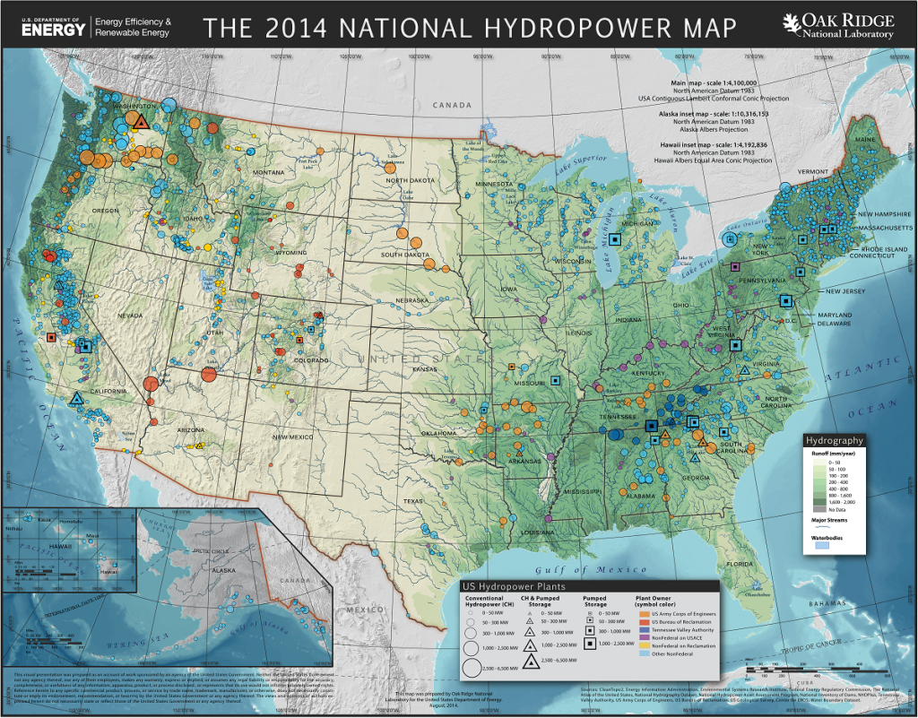
Rather than struggling to read Cadillac Desert, readers are encouraged to examine a hydrological map of The United States of America. The country can be divided into a wet eastern half, and a dry western half. Admittedly, there is also a strip of wetness along the Pacific coast that extends almost as far south as San Francisco Bay. The east-west dividing line is not particularly neat, and doesn’t follow state boundaries consistently. So people resort to meridians of latitude. Both 100 W and 110 W have been used as the dividing line, but often go through the middle of more states. Thus some prefer to use 95 W.
What makes this book difficult for non-Americans to read is its failure to provide context. The book is largely a history of the Bureau of Reclamation and the United States Army Corps of Engineers, both American federal government agencies, that were more concerned with settlement policies in the western half of the United States, than they were with the area’s geographical realities. It assumes that readers are sufficiently acquainted with the geography of the west that they understand these water realities, as well as how federal institutions function.
The map also shows the numerous dams that have been build on the various Western rivers. The Grand Coulee Dam on the Columbia River created Lake Roosevelt. This dam is especially destructive for assorted species of Pacific salmon. Further south, there are also many extensive dams on the Colorado River and its tributaries. The Hoover Dam created Lake Mead, close to Los Vegas, in Nevada. Further north, the Glen Canyon Dam created Lake Powell located in Utah and Arizona.
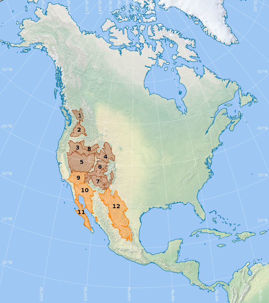
The four major deserts in the United States are the Mojave Desert, 124 000 km2 in Nevada, Arizona and California; the Sonoran Desert, 260 000 km2 from Mexico through Arizona and into southern California; the Chihuahuan Desert 360 000 km2 from Mexico through Texas, Arizona and New Mexico; the Great Basin Desert, 490 000 km2, in Arizona, California, Utah, Oregon and Idaho. The Great Basin Desert is often divided up into several different desert ecoregions (3 – 8) shown in the map below.

The title Cadillac Desert is not the name of a specific desert. Rather it refers to a very expensive desert, in contrast to, say, a cheaper Chevrolet Desert. Should I have written a book about the same topic, my choice of title would have been Gold-plated Desert. That is, a very thin but expensive coating that hides a base material underneath.
The book, Cadillac Desert, fails to interpret and describe water realities in terms of settlement and geography, with its focus on institutional history. There are other books that discuss the lack of water in the west. Perhaps the most enjoyable of these is, The West without Water: What Past Floods, Droughts, and Other Climatic Clues Tell Us about Tomorrow (2015) by B. Lynn Ingram and Frances Malamud-Roam.
This book documents the American West’s climate over twenty thousand years, with some explanations about past droughts and floods. It also looks forward, and predicts future climate impacts regarding water resources. One central question is what is a normal climate in the West, especially if the current relatively benign climate of the past century will continue. It also provides insights into paleoclimate research. This research shows that the area is subject to substantial climatic swings. Modern human environments are essentially artificial. Civilization is un/ ill-prepared for future climate changes. They end with a warning that residents must face the realities of the past, and prepare for a future where access to fresh water may be less reliable.

