I remember 1980-05-18 clearly. I was living with Trish at her parents’ house in Vancouver, contemplating a move to Norway, or perhaps New Zealand. That day, however, was focused on Mount Saint Helens.
Mount St. Helens’ eruption sent a 2.5 billion cubic meters of debris into the upper Toutle Valley, millions of tons of sediment still pour into the Cowlitz River each year. 45 years after blast, Mount St. Helens’ sediment still causing costly problems. Mount St. Helens’ sediment still causing costly problems. Cities grapple to maintain drinking water and deep ports. In 2024, the Port of Longview spent more than half a million dollars dredging about 5 600 cubic meters of Mount St. Helens’ sediment from the mouth of the Cowlitz River and nearby port berths.
A sediment retention dam has been in place since 1989, but it needs updating. That work has been delayed, leaving nearby cities to find their own solutions to drinking water needs and maintain deep draft levels at ports.
Kelso is looking to update its water system due to impeding sediment, while Castle Rock and Longview have changed their systems in light of the blast. The U.S. Army Corps of Engineers continues to monitor sediment levels.
The problem
Mountain runoff carries ashen remains of what was the volcano’s peak into the North Fork Toutle River and down to the Toutle. From there, the lower Cowlitz River ferries an average of nearly 3 millions tons of sediment through Castle Rock, Kelso and Longview, where it dumps into the Columbia River
On this post’s publication, 45 years after the destruction, there are suggestions that Mount Saint Helens may explode again.
Some Geography
I am learning that providing a mountain’s height is sometimes not enough. So I am now including prominence where it is relevant. Prominence measures the height of a mountain or hill’s summit relative to the lowest contour line encircling it but containing no higher summit within it. It is a measure of the independence of a summit. The key col = saddle around the peak is a unique point on this contour line. A parent peak is some higher mountain, selected according to various criteria.
This illustration shows the concepts of topographic isolation and prominence. Artwork: Andrew pmk.
As the forty-fifth anniversary of the eruption of Mount Saint Helens approaches there are two other volcanoes attracting my attention.
Mount Spurr
However, there are suggestions that Mount Spurr, in Alaska, will be the American volcano that erupts first. It has a height of 3 370 m, with a prominence of 585 m. It has been active: swelling, quaking and venting noxious gases. Fortunately, communities do not live on its slopes that would be destroyed by lava. Unfortunately, lots of ash could be produced, which could affect Alaska’s largest city, Anchorage about 130 km away.
The Alaska Volcano Observatory raised Mount Spurr’s Level of Concern Color Code from Green to Yellow, on 2024-10-23. The mountain is known aboriginally by the Dena’ina Athabascan name K’idazq’eni = that which is burning inside.
Axial Seamount Volcano
One of the most active volcanoes in the Pacific Northwest is the Axial Seamount. It sits on the Juan de Fuca Ridge about 480 km off the coast of Astoria, Oregon. In the recent past, Axial has erupted three times, in 1998, 2011 and 2015. After the 2015 eruption, the volcano saw a period of decreased earthquake activity and seafloor rise, which has since ramped up around late 2024. Earthquakes are an important proxy for volcanic activity. Axial saw hundreds, then thousands of earthquakes every day in the months leading up to its eruption in 2015. On the day of its last eruption 9 000 earthquakes occurred.
Cascadia Day
Some people are wanting to call 05-18 Cascadia Day, because of the eruption of Mount Saint Helens. People realized that the earth is (figuratively) alive! Alfred Wegener (1880 – 1930) proposed the idea of continental drift in 1912. This led to Arthur Holmes (1890 – 1965) to gain an understanding of the mechanical and thermal implications of mantle convection, which led eventually to an understanding of plate tectonics. This led to an understanding of the Cascadia Subduction Zone by the mid 1980s. Gradually, there was an awareness that massive forces including volcanic eruptions, mountain building, mega-earthquakes, tsunamis and more can be regarded as an interacting system working beneath the surface of the earth.
Below is the Doug = Douglas fir = Pseudotsuga menziesii Flag. Its designer, Alexander Baretich, describes it as a tricolor consisting of three horizontal stripes of blue, white and green, with a single Douglas fir tree in the center. The blue stripe represents the sky, Pacific Ocean and Salish Sea, as well as the myriad of rivers in the bioregion including the Columbia, the Snake and Fraser Rivers. The white represents clouds and snow and the green represents the region’s countless fields and evergreen forests. The tree symbolizes endurance, defiance and resilience against fire, flood, catastrophic change, and ever increasingly against the anthropocentric man.
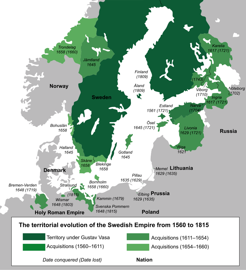
The above map is used to help people develop a new understanding of geography. If I had begun with a map of post World War II Scandinavia, or north America, it would have looked conventional. The map of Swedish territories in the 17th century, shows how this part of the world was in a state of flux.
When, I look at the above map, my focus is on Trondelag. With the exception of a three year period from summer 1985 to summer of 1988, when we lived in Bodø, in Nordland county, further north and off the map, we have lived our entire time in Norway, starting in the summer of 1980 in this light green area, which also includes Trøndelag county (previously separate North and South counties, that amalgamated 2018-01-01) as well as the northern part of Møre og Romsdal county, where we lived from 1980 to 1985. Altogether, that is more than forty years, considerably more than the thirty years, Trish and I spent in British Columbia.
Trøndelag is adjacent to Jämtland, originally a republic. Trøndelag could have become a part of Sweden. Jämtland could have become a part of Norway. It still aspires to regain its independent status. If it were not for the happenstance of military incompetence, it is quite likely that Trøndelag would have become an integral part of Sweden!
My hope is that this map will help people make sense of today’s Nordic area, because the current borders can no longer taken as a given, they have a history.
I started out researching this post by googling urb. The top result directed me to a website for a cannabis dispensary in Michigan. This seems to represent one of the major challenges for geography in the 21st century: people looking for places to numb their brains: tobacco, alcohol and worse; resorts; shopping meccas. For me, this is an inappropriate approach to life. Others will have to make their own decisions.
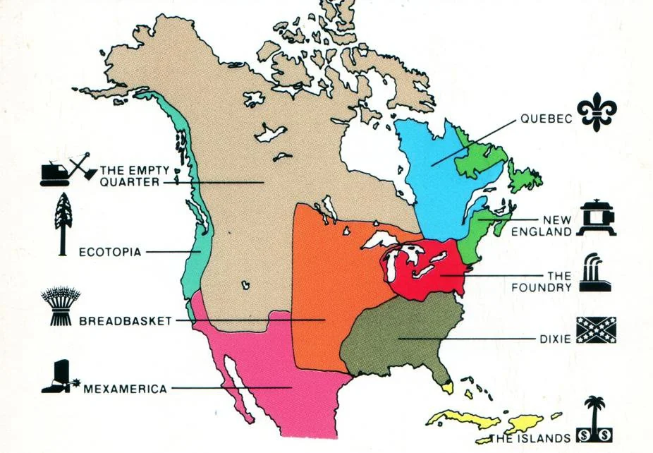
The literary starting point of this post are two books. Joel Garreau (1948 – ), The Nine Nations of North America (1981) and, thirty years later, Colin Woodard (1968 – ) American Nations: A History of the Eleven Rival Regional Cultures of North America (2011).
Most of my north American life was lived in Ecotopia = The Left Coast = The Wet Coast (in other sources). However, in my childhood many of my summers were spent in The Empty Quarter = Mountains West, where my mother, Jennie (1916 – 2021) experienced her early years. She was impacted by life there. My father, Mac = Edgar (1906 – 1991), was an ingrained west coaster. I remember learning about those rough American gold miners, sailing up from San Francisco to exploit a new gold field along the Fraser river in 1858. Later, my paternal great-uncle Robert McGinley Ellis (1863 – 1936) was a prospector during the Klondike gold rush (1886-1889). While I have cuff links from his efforts, I suspect fortune eluded him. He was born in Pakenham, Ontario, moved west to the Jumping Pound, Alberta, where his parents homesteaded, then moved onwards with them to Vancouver Island. He spent most of his life working as a carpenter in Port Alberni on Vancouver Island. He died in Port Coquitlam, in the lower mainland of British Columbia.
The following books have given me insights into north America. Of course, they are not the only works, although I admit a penchant for books about the west, increasingly California. In terms of atlases and railways, I have digested many different works – especially atlases – by Derek Hayes (1947 – ) and by Obi Kaufmann (1973 – ). Using the verb read with an atlas seems inappropriate. Yes, texts are read, but one spends ones time examining maps. Then there are other books, written by others: Marc Reisner (1948 – 2000) best known for Cadillac Desert (1986). Yes, the book is read, but so many other works are consulted to understand the rivers and assorted dams built. In many ways, I am more attracted to Lynn Ingram (? – ) & Frances Malamud-Roam (? – ), The West without Water (2013). More than a quarter of a century probably helps people to focus on the essence of a problem. The American west is not an expensive = Cadillac desert, but a wilderness without sufficient water to transform its existence.
These works provide me with insights into a newish geography, especially geographical terms needed to describe geography in the 21st century. The most important resource is water. One important duty is to allow forests to burn, regularly. I am reminded of that with the titles of two of Obi’s books: State of Water: Understanding California’s Most Precious Resource (2019) and State of Fire: Why California Burns (2024). As the subtitles emphasize, state in the title refers not to a specific condition, but to California. That said, I have nothing against Smokey Bear, discouraging people from starting wildfires.
On 2014-07-03, Joel Garreau, in the New York Times, claimed he began writing his book in the 1970s, when journalists were trying to discover how north America worked. He wants people to forget rectangular images of states, provinces and regions printed on maps, but to understand that north America is a clash between warring civilizations. A map based on culture and values does not reflect the perversely drawn state and national boundaries.
This attempt at understanding resulted in his 1981 book. Garreau comments that reader reaction was astonishing. His map revealed something much deeper. It was a map of culture and values. The idea of nine nations idea became a cult item among marketers, broadcasters, political operatives and even carmakers, who need to understand the north Americans tribes/ nations, how they emerged and how they function. Other authors have adopted the same methodology to explain China, Europe, Mexico, the former Soviet Union and the Middle East. I remember from my anthropology lectures at Dalhousie, about how the Druzes successively realigned themselves with the powers that be in Palestine, in an effort to retain their autonomy.
There were independent nations within American territory. The Iroquois Confereracy (1500 – 1775) is the longest lasting. It consisted of the Mohawk, Oneida, Onondaga, Cayuga and Seneca nations. After 1722, the Iroquoian-speaking Tuscarora people from South Carolina moved northwards, and joined as the sixth nation. This would have only been an academic footnote if I had not learned of my Mohawk ancestry, as a descendent of Ots-Toch (1600 –1646).
There is also the California Republic, a ministate that lasted for 25 days in 1846. Some are hoping that by the 200th anniversary of that republic, in 2046, there will be a new, improved and larger California Republic to replace it. The question is: Does California seek independence alone? Does it attempt to find allegiances with other current or former Mexican territories (Baja California, Dereret, Arizona and New Mexico)? or does it attempt something further north – Washington, Oregon, a strip of British Columbia?
There was also the Republic of Texas = República de Tejas (Spanish), a sovereign nation in North America that existed for almost 10 years, from 1836-03-02, to 1846-02-19. It shared borders with Mexico, the Republic of the Rio Grande – another sovereign nation, occupying what is now north-east Mexico, with its capital Laredo. and the United States. The Republic had diplomatic relations with various countries. Initially, the United States recognized Texas’ independence. The annexation of Texas by the United States in 1845, led to the Mexican–American War from 1846–04-25 to 1848-02-02.
The boundaries of Garreau’s nine nations are unchanged, after more than forty years. They have resulted in an American national gridlock, and the current division into red and blue states, even if I personally feel that the colours should be reversed. I note that my daughter lives on the left coast/ ecotopia, and not just some random location in USA. I can understand its appeal = warmth. Yet, I would be surprised if she left this strip of land for any other place in USA. No, I never expect her to become a Texan. I expect that for her the only American places with appeal are along the left coast and Hawaii. She had been indoctrinated with Cascadian values since she was a child.
Despite the turbulence in technology, finance, energy, population, mobility and polity, the boundaries as drawn in 1981 still make sense – even where events have gone exactly opposite his expectations. For example, North Carolina is even more “Dixie” today than when he wrote about it. He asks readers to check the last few presidential election results at the county level, and one will see these boundaries still influencing (voter) behaviour. He claims that the results in Canada are even more striking.
One explanation for this endurance may be that those boundaries were observed by a network of amateur anthropologists, residing all over the continent. This network documented the existence of these nations. Cultures and values endure. They change more slowly than Garreau first envisioned. He claims there are layers of unifying flavor and substance that define these nations, explaining the major storms through which public affairs pass. The Nine Nations is also a map of power, money and influence, the patterns of which have only deepened.
At this point in time, with Donald Trump and Elon Musk moving fast and breaking things, one wonders what will be happening in the United States in the coming months and years ahead. How much chaos will the American public tolerate?
Travel is still the great North American pastime because of our enduring diversity. Out of a sense of adventure, people still look forward to picking up their belongings and taking a new job in a different place. Trying on different values, different senses of the pace at which life should be lived, different attitudes about art, food and ethnic origin, a different relationship to nature. Yet every North American also knows a place where, on their way back from their wanderings, surroundings stop feeling threatening, confusing or strange. It is a place within their comfort zone.
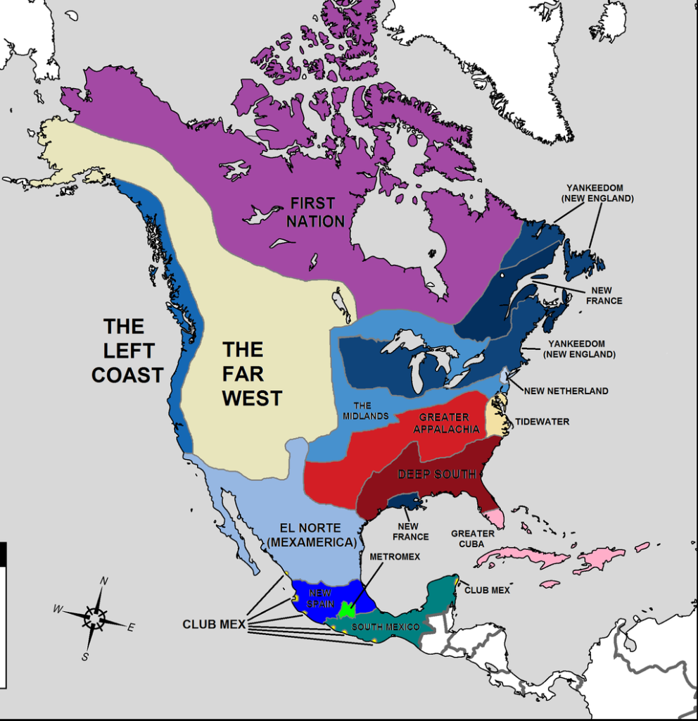
Here are some concepts that have been presented, along with definitions. In general, the definitions provided come from Wikipedia. My internal map of north America is largely inspired by Garreau’s map, supplemented by that of Woodard. For me, the differences between the two maps, encourage an internal discussion. For example, with a new found discovery of an ancestry in Upper New York state, I ask why New Netherland (on the Woodard map) does not extend further north? It seems to represent just New York, or New Amsterdam.
Joel Garreau’s map of north America.Colin Woodard, Map of north America
Edge city = a concentration of business, shopping, and entertainment outside a traditional downtown or central business district, in what had previously been a suburban, residential or rural area. The term was popularized by the 1991 book Edge City: Life on the New Frontier by Joel Garreau. Garreau argues that the edge city has become the standard form of urban growth worldwide, representing a 20th-century urban form unlike that of the 19th-century central downtown.
Suburb = an area within a metropolitan area which is predominantly residential and within commuting distance of a large city. Suburbs first emerged on a large scale in the 19th and 20th centuries, as a result of improved rail and road transport, which led to an increase in commuting. In general, they are less densely populated than inner city neighborhoods within the same metropolitan area, and most residents routinely commute to city centers or business districts via private vehicles or public transits; however, there are many exceptions, including industrial suburbs, planned communities, and satellite cities. Suburbs tend to proliferate around cities that have an abundance of adjacent flat land.
Boomburb = a large, rapidly-growing city that remains essentially suburban in character, even as it reaches populations more typical of urban core cities. It describes a relatively recent phenomenon in a United States context. The boomburb I am most familiar with is Bellevue, in Washington State.
Exurb = an area outside the typically denser inner suburban area, at the edge of a metropolitan area, which has some economic and commuting connection to the metro area, low housing-density, and relatively high population-growth. It shapes an interface between urban and rural landscapes, holding a limited urban nature for its functional, economic, and social interaction with the urban center, due to its dominant residential character. Exurbs consist of agglomerations of housing and jobs outside the municipal boundaries of a primary city and beyond the surrounding suburbs.
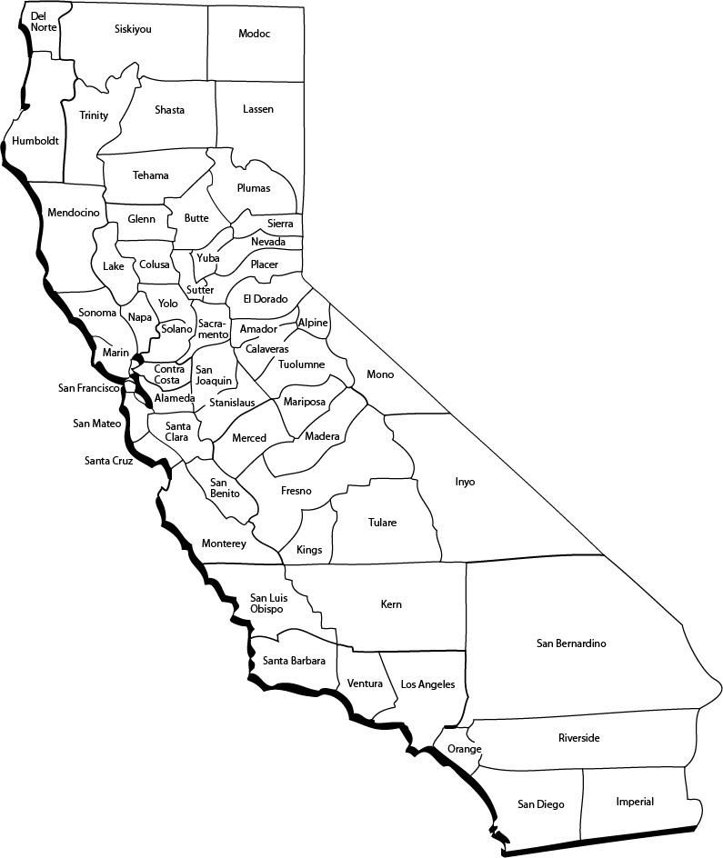
Recently, I sent a map (see below) and some instructions for the California game, to people I know living there. The main rules is that a person can play this game as often as they like, hopefully generating new content each time. This game differs from two other California games: A) Include California in Cascadia, and B) Imagine California as an independent country. This game, C) involves keeping California in USA, but dividing it into several different states, each with two senators! Other rules: 1) Decide how many states you want to create out of California. 2) Find sufficient pencil crayons with distinctive colours, one for each proposed new state. 3) Use the existing counties as potential dividing lines. 4) Find the borders. 5) Enjoy the colouring.
People living in other states, say Kansas, could also play a similar game with their own state.
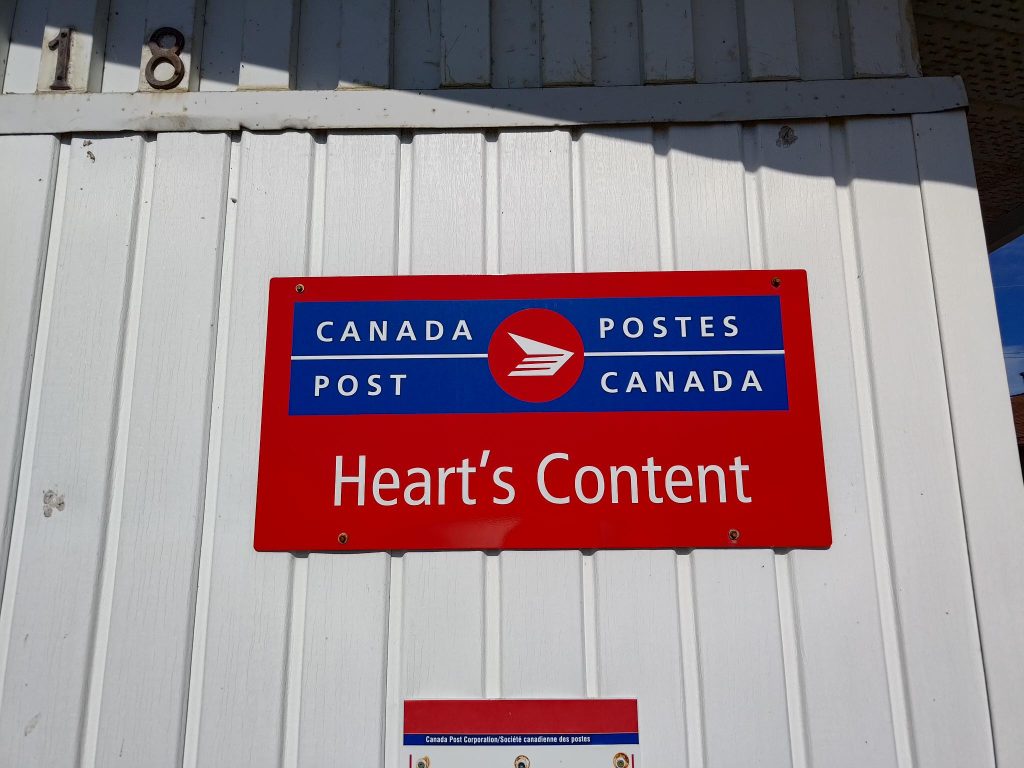
It would be heart warming to write that the the first transatlantic cable between Europe and north America landed at Heart’s Content on the Bay de Verde Peninsula, in Newfoundland. Unfortunately, it wasn’t, as described below. Despite this, Heart’s Content is world famous for the second trans-Atlantic telegraph cable, one laid between Heart’s Content and Valentia, Ireland. It was this cable that lead to the establishment of the Heart’s Content Cable Station.
Today’s weblog post is less about our visit to Newfoundland, and Heart’s Content, than it is about the history of connecting two continents with communication cables.
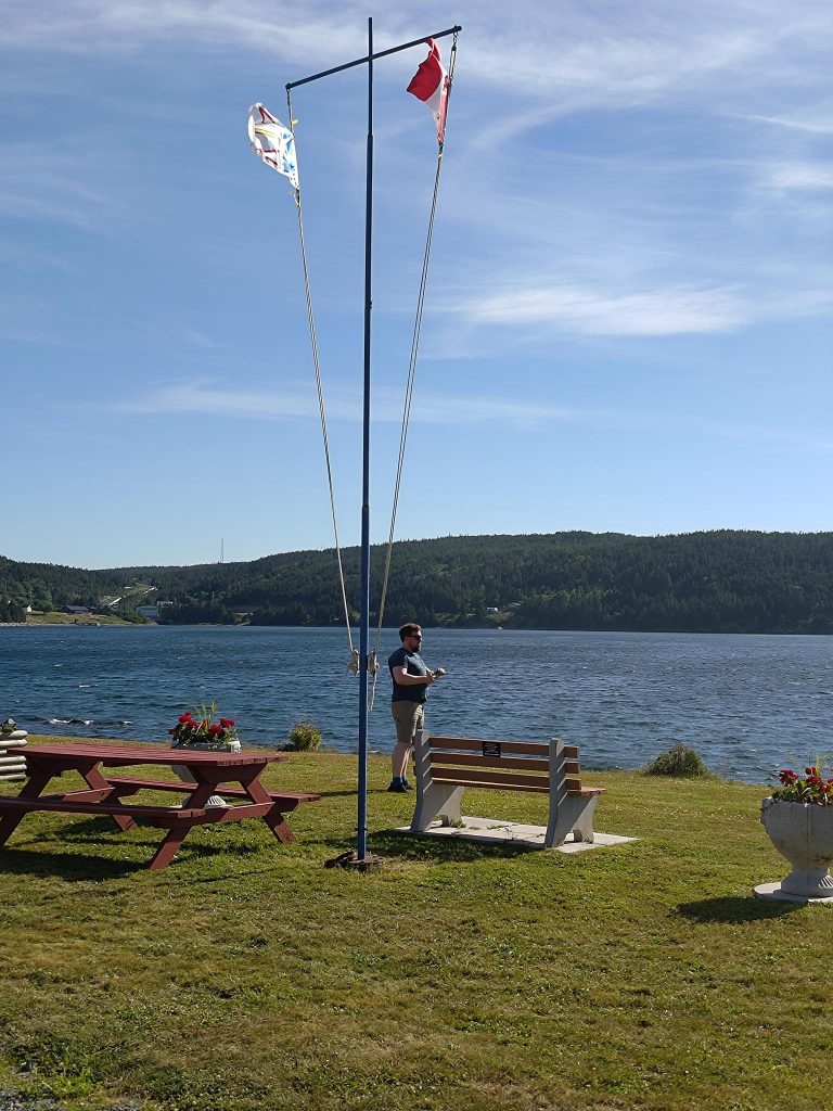
Alasdair at the park in front of the Heart’s Content Cable Station.
Preface
It is difficult to state, with any degree of precision, the person and date for the invention of the telegraph. There are just too many things and people involved, including an electrochemical telegraph invented by Samuel Thomas von Sömmerring (1755 – 1830) in 1809. He also worked with undersea communication cables in 1811, when he and Pavel Schilling (1786–1837) made a trial with a wire cable which was sheathed in rubber, in Munich.
Samual Morse (1791 – 1872) gets credited with the invention not only of the machinery used, known as the one wire telegraph, from 1837, but for the code used to transmit messages. There inventions competed with others, such as one by William Fothergill Cooke (1806 – 1879) and Charles Wheatstone (1802 – 1875) who invented and patented a needle telegraph in 1837. The receiver consisted of a number of needles that could be moved by electromagnetic coils to point to letters on a board. This feature was appreciated by early users who were unwilling to learn codes, and employers who did not want to invest in staff training. In 1838 they installed the first commercial telegraph, on the Great Western Railway, running 21 km from Paddington station to West Drayton. It was a five-needle, six-wire system. It was far too complex to be reliable.
In 1838 William O’Shaughnessy (1809 – 1889) lay an underwater cable across the River Hooghly at Calcutta. He covered his wire with pitch, then enclosed it within a split cane and wrapped tarred yarn around the outside. Charles Wheatstone later and independently developed a similar system.
In 1842 Samuel Morse transmitted an electric current under New York Harbour. The wire was insulated with tarred hemp and an outer sheathing of rubber. In 1845, Ezra Cornell (1807 – 1874) lay two copper wires, enclosed in cotton and insulated with rubber, then placed in a lead pipe, across the Hudson River between New York and Fort Lee. It worked initially, but was damaged beyond repair by drifting ice in 1846. Also in 1846, Charles Samual West (1809 – ca. 1889) succeeded in transmitting telegraph messages to a ship in Portsmouth Harbour, England, through a rubber insulated wire. In 1842, Samuel Morse lay an underwater cable in New York Harbor and succeeded in sending messages across it. A few years later, Ezra Cornell placed a telegraph cable across the Hudson River from New York City to New Jersey.In 1842, Samuel Morse lay an underwater cable in New York Harbor and succeeded in sending messages across it. A few years later, Ezra Cornell placed a telegraph cable across the Hudson River from New York City to New Jersey.
In the late 1840s Werner von Siemens (1816 – 1892) invented a machine for applying gutta-percha (a type of rubber) to wire.
In 1850, 25 nautical miles (nm) = 46 km of cable from the Submarine Telegraph Company was lain from Dover to Calais. It soon failed, because it wasn’t armoured. The company then ordered, a new, larger cable with four insulated cores, that was armoured before laying. This cable became the first working oceanic submarine cable.
Heart’s Content & the Trans-Atlantic Telegraph Cable
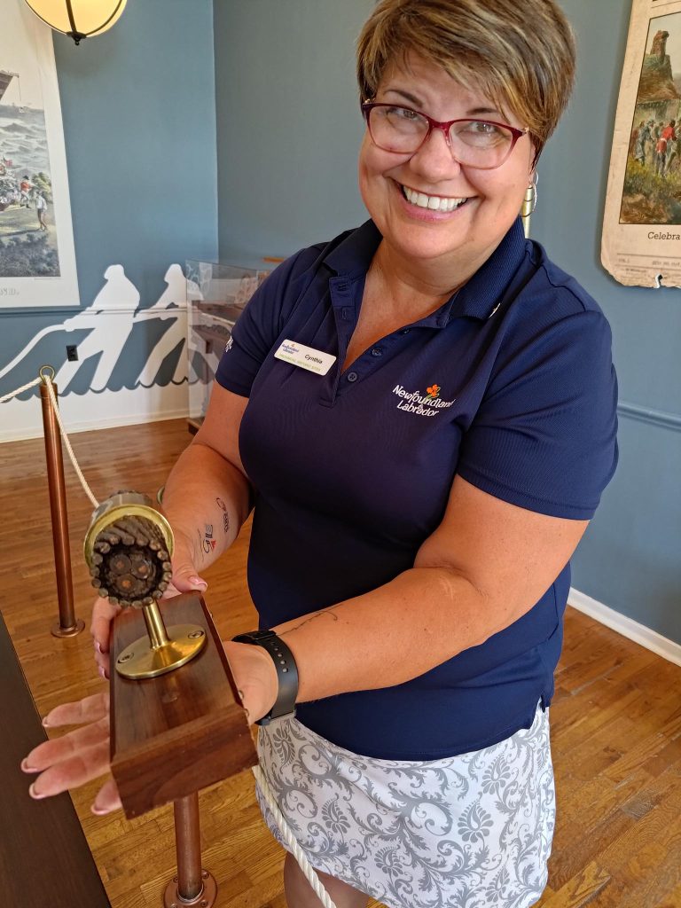
The key to getting a personal guided tour of the Cable Station at Heart’s Content is to arrive late. Here is Cynthia doing her best to get rid of me, before closing time.
Heart’s Content owes much of its reputation to the American businessman Cyrus Field (1819 – 1892) who in 1855 chose Trinity Bay as the terminus of his Transatlantic telegraph cable. Originally, the landing site was to be at Bay Bulls Arm, directly across Trinity Bay from Heart’s Content. It arrived there on 1858-08-05. However, due to a malfunction, its operation broke down after three weeks, and was terminated on 1858-10-20. On its first day of operation, Queen Victoria sent President James Buchanan the first message in Morse code.
On Friday, 1866-07-13, the Great Eastern left Valentia, Ireland with 2 730 nautical miles (nm) = 5 056 km of cable in her hold. On 1866-07-27, 1 852 nm = 3 430 km of this cable lay at the bottom of the Atlantic ocean, while the Great Eastern was anchored in Trinity Bay. The cable was laid at a rate of 5.5 nm/ hour = a speed of 5.5 knots = about 10 km/ hour.
This was the fifth attempt in twelve years to establish a transatlantic telegraphic link. Cyrus Field consulted with oceanographer Matthew Maury (1806 – 1873), about the feasibility of connecting Ireland with Newfoundland, and with Samuel Morse (1791 – 1872) about other aspects of its technical feasibility. Once those questions had been Field sought financial backing in New York from Chandler White (? – ?), Peter Cooper (1791 – 1883), Marshall Roberts (1813 – 1880) and Moses Taylor (1806 – 1882), founding with Cyrus and Dudley Field (1805 – 1894) the New York, Newfoundland, and London Telegraph Company. Submarine cables were laid between Cape Ray, Newfoundland, and Cape Breton Island, Nova Scotia, and then between Cape Breton Island and the Nova Scotia mainland. Thus,St. John’s, Newfoundland, and New York City were connected in 1855.
Field and nine associates then formed the American Telegraph Company (ATC). By mutual agreement with other telegraph companies, regional operating boundaries were established, with Newfoundland, Nova Scotia (?), New Brunswick, and the United States’ eastern seaboard became ATC’s territory.
The next several months were spent in establishing the Atlantic Telegraph Company, choosing the cable design, manufacturing the cable, finding backers, and securing support for the project from both the British and American governments. Note: It must be remembered that, at the time, Newfoundland was not part of Canada, but British territory.
Cable laying attempt 1: On 1857-08-05, the American steam frigate Niagara and the Royal Navy’s steamer Agamemnon left Valentia Bay, Ireland. Each held half-an- ocean’s length of cable. However, after laying about four hundred nm = 640 km, of cable the line snapped, and could not be recovered from the ocean floor.
Improvements were made to the machinery for laying the cable, a better insulating compound was developed, William Thomson invented a mirror galvanometer, used to detect cable signals, and still more capital was raised. The cable was stored on the docks at Plymouth, England. This was reloaded onto the Niagara and the Agamemnon.
Attempt 2: The ships left Valentia on 1858-06-10. Only 160 nm of cable were laid when it broke.
Attempt 3: Field pushed to try again immediately. The two ships met in mid Atlantic ocean on 1858-07-29, spliced the cable, then laid the cables in opposite directions. Both reached their respective ports in Newfoundland and Ireland on 1858-08-05. The cable was inoperable by 1858-09-18.
There was little interest in reviving the cable laying venture in either Britain or USA. The British Board of Trade set up a special commission to investigate submarine cables, that was active in 1859 and 1860. Members of the commission included Charles Wheatstone and Latimer Clark (1822 – 1898). They carried out experiments on the construction, insulating, testing, and laying of cables. Their conclusion was… a well-insulated cable, properly protected, of suitable specific gravity, made with care, and tested under water throughout its progress with the best known apparatus, and paid into the ocean with the most improved machinery, possesses every prospect of not only being successfully laid in the first instance, but may reasonably be relied upon to continue for many years in an efficient state for the transmission of signals.
By this time, the British government had lost interest in the cable project, and the United States was in a civil war. Despite this, in 1862 Glass, Elliott and Co. offered to make and lay the new cable and to put up $125,000 as well, in return for reimbursement of materials and labor costs, plus an additional 20% of the cost of the line. With this, Field found private investors in Britain and USA to raise the necessary capital, with London railroad entrepreneur Thomas Brassey (1805 – 1870) being critical, encouraging Manchester industrialist John Pender (1816 – 1896) and the Gutta Percha Company to form Telegraph Construction and Maintenance (TC&M) responsible for all aspects of the cable’s construction and the remaining necessary capital.
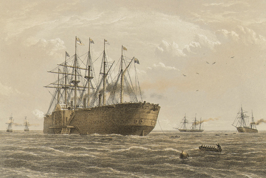
This print was made by Robert Dudley (1826 – 1909), official artist at work on the Great Eastern under the direction of its captain, James Anderson (1824 – 1893): His task was to record in the form of an illustrated book the minutiae of the voyage, charting in detail the technical processes, life on board, the movements of the ocean, departures and arrivals and (it was hoped) a successful outcome. This photo shows the SS Great Eastern starting to lay the trans-Atlantic telegraph cable in 1865-07-23 at Valentia, Ireland. Also shown are other ships involved in the cable laying process: Terrible, Sphinx, Hawk & Caroline. Of particular interest in the mechanism used to pay out the cable on the Great Eastern.
The SS Great Eastern was an iron sail-powered, paddle wheel and screw-propelled steamship designed by Isambard Kingdom Brunel (1806 – 1859), and built by John Scott Russell (1808 – 1882) & Company in London, but registered in Liverpool. It was in service from 1859 to 1889: length = 211 m, beam = 25 m, draft = 6.1 – 9.1 meters (load dependent), with a maximum displacement of 32 160 tons = 29.175 Gg, with a double hull and initially with sufficient coal bunkers giving it a range of about 11 000 km. Sources vary on how much this was later reduced, but it needed a range exceeding 4 000 nm = 7 500 km to cross the Atlantic. The Great Eastern captured the popular imagination as the largest ship afloat until the RMS Celtic (1901 – 1928). Because the Great Eastern had always lost money, she was auctioned in 1864-01, The purchaser was Daniel Gooch (1816 – 1889) who, with the financial help of Field and Brassey, bought the Great Eastern for $125 000. It had cost over $6 million to build. It was put at the disposal of the cable laying expedition. Note: The 1800s saw the GBP to USD exchange rate to be about GBP 1 = ca USD 5, except during periods of war. The GBP 1 was as low as USD 3.62 during the Napoleonic wars (1803 -1815), but as high as USD 10 during the US Civil war and its aftermath (1861 – 1875).
Attempt 4: On 1865-07-23, the Great Eastern lay cable manufactured according to higher technical specifications. Yet, the cable once again snapped and was lost only 1 000 km from Newfoundland. The improved methods of making and laying the cable were proven sound, and there was less skepticism about any next attempt failing.
Attempt 5: Capital was raised, the Anglo-American Telegraph Company formed, a new cable was constructed, the Great Eastern began laying cable on 1866-07-13 and on 1866-07-27, the cable was landed and began operating at Heart’s Content. The Great Eastern then returned to the location where the 1865 cable had been lost, retrieved it, spliced it, and paid out the remaining distance to Newfoundland. By 1866-09-08 two telegraph lines were sending messages across the Atlantic.
With it’s location on the east coast of Trinity Bay, Heart’s Content is better sheltered from storms, proving itself to be a good location for operating the trans-Atlantic cables. Two more cables were laid from Valentia to Heart’s Content in 1873 and 1874, then another two in 1880 and 1894.
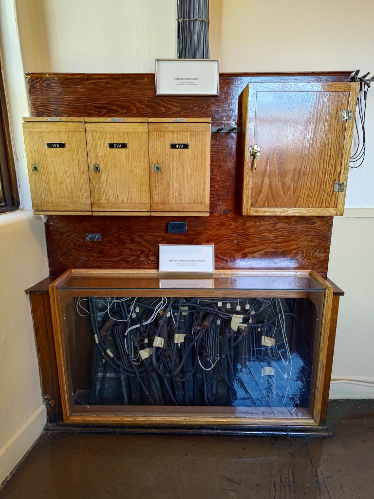
After landing at Heart’s Content, it is then sent to the Cable Station, which the signals are processed.
Messages arriving at Heart’s Content, had to be sent onward to New York and elsewhere. Field also provided a cable from Newfoundland to Baddeck, Cape Breton Island, where a telegraph house was built in 1861 that contained the Trans-Oceanic Cable Company office.
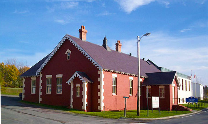
In 1918 the cable station was enlarged to serve increased communication volume of the Anglo-American Telegraph Company’s successor, Western Union, that had taken over the business in 1912. The station lasted until 1965, when it closed. Much of the reason for this closure was the replacement of telegraph with telephone. In 1968, the cable building was bought by the Newfoundland Government as an historic site, to be transformed into a communications museum. On 1974–07-27, 108 years to the day, after the 1866 landing of the transatlantic cable at Heart’s Content, the museum officially opened. We visited the museum 50 years and 3 days later = 2024-07-30!
Heart’s Content Cable Station
The Canadian and the Republic of Ireland governments want to create a transboundary World Heritage Site consisting of both the station at Heart’s Content and the station on Valentia Island. On 2022-12-20, Heart’s Content Cable Station and Valentia Cable Station were officially submitted to the UNESCO as a site entitled Transatlantic Cable Ensemble.
A reply from Tara Bishop, Site Supervisor at the museum: Generally all visitors are offered a guided your of the exhibit unless there is a time constraint that doesn’t allow ample time to do so.
Clarenville & TAT-1
The first radio-based transatlantic telephone call that began at 9:35 (New York time; 14:35 London time) on 2027-01-07 from the 26th floor of the AT&T building, 125 Broadway, New York City. It traveled over 5 000 km, via wire to a radio transmitter at Rocky Point, Long Island, New York State and then by radio waves to a radio receiving station at Rugby, England, then onward by wire to London. The return conversation went from London via wire to Cupar, Scotland, from there via radio waves to a receiving station at Houlton, Maine, and finally by wire back to New York City. This inaugurated In 1927 a 3 minute call cost £9 = ca US$45. The purchasing power of US$1 = US$18 in 2024, = US$ 810 for a 3 minute call. This system handled slightly more than 800 calls a day.
The main challenges with increasing traffic volume were technology related. Many advances came with developments during World War II. These included: coaxial cable, polyethylene insulation (replacing gutta-percha), reliable vacuum tubes for submerged repeaters and a general improvement in carrier equipment. Transistors were not considered since they were a recent invention with unknown longevity.
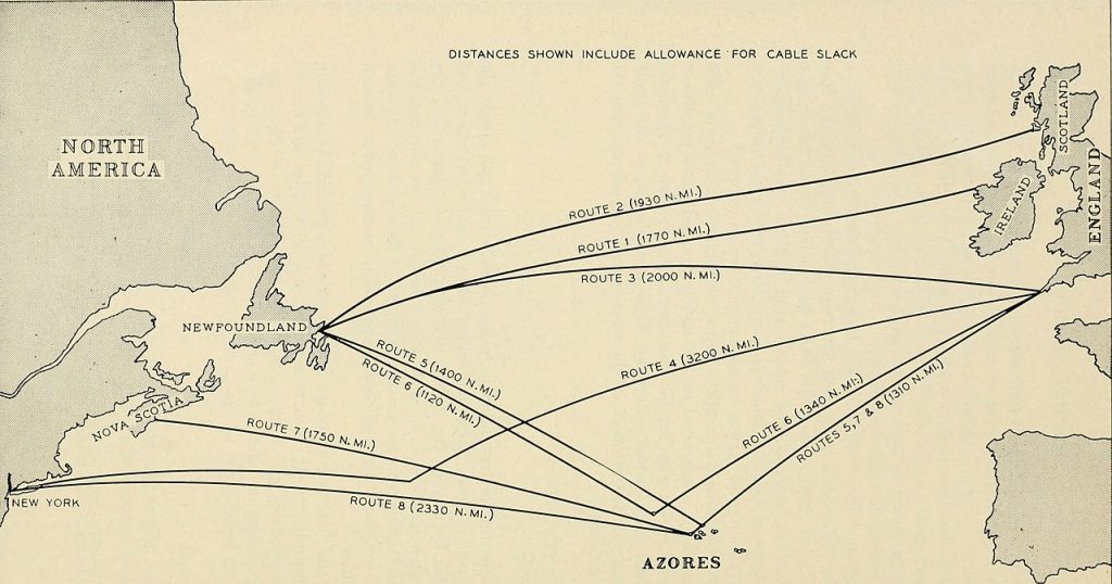
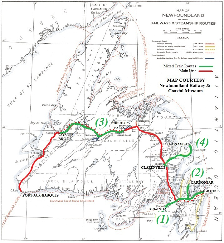
Route 1 was used for the trans-Atlantic telegraph cables, Route 2 was used for the TAT-1 telephone cables. Image: Bell Telephone System.
In North America, after a 1952 submarine telephone cable proved successful between Florida and Cuba, discussion emerged about a cable between North America and Europe in 1953, with the North American end ultimately proposed to be Clarenville.
There were to be two main cables, one for each direction of transmission. Each cable was produced and laid in three sections, two shallow-water armored sections, and one continuous central section 1,500 nautical miles (2,800 km) long. The electronic repeaters were designed by the Bell Telephone Laboratories of the United States and they were inserted into the cable at 37-nautical-mile (69 km) intervals – a total of 51 repeaters in the central section.
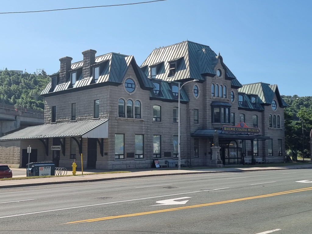
Clarenville was a junction on the Newfoundland Railway, that operated from 1898–1949 when it was merged into the Canadian National Railway (CN), before it was abandoned in 1988. The junction resulted in a branch line to the Bonavista Peninsula, from the main line. The construction of the Trans-Canada Highway through the community, completed in 1965 helped it become a service centre for central-eastern Newfoundland, serving 96 000 people, in 90 communities within a 100 km radius. There are claims that about 70% of Newfoundland & Labrador’s population live within two hours of Clarenville.
TAT-1, the first submarine transatlantic telephone cable system, was laid between Clarenville and Kerrera, Oban, Scotland. Two cables were laid between 1955 and 1956 with one cable in each direction. It was inaugurated 1956-08-25. Each cable was able to carry 35 channels = simultaneous telephone calls. A 36th channel could carry up to 22 simultaneous telegraph messages.
At the land-end in Gallanach Bay near Oban, Scotland, the cable was connected to coaxial (and then 24-circuit carrier lines) carrying the transatlantic circuits via Glasgow and Inverness to the International Exchange at Faraday Building in London. On the other end, from Clarenville a terrestrial line carried signals about 100 km to Terranceville, where another 480 km long submarine cable crossed the Cabot Strait ending up in Sydney Mines, Nova Scotia. From there the communications traffic was routed to the US border by a microwave radio relay link, and in Brunswick, Maine the route joined the main US network and branched to Montreal to connect with the Canadian network.
In 2024, 35 simultaneous conversations is not impressive. Yet, I find the speed of cable-laying impressive, 6 knots = 11 km/h, despite it being just marginally faster than that of 1865 = ca. 10 km/h.
The cables were laid over the summers of 1955 and 1956, with the majority of the work done by the cable shipHMTS Monarch. At the land-end in Gallanach Bay near Oban, Scotland, the cable was connected to coaxial (and then 24-circuit carrier lines) carrying the transatlantic circuits via Glasgow and Inverness to the International Exchange at Faraday Building in London. At the cable landing point in Newfoundland the cable joined at Clarenville, then crossed the 300-mile (480 km) Cabot Strait by another submarine cable to Sydney Mines, Nova Scotia. From there the communications traffic was routed to the US border by a microwave radio relay link, and in Brunswick, Maine the route joined the main US network and branched to Montreal to connect with the Canadian network.
HMTS (later Cable Ship) Monarch, the 5th cable-laying ship of that name, as she appeared in 1956. Photo: General Post Office, owner of the vessel, at the time.
Opened on September 25, 1956, TAT-1 carried 588 London-US calls and 119 London-Canada calls in the first 24 hours of public service.
The original 36 channels were 4 kHz. The increase to 48 channels was accomplished by narrowing the bandwidth to 3 kHz. Later, an additional three channels were added by use of C Carrier equipment. Time-assignment speech interpolation (TASI) was implemented on the TAT-1 cable in June 1960 and effectively increased the cable’s speach capacity from 37 (out of 51 available channels) to 72.
TAT-1 carried the Moscow-Washington hotline between the American and Soviet heads of state, using a teleprinter to avoid misinterpretations. This link became operational on 1963-07-13, motivated by communication delays during the Cuban Missile Crisis.
Other TAT cables were subsequently laid. TAT-1 was retired in 1978.
Back in Norway, I started to read Arthur C. Clarke’s (1917 – 2008) Voices Across the Sea (1974, 2nd edition). I am glad that it was not the first edition from 1958, because the second edition looks at the future of transoceanic communication, including the use of satellites. Fortunately, for the world, there is unexpected progress. In 2024 people read fewer books, but rely on websites.
For me, as a technologist, that includes sites with a focus on fibre cables, possibly without even mentioning satellites. My choice of a website is: https://atlantic-cable.com/ No, it is not just about transatlantic cables, but undersea communication, generally. Its subtitle is: History of the Atlantic Cable & Undersea Communications from the first submarine cable of 1850 to the worldwide fiber optic network.
Connections: In 2000, my wife, Trish, and I visited Field, British Columbia, home to about 170 souls in the Kicking Horse River valley within Yoho National Park. It is 1 256 m high, and 27 km west of Lake Louise on the Trans-Canada Highway. It was named for Cyrus West Field. The purpose of our visit was to visit the Burgess Shales, a fossil-bearing deposit noted for the exceptional preservation of the soft parts of its 508 million years old (middle Cambrian) fossils.
Newfoundland & Labrador Conclusions
This is the last of the series about Newfoundland & Labrador. At some future date, I hope to publish a weblog post with recommendations for visiting Newfoundland, especially for people with an interest in transportation and communication, including amateur radio operators.
At the end of the trip, Alasdair answered some questions. These are followed by my own answers.
Did I enjoy the trip to Newfoundland? Yes. / Yes. Will I be back? I doubt it. / No. Would I recommend it? Not really. / It is for people with specific interests.
Alasdair concludes: The problem is that although there are some very quaint and interesting things to see, they are hundreds of km from each other. Most of the other tourists we saw and met were seniors. Strikes me it’s a place to go when one has been everywhere else.
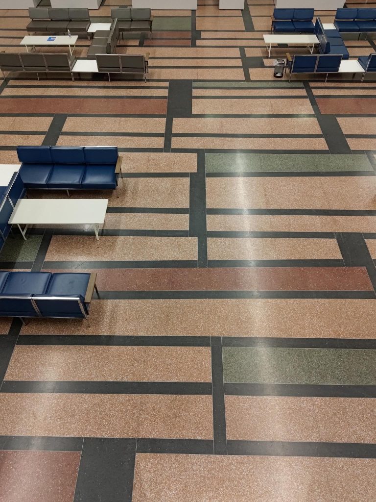
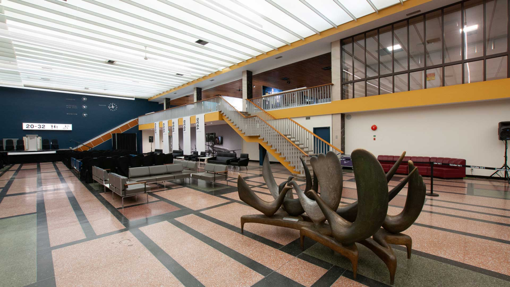
YQX International Lounge in 2024, reflecting how it looked when it opened in 1959.
At Cliff Cottage it is common to use the IATA airport codes to denote an airport location. YQX refers to Airlandia, sorry that suggested name from Ottawa was never used, Gander! The Crossroads of the World, in Newfoundland. A gander is an adult male goose. Before one thinks of some testosterone fueled bird, the term also refers to a naive person, a simpleton.
My parents married in 1942-08 in St. John’s. I believe they spent some of the war years living in Gander, with the RCAF, the Canadian air force. Most of the time I was simply told they were stationed in Newfoundland. My mother described her work as being a plane plotter, moving objects representing planes across a floor. I think this had to do with ferrying planes to Britain. My father, ultimately with the rank of squadron leader, was involved with airport construction, at Gander as well as Goose Bay. I am unsure how much time they actually spent in each of these places. However, they admitted to flying between airports on transport aircraft. I have so many unanswered questions.
I have finished reading Jean Edwards Stacey’s (? – ), Voices in the Wind: A History of Gander, Newfoundland (2014). History incorrectly describes the work. There are moments when there is a chronology of events in and around the airport, but much of the space is given to unedited reminiscences of former and current residents. It was written by a journalist, not a(n) historian.
This was not the only book about Gander that was purchased. While at the North Atlantic Aviation Museum, Darrell Hillier was in attendance, selling his book, North Atlantic Crossroads: The Royal Air Force Ferry Command Gander Unit, 1940 – 1946. We now have a signed copy of his book.
The museum, itself, was interesting, but with the technology looking so outdated, early to mid 20th century, at best; analogue devices, rather than digital.
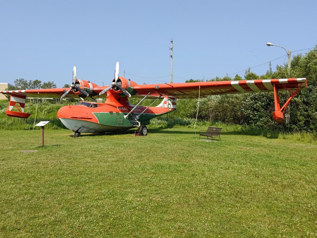
The museum had a Canso on display. It had been used in Newfoundland as a waterbomber fighting forest fires. These were Catalinas flying boats, which were modified with landing gear, transforming them into amphibians. The Catalina dates from 1933 when the US Navy ordered it, and Consolidated Aircraft designed it. A prototype was first flown in 1935 or 1936 (sources vary) in San Diego Bay. It became the most successful and prolific flying boat with 4 051 built. These aircraft were used in WWII by the American, British and Soviet Air Forces. Many of these aircraft came through Gander on their way across the Atlantic. Consolidated Aircraft and its successor Consolidated-Vultee Aircraft (Convair) built 1851 of these in San Diego, California. An undisclosed number were made by Vickers in Montreal starting in 1941-06. In addition, the Canadian government awarded Canadian Vickers a contract to produce PBV-1 Canso amphibians (a version of the Consolidated PBY Catalina flying boat) for the Royal Canadian Air Force. To speed Canso production, the government authorized construction of a new manufacturing facility at Cartierville Airport in Ville Saint Laurent, on the north-western outskirts of Montreal, and appointed Canadian Vickers to manage the plant’s operation; 240 PB2B-1 flying boats were made for the Royal Air Force (RAF) and RCAF patrol bomber squadrons, 55 PB2B-1A and 67 PB2B-2 planes were also built by Boeing Canada, at a facility located on Sea Island, in Richmond, British Columbia. The site has since been re-developed as the Burkeville residential area, named for former Boeing-Canada President Stanley Burke. The PBN-1 Nomad, a heavily modified Catalina, was built by the Naval Aircraft Factory in Philadelphia, Pennsylvania, supplying 155 to the RAF and 138 to the Soviet Navy. Soviet Gidrosamolet Transportnii factory at Taganrog, Rostov Oblast, also built 27 Catalinas.
In Scandinavia, the most prominent incident involving these planes was the Catalina Affair in which a Swedish Air Force search and rescue/maritime patrol Catalina = TP 47 was shot down by Soviet MiG 15 fighters over the Baltic Sea in 1952-06-16 while investigating the disappearance of a Swedish Douglas DC-3A-360 Skytrain Hugin on a signals intelligence mission, 1952-06-13, later found to have been shot down by Soviet MiG-15s in Swedish waters. The DC-3 was found in 2003 and raised in 2004–2005. In Norse mythology, Huginn = thought (Old Norse) and Muninn = memory (Old Norse) are a pair of ravens that fly all over Midgard = the world, and bring information to the god Odin.
In terms of aircraft, I have always been fascinated with amphibians, especially the Grumman Goose, possibly because it was featured in The Islanders, a 24 episode television series shown from 1960 to 1961, with William Reynolds (1931 – 2022) = Sandy Wade, James Philbrook (1924 – 1984) = Zack Mally, Diane Brewster (1931-1991) = Wilhelmina Vanderveer = Steamboat Willy and Roy Wright (? – ?) = Shipwreck Callighen, about a one-airplane airline run by the first three principals listed, in the East Indies.
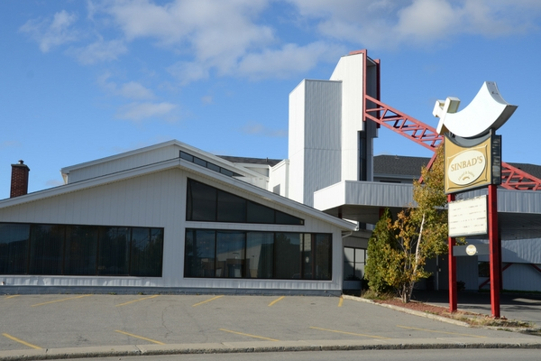
We stayed at another Steele hotel, Sinbad’s. In many ways it was the opposite of Glynmill Inn: a more modern design, a scimitar symbol, breakfast included. Inside, there was not much that exuded Arabia. I have always had a positive impression of Sinbad, the 8th century fictional mariner from Baghdad and the Abbasid Caliphate, who during seven voyages has fantastic adventures in magical realms. These became late additions to the Thousand and One Nights framing the fictional Persian king Shahryar, and the tales narrated by his wife Scheherazade.
Sinbad’s hotel in Gander, with its sign featuring a scimitar. Photo: Steele Hotels.
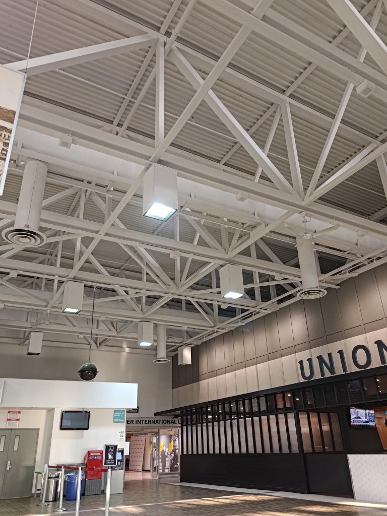
In the early evening we visited Gander airport. Above the main floor there was a display, showing its history.
The International Lounge was opened in 1959. It was given a CAD 1.5 million restoration, that was completed in the summer of 2020. Photo: Gander Airport.Welcome to CYQX Gander. Yes, the International Civil Aviation Organization (ICAO) uses CYQX for Gander. The International Air Transport Association (IATA) uses YQX.
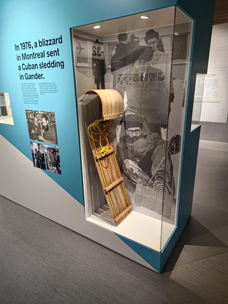
The exhibits included a toboggan, and a story of Fidel Castro tobogganing in Gander.
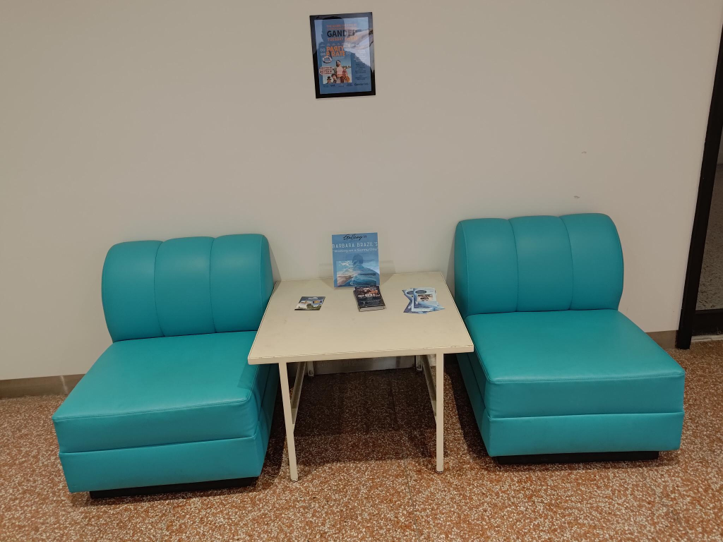
A toboggan, and a photo of Fidel Castro on a toboggan in 1976.Admittedly, I am a product of the 1950s, more turquoise than avocado green so prominent in the 1960s. Yes, colours should be bold, not timid.Support details
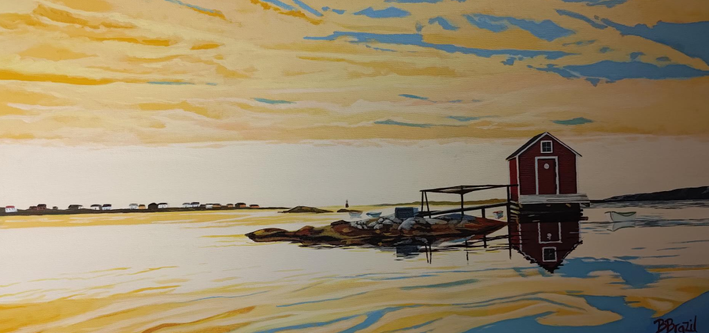
At the airport there was a display of paintings by Barbara Brazil. This one, titled Fair Isle, Fogo attracted our attention. Yes, I am always fascinated by how light influences perception.
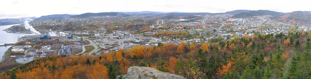
Corner Brook from James Cook park. Photograph: H. Keats, 2005-10-18.
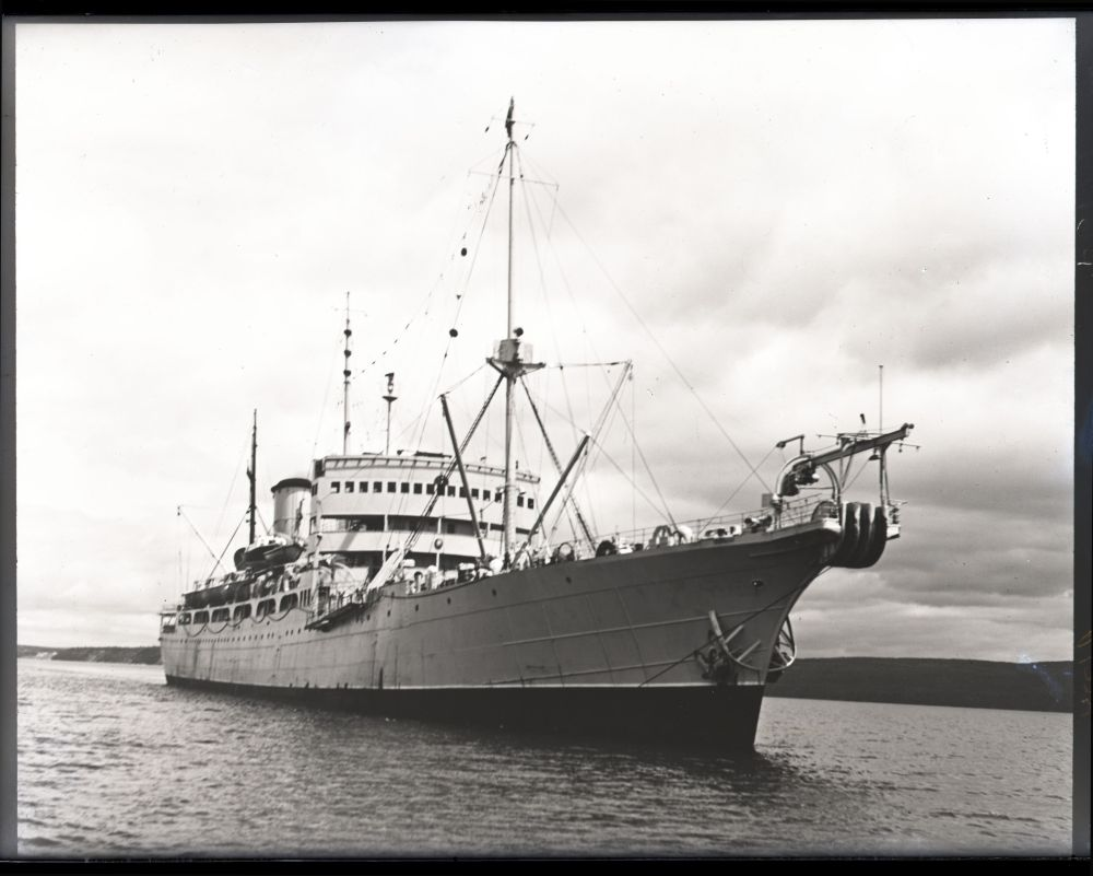
In terms of our family history, Corner Brook was a regular port of call for my father-in-law Paddy (1911 – 1989) in the 1930s. He was an engineer on a freighter that was taking paper somewhere, possibly New York. He was also taking bananas somewhere else. Yes, it was a pity that someone did not listen carefully enough to record the details of these actions, although additional research could possibly find more facts.
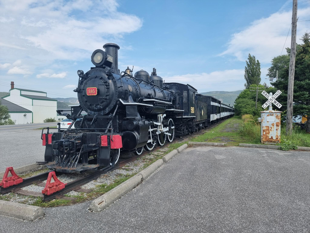
The distance between Genevieve Bay and Corner Brook is about 340 km, which takes about 4 hours (plus stops) to drive. While one could call the scenery attractive, it is also repetitive. There is not much variation to see along the route. Before officially arriving at Corner Brook, we paused at the Humbermouth railway station, home of Newfoundland railways locomotive 593. It was built at the Baldwin works in Philadelphia, and entered service in 1921. It retired in 1957.
The rail museum is yet another Newfoundland museum that has not entered the modern age. They expect people to pay entry fees (and everything else) in cash, which is something I refuse to do.
Corner Brook was a small community on the Humber Arm of the Bay of Islands in Western Newfoundland. A pulp and paper mill put Corner Brook on the map. Construction started in 1923 and it was completed in 1925. New Westminster, where I come from, also has a paper mill, without pulp production dating from 1922. Both are now owned by Kruger.
Sawmilling had been an important activity in the Bay of Islands starting in the 1860’s. The Newfoundland railway provided a reliable transportation link with the rest of Newfoundland, starting in 1888. The area, and Newfoundland more generally, held vast expanses of forests. These were useful to fuel the growth of newspapers in Europe and North America. The mill was a major economic benefit pumping millions of dollars into the economy, encouraging the development of new skills, increasing employment, generated new services and stimulating building construction.
Perhaps the most negative impact of pulp production was their sulpher smell. That said, there was no unpleasant odor in Corner Brook.
For me, Corner Brook was a relaxing town, admittedly with some traffic challenges. I am sure the locals have no trouble navigating its urban idiosyncrasies, but the streets have unexpected curves.
I enjoyed the diner where we chose to eat. Basic food, which is what I prefer.
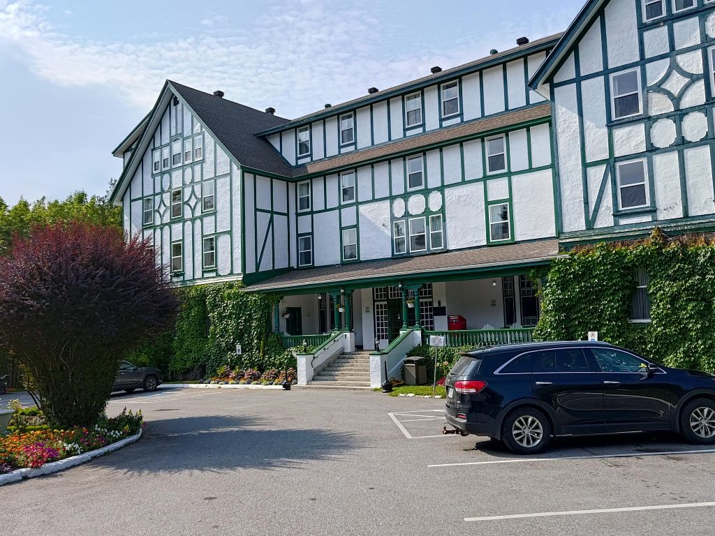
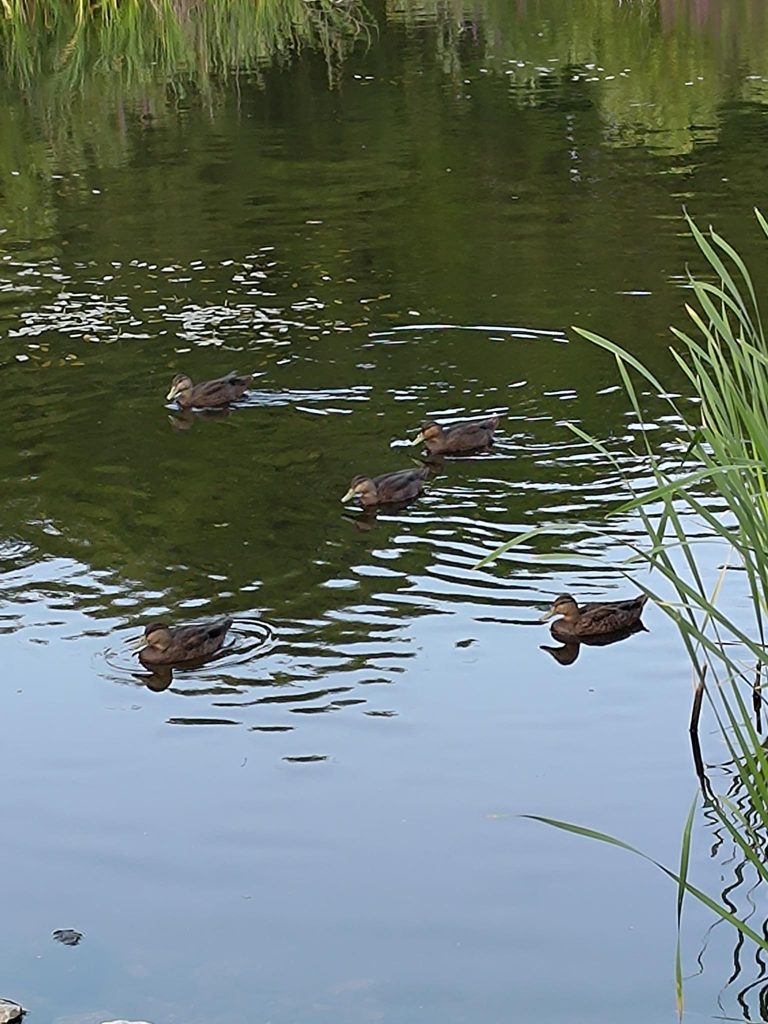
We stayed at the Glynmill Inn, a registered heritage structure in Tudor revival style, with 78 guest rooms. It was designed and built in 1923 by Nova Scotia architect Andrew Cobb (1876 – 1943) to house employees and senior staff during the construction of the paper mill. It was converted into a hotel in 1925. It is adjacent to Glynmill pond, which provided an opportunity to become acquainted with the local wildlife.
As I write this post, I am listening to Bay (of Islands) FM at 100.1. It is 07:00 in Corner Brook, but already 11:30 here in Norway. It’s studio is located at the Inn.
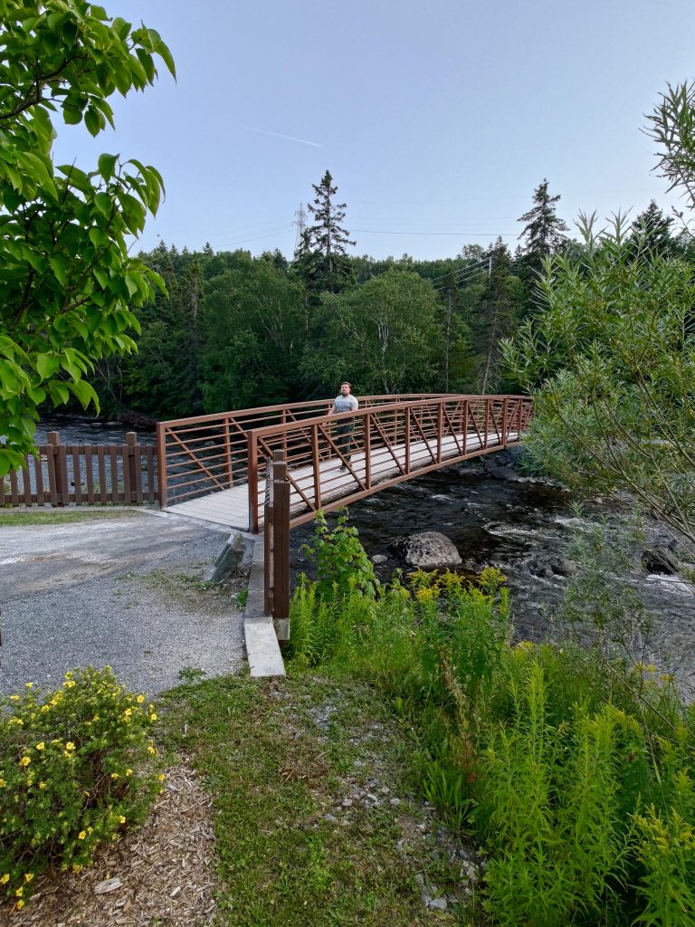
Alasdair crossing the bridge at the western end of the Corner Brook Stream trail.Residents of Glynmill pond.
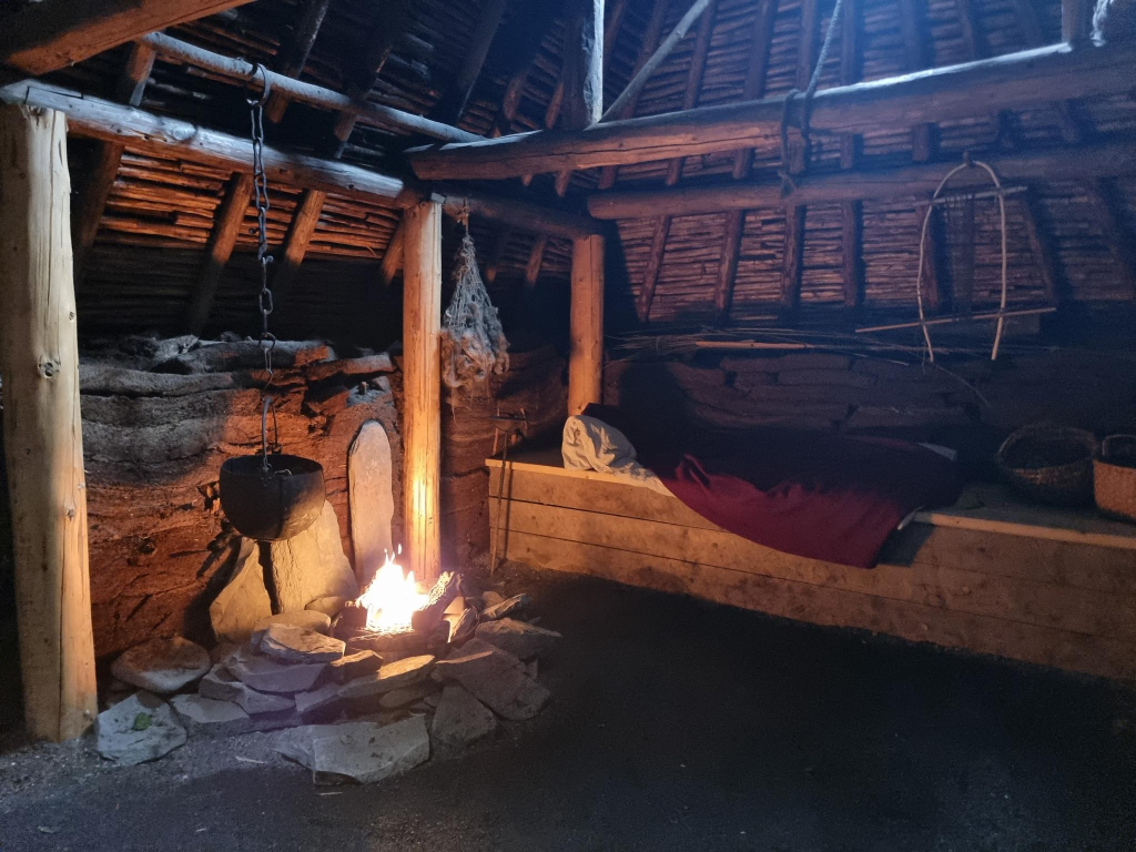
The visit to the Viking site at L’Anse aux Meadows, was a highlight of our trip to Newfoundland. Our guide, local resident Kayla, was educated as a folklorist, which means she was trained to tell stories. These were informative. We certainly gained a better understanding of the Viking settlement there. Lots of talk about the use of bog iron to make iron. In a reconstructed viking house, we also met a freeman who was doing wood working, and a freewoman who was weaving. Both of them should be happy that they did not need to rely on their crafts to support themselves!
There is a Norwegian connection that begins with Helge Ingstad. He is one of few people who have lived in three different centuries. He was born in 1899-12-30 in Meråker and died 2001-03-29 in Oslo. Meråker is in Trøndelag county where we live, but perhaps 100 km further south, and adjacent to Sweden. Helge was educated as a lawyer, and had a practice in Levanger, about 50 km further south from Cliff Cottage. In 1926 he explored the wilderness of Canada, working at times as a fur trader, before becoming the Governor of Norwegian territories on Greenland, then Svalbard = Spitsbergen.
In Svalbard he met Anne Stine Moe (1918-1997). They married in 1941. In 1946, they moved to the Holmenkollen area of Oslo, where they lived when not travelling the world. Anne Stine was an archaeologist. The couple also began to go through saga texts and archaeological material from the northern regions, where they came across a hypothesis put forward by the Swedish philologist Sven Söderberg (1928 – 2004), that the prefix -vín in Vinland did not necessarily have to do with wine, but rather with the old Norse language vín in the sense of meadow, field, grassland, as in the old name for Bergen, Bjørgvin.
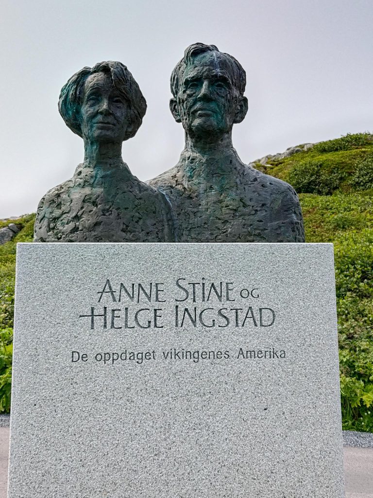
“Anne Stine and Helge Ingstad, they discovered the Viking’s America.” This is the inscription in Norwegian on the support for their busts at the entrance of L’Anse aux Meadows visitor centre. It was made by Inderøy sculptor Nils Aas, and given from Norway to Canada in 2001, after Helge Ingstad’s death.
Between 1961 and 1968, the Ingstads discovered settlement traces at L’Anse aux Meadows, that turned out to be Nordic from the Viking period. Folklorist Kayla thought that the reason why the Ingstads managed to discover them had to do with Helge’s personality. People did not view him as an aloof academic or professional, but an ordinary person local residents could relate to. He established rapport with the people he spoke to, before asking questions. This meant he received honest replies. His questions often had to do with humps and bumps in the local landscape that could conceal an archaeological site! When he asked local resident George Decker that question, he was shown L’Anse aux Meadows!
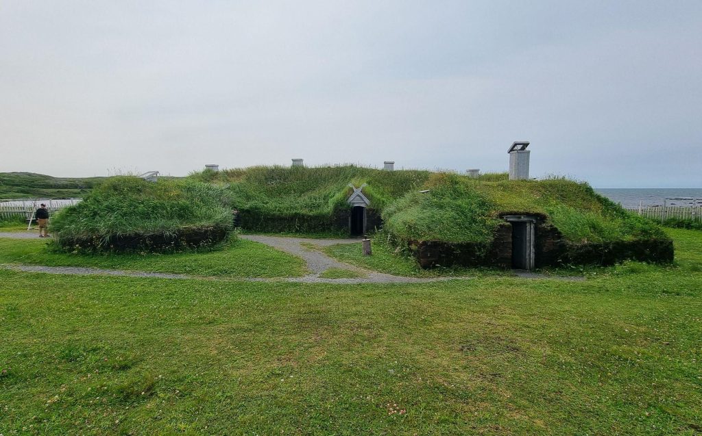
The outside of a reconstructed Viking longhouse at L’Anse aux Meadows. No, the Vikings did not use chimneys, but modern fire regulations require them. Photo: Alasdair McLellan.The inside of a reconstructed Viking Longhouse at L’Anse aux Meadows. Photo: Alasdair McLellan.
L’Anse aux Meadows was not located in Vinland. That was further south, possibly in New Brunswick. L’Anse aux Meadows was a boat repair centre, sometimes referred to as a pit stop, used seasonally. After about one generation of use, valuable possessions were removed from the settlement, and what remained was deliberately destroyed.
“Anne Stine and Helge Ingstad, they discovered the Viking’s America.” This is the Norwegian inscription on the sculpture at the entrance of L’Anse aux Meadows visitor centre, made by Inderøy sculptor Nils Aas, who was raised in Straumen, 13 km from Cliff Cottage. The sculpture was given by the people of Norway to the people of Canada in 2001, mediated by the Norwegian king Harald, after Helge Ingstad’s death.
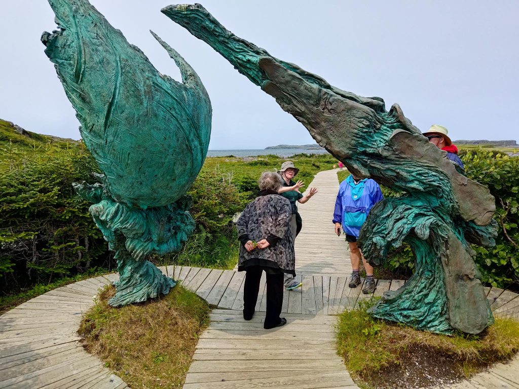
Sandra (1943 – ), one of the visitors, was having some difficulty walking, so I slowly walked with her through the site, while the young people walked quickly on, but had to wait for us to catch up. Little at the site is a thousand years old. Luben Boykov (1960 – ) and Richard Brixel (1943 – 2019) created each their half of The Meeting of Two Worlds, unveiled 2002-07-06. The sculpture symbolizes the suspected meeting of the Norse and the Indigenous peoples of North America
Sandra (1943 – ) with her back to the camera, and other, half hidden visitors, listening to the guide Kayla, at The Meeting of Two Worlds sculpture.
YAY
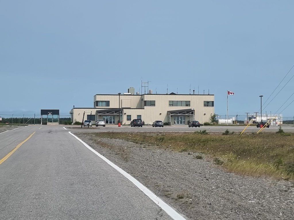
Of course we visit airports when given an opportunity. On the Great Northern Peninsula, YAY airport is located at St. Anthony. We visited it on our way to L’Anse aux Meadows. There are about eight scheduled flights a week: five involve YXB at Blanc-Sablon, Quebec; three YYT at St. John’s.
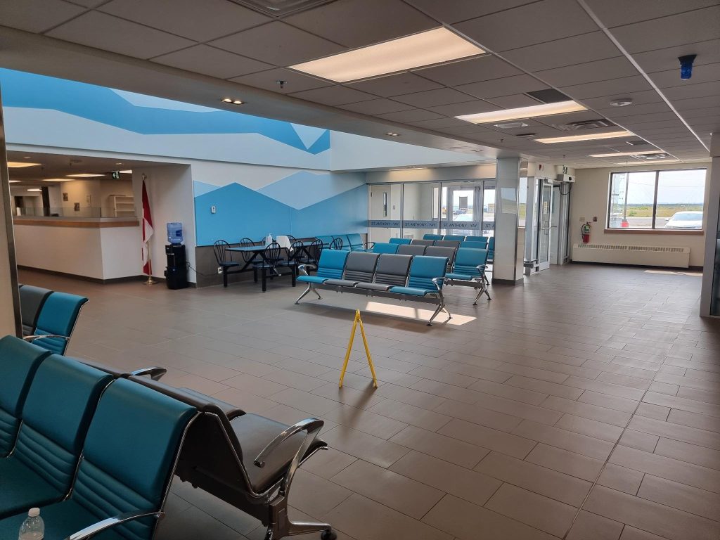
After entering the airport, we (as in Alasdair) were able to take a lot of photographs without having to disturb or be disturbed by passengers. The security guard was unperturbed by our presence.
The exterior of the YAY airport at St. Anthony, Newfoundland. Photo: Alasdair McLellanThe transit hall of YAY airport at St. Anthony. We were advised by a sign that the floor could be slippy. Photo: Alasdair McLellan.
Meanwhile back at the Genevieve Bay Inn
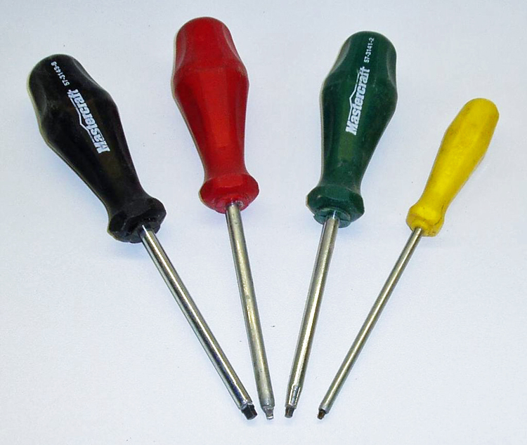
I talked to Wilfred Doyle, who – with his wife Donna – owns the Genevieve Bay Inn where we stayed. Wilfred’s area of responsibility is maintenance, as well as Thirsty’s Lounge = the largest bar in Newfoundland, opened 2003-12-31. Donna seems to be in charge of everything else. At the inn, most rooms are fitted with two home-made double bunk beds, to accommodate eight. These are family rooms. Not everyone is expected to share a bed with someone. I complimented Wilfred on the use of Robertson screws in the beds he made. He admitted, he prefers to use Robertson, but will use Torx if there is nothing else.
Four Robertson screwdrivers, known for their sloping/ inclined square bits: black (#3), red (#2), green (#1) and yellow (#0), Orange (#00) and brown (#4) screwdrivers are also available, but are not in common use. Photo: Luigi Zanasi, 2005-10-16.
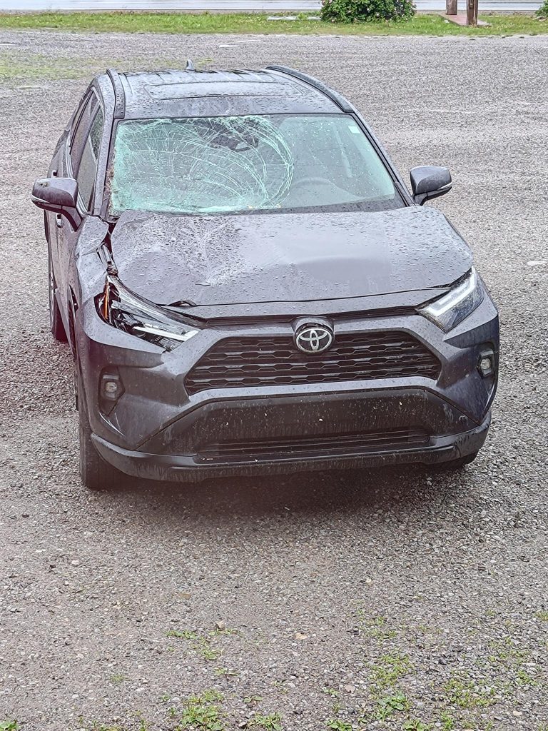
One of the guests had hit a Moose on the highway with his smallish Toyota. All the passengers (including his two younger children) had survived without injury. We talked about this, snow, studded snow tires and moose hunting.
I am not overly enthusiastic about Toyota cars, but was impressed with the condition of this one, after it had encountered a moose travelling at highway speeds in Newfoundland. In Newfoundland, license plates are only fitted to the rear of a vehicle.
Wilfred says that there is less snow now than previously, so he changes his “tires and rims” close to the end of November, then back again, some time in April. He is an active moose hunter. Which means he watches the moose from inside the Inn. When one is coming through, he gets his rifle, goes outside and shoots it. This is not hunting for sport, but food, possibly the difference between survival and starvation, a century before.
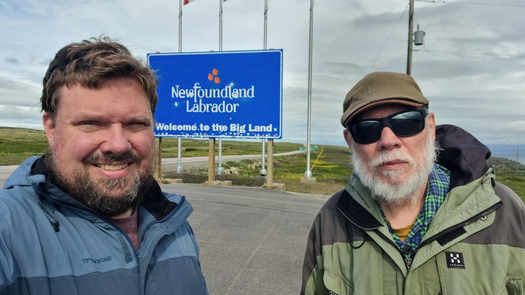
A selfie taken at the border between Quebec (to the left) and Labrador (to the right). Photo: Alasdair McLellan.
As a naturalized Norwegian, one acquires a number of skills that people of other nationalities can only dream about. In today’s weblog post, the focus is a detailed insight into ferry operations. Perhaps I should start by bragging about living 300 meters from a ferry terminal, although that ferry was replaced by a bridge on 1991-12-19.
This is mentioned because our visit to Red Bay in Labrador, required the use of a ferry across the Strait of Belle Isle. The route is between terminals at St. Barbe on Newfoundland’s Great Northern Peninsula and Blanc-Sablon in Quebec. Theoretically, the crossing takes 1 hour 45 minutes, and covers 36 km. The first problem is that one has to meet up one hour ahead of the scheduled departure time, if one has a reservation. The second is that the ferry was not ready to leave at its scheduled departure time.
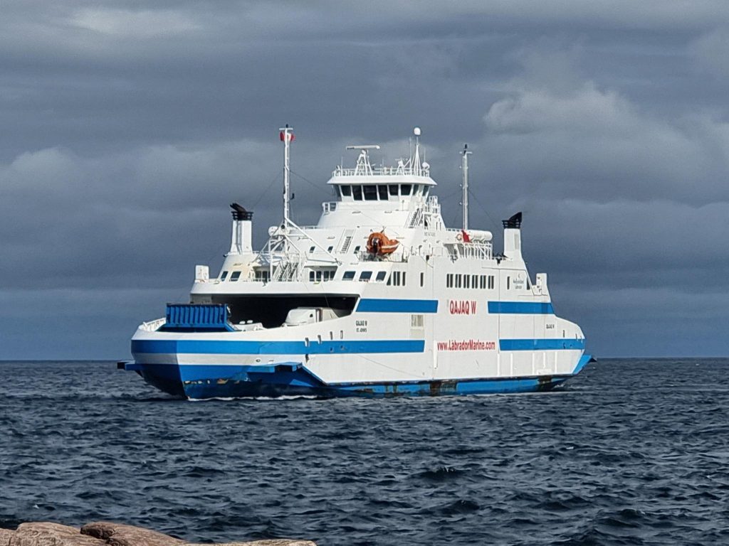
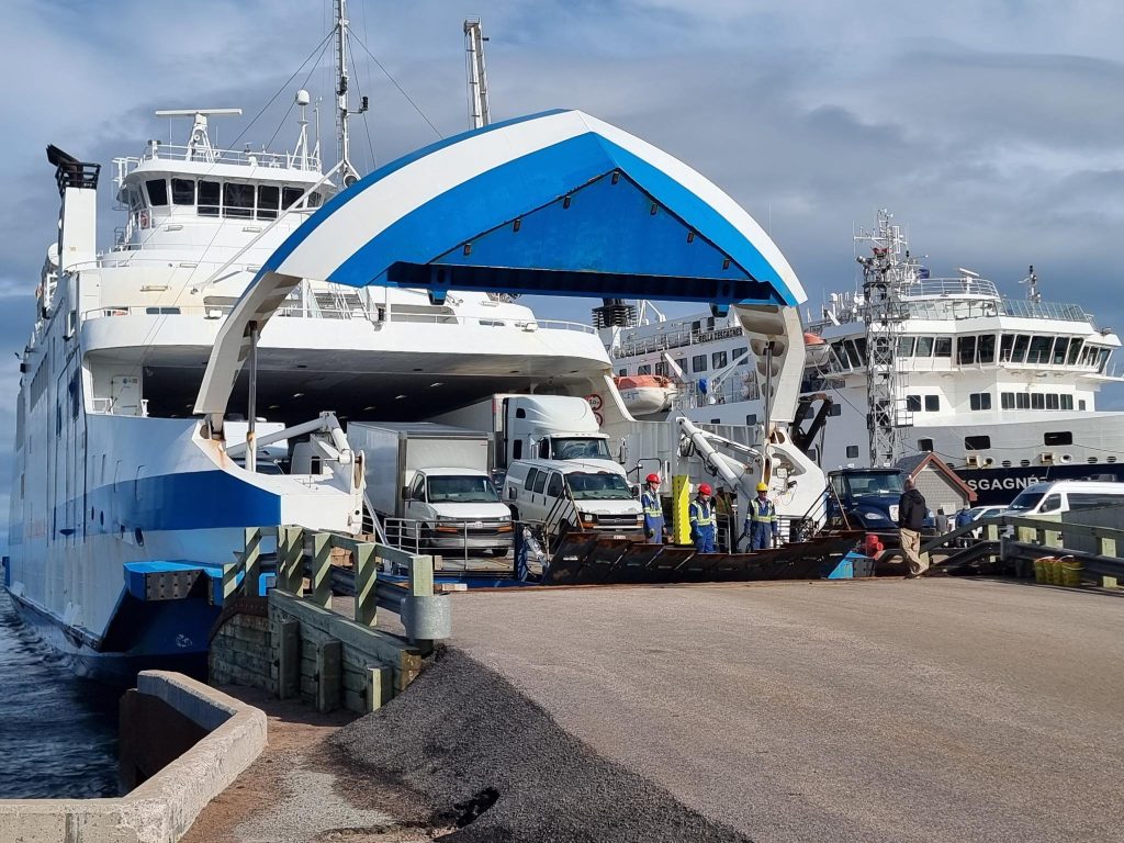
MV Qajaq W (the middle part is pronounced kayak) has been used on the route since 2019. It can carry 120 standard vehicles, including up to 8 tractor trailers, along with 300 passengers.
The MV Qajaq W
Qajaq was built in 2010, it has a length of 97.84 m, and has 5 233 gross tonnage. Working backwards from 5.6 MW of power, it is likely that it is equipped with 4 Wärtsilä BL20 engines, each providing 1 400 kW. It has an ice classification 1A, which is immediately below the best joint Finnish-Swedish ice-classification for merchant ships, 1A Super. Both bows are ice-strengthened. It was built in Norway at Fiskerstrand, outside of Ålesund, As MV Muhumaa, it sailed in the Baltic between Saaremaa island in Estonia and Ventspils in Latvia from 2011 to 2017.
This vessel replaced the 108.7 m long MV Apollo completed in 1970, that was unsuitable for the route, despite it being a Baltic ferry. The Apollo was equipped with accommodation for 1 500 people, that was never used. The Apollo had 2 x 3 400 kW MAN 9L32/36 diesel engines (altogether 6.8 MW), and 6 609 gross tonnage. At times, ice prevented it from landing at St. Barbe, and it would be redirected to Corner Brook, taking 12 hours for the crossing from Labrador. It was taken out of service in 2019, and scrapped in Turkey, in 2021.
Most Norwegian ferries simply drive into the dock (at low speed), and use their engines/ motors to keep their position as vehicles and passenger leave and enter. An even more advanced Auto-docking eliminating human input, has been a reality on some routes since 2018. Electric ferries have been used since 2015, and complete electrification is expected in 2025.
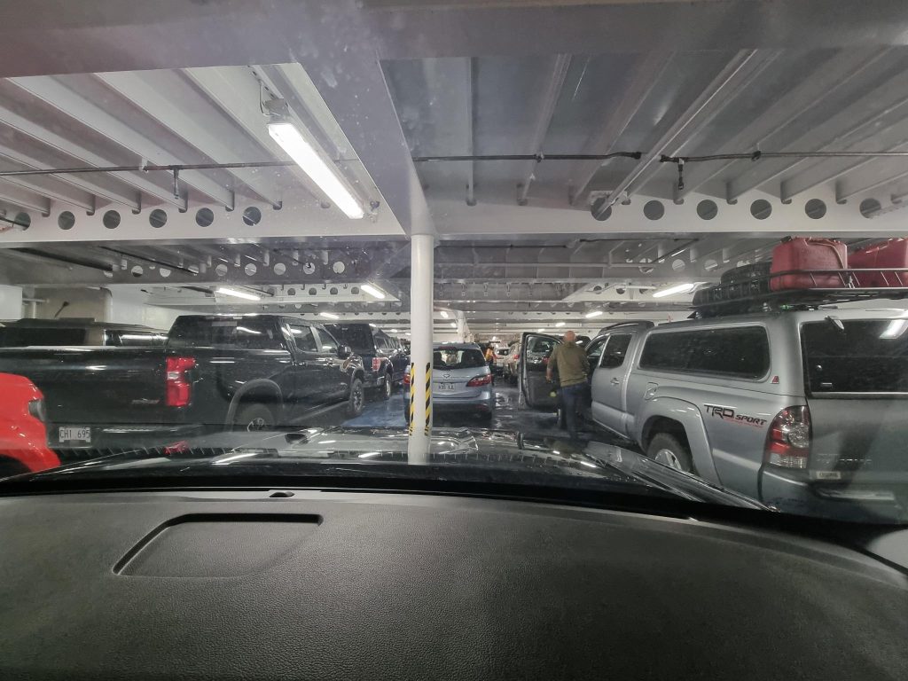
The interior of the MV Qajaq W, showing the middle lane of the lower car deck. Hélène’s Mazda 5 is immediately in front of ours. Photo: Alasdair McLellan
The ferry left about half-an hour late, mainly due to a design feature where, after service in the Baltic, the number of lanes of vehicles onboard the lower car deck was reduced from six to five, because north Americans prefer larger vehicles. With the middle lane being underused, because the crew spent precious loading minutes parking vehicles between support columns. We were shunted into this middle lane. Immediately ahead of us was a Mazda 5, identical to Alasdair’s. On my way to the passenger deck, I complemented the woman owner, Hélène, on her very attractive vehicle.
As for the ferry, my advice would be to just use four lanes, in an attempt to speed up loading, and in doing so, be able to make an extra trip each way, each day. I also note that some days there are an odd number of trips made, meaning that the ferry overnights on a different side of the strait.
After landing in Quebec, it did not take us many minutes to drive the 6 km to the Labrador border. We continued onwards to the tourist office, to make important enquiries, such as finding places to buy a Labrador flag.
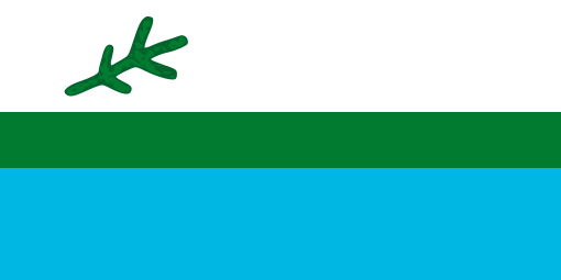
The Labrador Flag as specified, and originally made in 1973-4.
The Labrador flag was the most popular flag in Newfoundland. Yes, much more popular than the Canadian or Newfoundland flags. It was created in 1973 by a small group of Labradorians led by Michael S. Martin (1938 – ), then representative for Labrador South in the provincial legislature, to celebrate the then upcoming 25th anniversary of Newfoundland and Labrador’s entry into Canadian confederation, Many regard the creation of the Labrador flag as an act of political mischief/ vexation aimed at Premier Joey Smallwood (1909 – 1990) and his Liberal government’s perceived indifference to Labrador.
Patricia (Bryne) Martin sewed 64 flags, while her husband used a marker pen to add a spruce twig to each: 59 of the flags were given to Labrador communities, 3 to Labrador representatives in the provincial House of Representatives, One was for her husband, and another for herself.
The flag can be regarded as being 10:5 = 2:1 in proportions, with three fesses = wide horizontal bands, in flagspeak. From the top they are white, green (Pantone Green 356) and blue (Pantone Blue 306), in a proportion of 2:1:2. On the left of the white field is a stylized representation of a black spruce sprig, which is the most common tree, not just in Labrador but also in Newfoundland. Its is intended to remind viewers that Labrador is part of that province.
The flag’s colours are mirrored in the flag of Nunatsiavut = the Labrador Inuit Association. The black spruce twig was adopted for use on the Franco-Terreneuvien = French Newfoundlander flag.
Any six-year old, following a flag description, should be able to draw and colour any flag. If s/ he can’t, then the flag is too complex. We ended up buying both a Quebec and Labrador flag. Most Labrador flags (including ours) are fake/ bootleg. Michael Martin commented, “The problem stems from efforts by unscrupulous dealers and manufacturers to get around the copyright requirements by creating flags that have the wrong dimensions, wrong colours and wrong shape and size of the black spruce twig.” This is a common problem when attempting to buy flags! Justin Brake wrote about this situation ten year ago! The Labrador flag is now over 50 years old.
Red Bay
About 80 km north of Blanc-Sablon is the former whaling station at Red Bay. Starting in 1530 and lasting for almost 100 years, it was a major Basque whaling area. Several whaling ships, both large galleons and small chalupas, sank there. Their discovery led to the designation of Red Bay in 2013 as a UNESCO World Heritage Site. Data from the 2021 census shows that Red Bay had a population of 142 living in 65 of its 69 total private dwellings. That is down 16% from its 2016 population of 169. It’s land area is 2.31 km2.
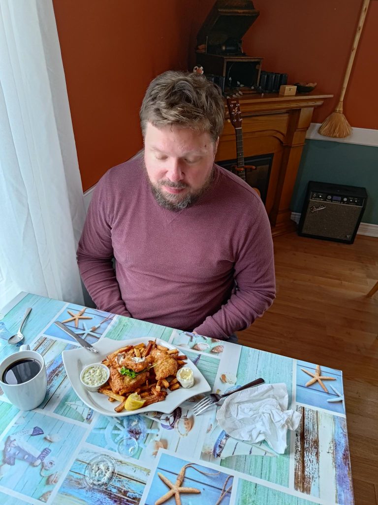
A bus load of tourists, travelling on our ferry, arrived at about the same time as us. They managed to inundate the local museum, so Alasdair and I thought the best counter move was to visit the Whaler’s Restaurant. When I asked for a meal of whale meat, I was politely told that they were sold out. Both Alasdair and I ate their fish and chips.
Coffee with Fish and Chips, but not many vegetables
Return to Newfoundland
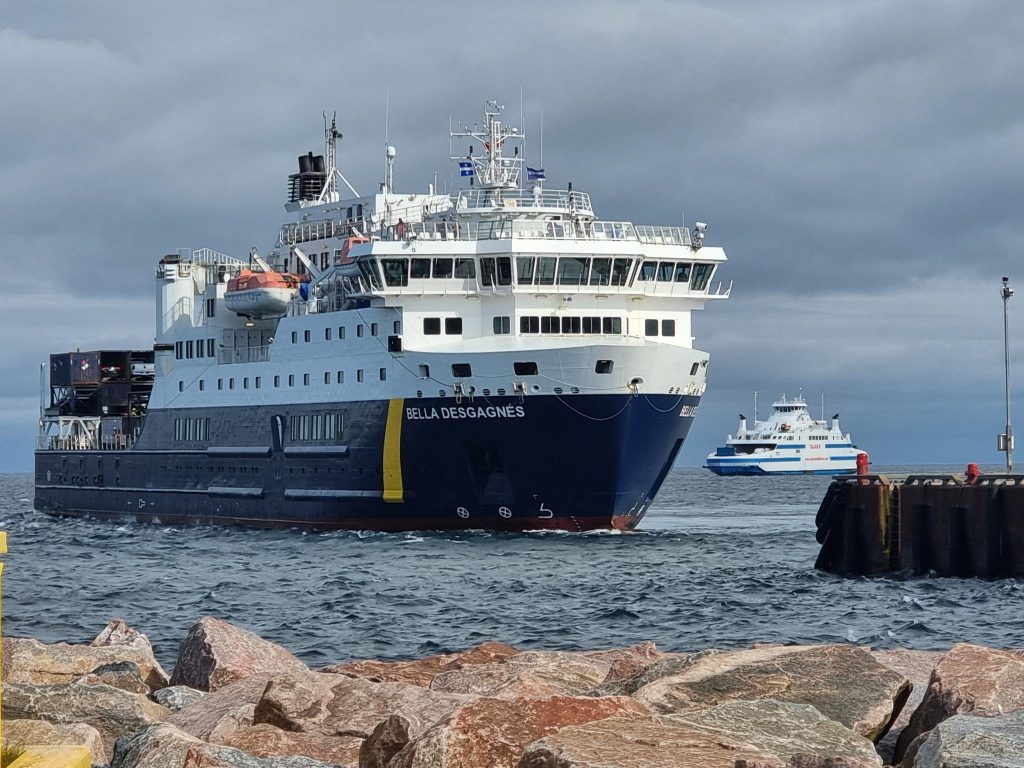
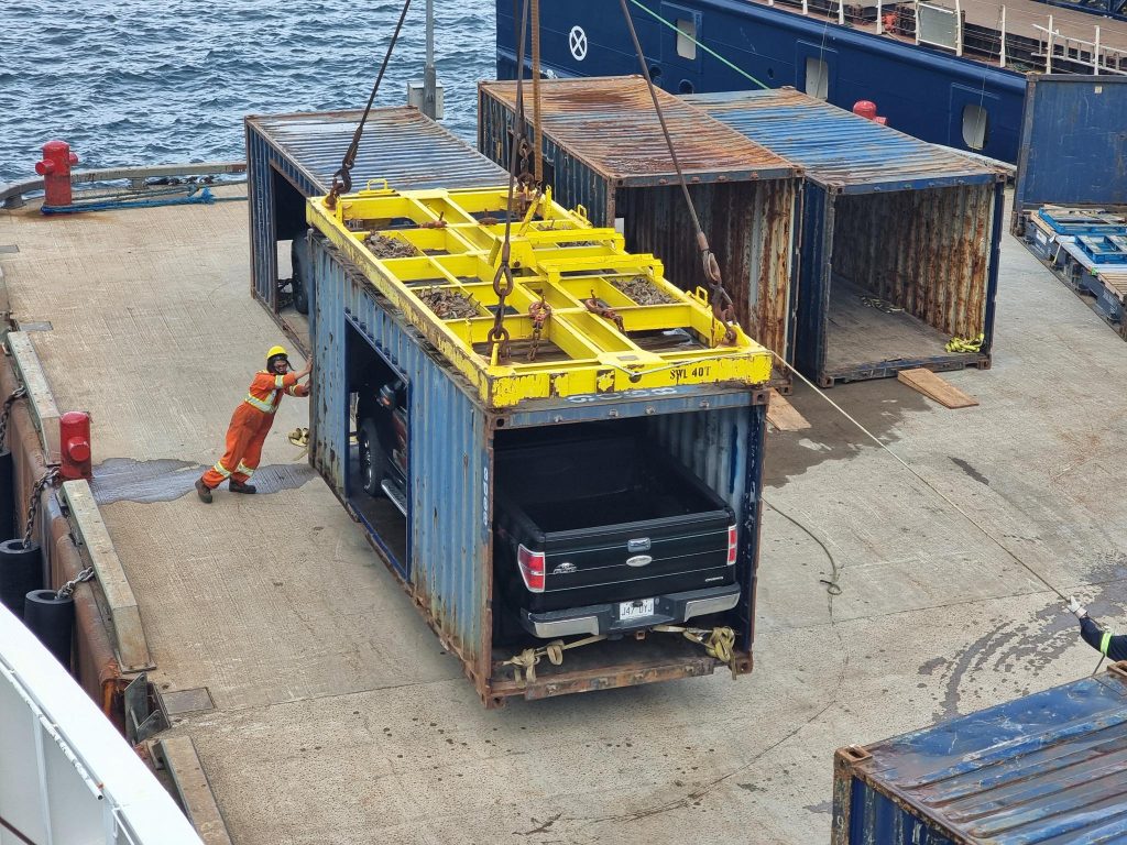
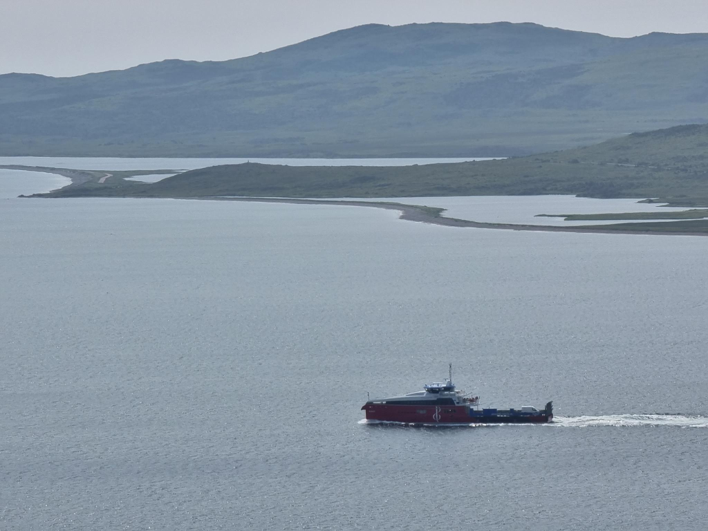
The Bella Desgagnés cargo-passenger ship arrived minutes before the Qajaq W at Blanc Sablon. Its voyage from Rimouski to Blanc Sablon and back to Rimouski takes a week. The first stop is at Sept-Îles on the north shore, then it stops at Anticosti Island, before stopping at other coastal villages. The return trip on Qajaq was considerably delayed according to its schedule. This gave us an opportunity to view the unloading of the Bella Desgagnés. Many unloaded vehicles were making their way to Newfoundland on the Qajaq.
Future Trips
I will probably not visit Labrador again, but Alasdair expressed an interest. The Trans-Labrador Highway (TLH) is the primary public road in Labrador, with a length of 1 149 km. The original western/central portion of the TLH is designated as Route 500 and measures 543 km from the Quebec – Labrador boundary through Labrador City/Wabush, Churchill Falls, and Happy Valley-Goose Bay. From there, heading southeast is Route 510 = Labrador Coastal Drive, 606 km. Centres en route include Cartwright Junction, Port Hope Simpson, Mary’s Harbour, Lodge Bay and Red Bay.
The TLH runs through dense wilderness for most of its length. Route 500 connects with Quebec Route 389, which runs 567 km through wilderness north from the Quebec – Labrador boundary to Baie-Comeau, where it connects with Quebec Route 138. At one time Quebec promised that the route would follow the entire north shore of the St. Lawrence River eastwards to Blanc-Sablon. This has not happened. However, The western terminus is in Elgin, at the border with New York State south-west of Montreal. At the Trout River Border Crossing, it connects with New York State Route 30. Route 30 leads to Schenectady County, where some of my biological relatives settled about 1660.
Back to Happy Valley
If one wants to explore the coastal communities north of Happy Valley – Goose Bay, there is a ferry service that operates each summer in the ice-free season, from roughly June to November. The Kamutik W is often described as a sister ship to the Qajaq, although it is outfitted very differently. It began life as the Hiiumaa in 2011, and sailed in Estonia.
In its new life it has a weekly schedule. It departs Happy Valley-Goose Bay and visits each community on its voyage north. At Nain (most northerly community), it turns around and revisits each community on the return trip to Happy Valley-Goose Bay.
Unloading vehicles from the Belle Desgagnés at Blanc-Sablon. Photo: Alasdair McLellanUnloading vehicles from the Qajaq W at Blanc-Sablon. Photo: Alasdair McLellan.
Wikipedia tells us that demography is the statistical study of human populations: their size, composition and how they change through the interplay of fertility, mortality and migration. In trying to learn more about the population of Newfoundland and Labrador I consulted Statistics Canada data, but allowed Wikipedia editors to summarize some findings to gain further insights. Since entering confederation in 1949, Newfoundland and Labrador have always been the 9th most populated Canadian province.
In terms of provinces, only Prince Edward Island is less populated, at about 177 000. On 2024-04-06, Statistics Canada’s population clock indicated that New Brunswick’s population had grown to 850 000. Nova Scotia has seen record population growth in recent years, with young people moving in from Ontario and other provinces. Nova Scotia is attempting to reach 2 000 000 by 2060, but faces challenges in health care, education and housing.
Newfoundland and Labrador (NL) reached their maximum population in about 1991, at somewhere around 568 500 people. Since then, it has declined, reaching about 510 500 people in 2021, the last census year. More than half live on the Avalon peninsula.
Labrador has an area of 294 330 km2 and a population in the last census (2021) of 26 655.
In terms of NL, one has to ask why its population has stagnated, if not declined? NL has been overly dependent on one resource, fish, and cod in particular. There are some exceptions. In Corner Brook and Grand Falls – Windsor, there is an emphasis on forestry and pulp and paper production.
In the following section, a comparison will be attempted between Trinity and Twillingate. Both are small villages, yet they are very different.
Trinity
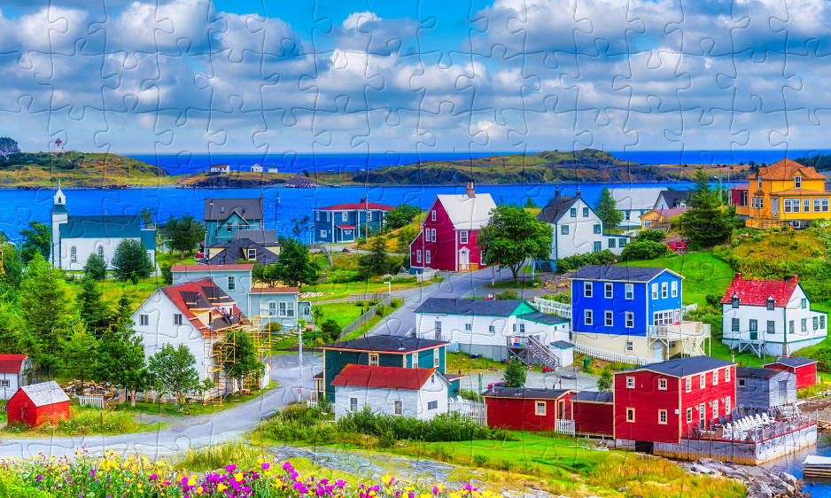
This is not just a photograph of Trinity, Newfoundland. It is also a screenshot of a jigsaw puzzle I created on 2024-07-21, using 1 hour 44 minutes and 53 seconds to complete the puzzle.
If I have one piece of advice to travellers to Newfoundland, it is to avoid visiting the village of Trinity. The problem with Trinity, is that they have done everything right to make it into a model village. It is more Disneyland, than a thriving village.
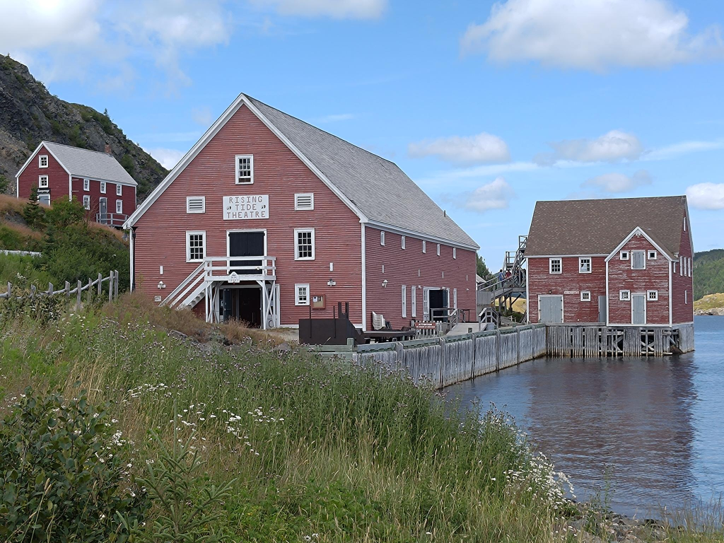
The Rising Tide Theatre is one of many attractions in Trinity.
There are many attractions in the village, including the Rising Tide Theatre. However, there is little coordination, and almost no parking. We were able to park at the museum because it was closed for an hour long lunch in the middle of the day.
Twillingate
About 300 km north-west of Trinity, and about 112 km = 1.5 hours driving, north of Gander, is the town of Twillingate, with a population just over 2 000. It calls itself the Iceburg capital of the world. To arrive there, one travels across several islands connected by causeways, including New World Island, which commemorates the 1523–24 expedition of Giovanni da Verrazzano (1485–1528) to Newfoundland that established the coast to be part of the New World rather than Asia. Yes, that was over 500 years ago! Fogo is the one island in the area still requiring a ferry connection.
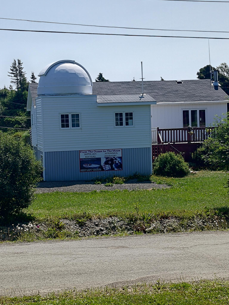
Our stay there was the most refreshing of the trip, we rented a cottage outside of the town. Across the street from our cottage, retired fisherman Jim Gillard has expanded his horizons, setting up a $16 000 telescope in the hand-built Twillingate Astronomical observatory, in his front yard.
Across the street from our cottage, Skipper Jim had opened the Twillingate Astronomical Observatory. It was a way to transform a hobby into a livelihood, and less competitive than turning a fishing boat into a whale watching vessel.
This is not the only attraction. A few hundred meters away, is the Top of Twillingate walk, which provided a refreshing view of the area. This is the one part of Newfoundland that I would want to visit again. We also visited the town, which is divided between two islands, South and North Twillingate. We also visited the Long Point lighthouse, located in the town (?) of Crow Head, also located on North Twillingate. The town’s current population is 156, and declining.
Low Mist Pond with the Top of Twillingate pathway around it.
Travelling to New France from St. John’s, Newfoundland involved a day of travel: one drives on the Trans Canada Highway across the Avalon peninsula to the Burin peninsula, then turns left at Goobies onto Highway 210. One keeps driving on it, until one reaches Marystown. A right turn onto Highway 220, leads to the port of Fortune, which is where the SPM ferries dock in Canada. From there those with vehicles reverse onto the ferry, so they can drive forward when they arrive in Saint-Pierre. Altogether, this involves 363 km and almost 4 hours of driving. The ferry from Fortune to Saint-Pierre is about 45 km, and takes another 1.5 hours.
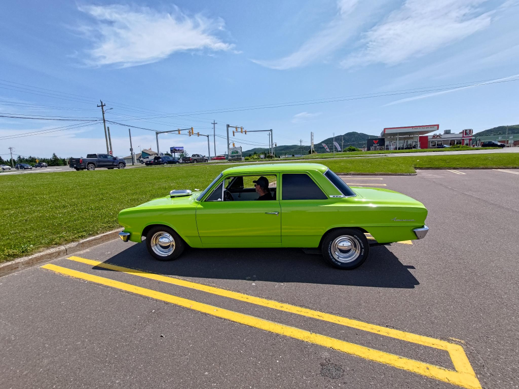
If one is fortunate in Marystown, one meets the Little Green Devil, a 1965 Rambler American 2-door sedan. This model, and many others in the Rambler lineup, was designed by Dick Teague (1923 – 1991). From my perspective, it is Teague’s most successful design. These vehicles are known for their smooth ride, despite their compact size. WhiIe I would not criticize anyone’s vehicle preferences (with the possible exception of motorcycles), i prefer utility vehicles ( vans and station wagons). Vehicle solidity is my focus. Thus, I prefer vehicle construction incorporating a frame around every door, in contrast to flimsier hardtop models. Despite having a driving license since Tuesday, 1965-01-05, I have owned only four vehicles, including one jointly with my wife, Trish.
At Fortune, we were able to eat a chicken dinner at Mary Brown’s. This was our first experience of this fast food chain. Originally it was named Golden Skillet, the first location was at St. John’s Avalon Mall. However, the owners were forced to rename the establishment for legal reasons. Currently, there are over 300 locations across Canada.
After that meal we picked up our ferry tickets, then went next door to arrange to park our rental car for two days on the outskirts of town. We were driven back to the ferry terminal. The 1.5 hour ferry ride was uneventful. There was little to see apart from waves on the ocean, despite having window seats.
St. Pierre
The Overseas Collectivity of Saint-Pierre and Miquelon = Collectivité d’outre-mer de Saint-Pierre et Miquelon (referred to hereafter as SPM) has a population of about 6 000, and occupies an area of 242 km2 on eight islands. It is located about 19 km west of Point May on the Burin peninsula.
Two almost identical ferries provide for much of the transportation needs of the archipelago. These are the blue hulled Nordet and the red hulled Suroît. The vessels are 56.7 m long, with a 768 UMS tonnage. Both entered service in 2019. They are named after a northerly, and southerly wind, respectively.
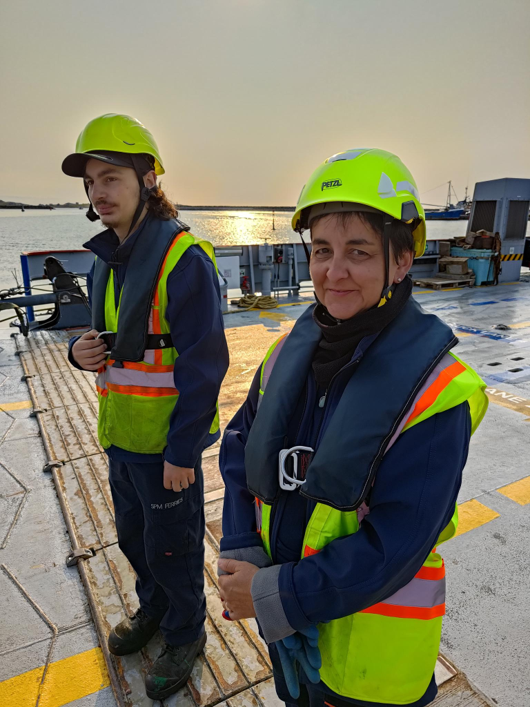
Compared to the casual, and often inappropriate dress of deck crew on Norwegian ferries, the deck crew of these French ferries were dressed for any emergency. They were equipped with helmets, hi-vis vests, life preservers, gloves and safety shoes.
After landing in St. Pierre, we passed through French immigration and were able to enter France. We walked through the town, until we found our bed and breakfast, where we had rented two rooms. This was followed by yet more walking around the town. The gradient was intermediate to my two reference points. It was steeper than most places in Inderøy, Norway, but not as steep as the worst hills in New Westminster, British Columbia, Canada.
St. Pierre, the island and village is named for St. Peter, the patron saint of fishers, net makers and ship builders. He was born Simon, possibly Simeon. Both he and his brother Andrew were themselves fishers, later, they became two of the twelve apostles. Details of Peter’s life are vague, although he was the Bishop of Rome = Pope, from 30 AD to his death 64 – 68 AD, crucified by Nero (37 – 68).
While Saint-Pierre is far too urban for my tastes, with a population over 5 000, and an area of 26 km2, Grande Miquelon is appropriately populated (ca. 700 people) and sized (110 km2). If I lived there, I am sure that I would want to spend much of my time in the wilderness of Langlade.
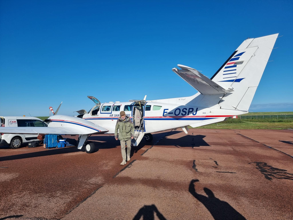
Air Travel
One of the main reasons for wanting to visit SPM was to experience flights with Air Saint-Pierre. We were going to fly both ways on inter-island flights between Saint-Pierre and Miquelon.
On Monday, 2025-07-23, we left our bed and breakfast at 07:30 and walked to Aéroport de Saint-Pierre = Saint-Pierre Airport (FSP), a regional airport located south of Saint-Pierre. It opened in 1999 and consists of four buildings excluding the control tower. It replaces an older airport that opened in 1965. The new 08/26 runway is 1 800 m long, while the old 11/29 runway was 1 250 m, not long enough for most commercial aircraft.
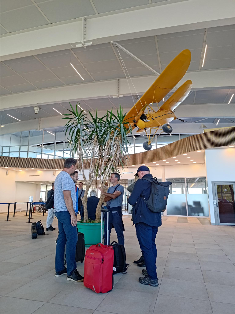
The passenger terminal at 2 200 m2, is large given the traffic.
We boarded our aircraft at about 08:30, without any form of security check. It took about 10 minutes to get the aircraft in condition to fly. After about 15 minutes in the air, we were landing at Aéroport de Miquelon = Miquelon Airport (MQC), the regional airport on Miquelon Island. The 12/30 runway is only 1 000 m long, suitable for the Reims-Cessna F406 Caravan II machine, but nothing much larger.
Our return flight was delayed, because the number of passengers exceeded the number of seats available. Thus, we had to wait until the plane flew to Saint-Pierre, then returned to pick us up. Alasdair was happy that he was issued seat 1A for both flights. I was assigned 1B for both flights.
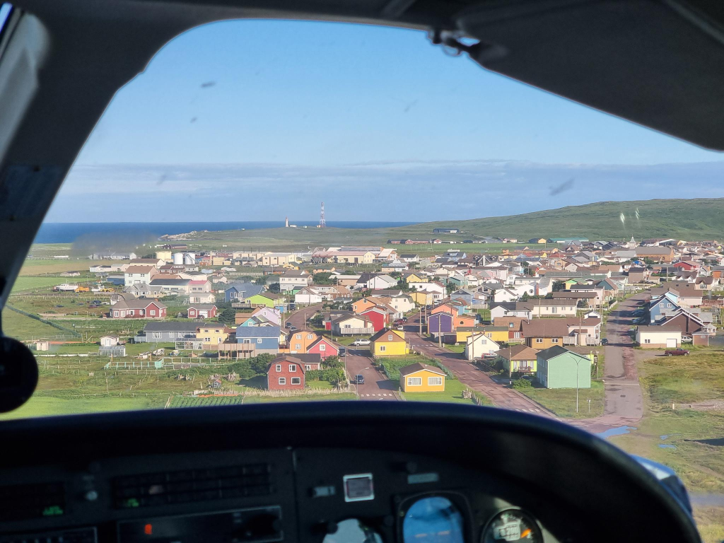
Flying close to the village of Miquelon, on a landing approach. Photo: Alasdair McLellan.
Here I am emerging as the last passenger out of our aircraft, a Reims-Cessna F406 Caravan II of unknown vintage. Photo: Alasdair McLellan.
The Suroît off Miquelon.
I have experience with ferries, of various types, especially from six years with weekly commutes in Norway between Molde and Inderøy, usually involving four ferries each week. I appreciate their efficiency, especially in docking, unloading and loading vehicles. However, I note the lack of crew safety equipment.
Here, the deck crew of Suroît are dressed for any emergency. They are equipped with helmets, hi-vis vests, life preservers, gloves and safety shoes. Later, I talked with Fréderique Ragot, about her work.
Visiting remote airports and train stations is one of the perks of being the parent of someone who studied transportation economics, then took a B.Com. with a marketing specialization, before turning to history, ending with a M.A. and a thesis about the development of a now-defunct Norwegian airline.
Regional Influences
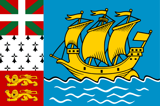
While the official flag of SPM is the French flag, an unofficial SMP flag is also used. Because of my interest in flags, often collecting them from places I visit, I wanted to buy a SPM flag. This proved impossible. Much of the flag contains elements found on the SPM coat of arms. Along the hoist, from bottom to top, are the flags of Normandy, Brittany and, in the uppermost position, the Basque Ikurriña, officially described as a white cross over a green saltire on a red field. Basque nationalists Luis Arano (1862 – 1951) and his brother Sabino (1865 – 1903) developed the Basque flag. Its neologistic name comes from ikur ‘mark, sign’ (itself a neologism extracted from irakurri ‘to read’). These are the places that contributed most of the population of SMP.
The yellow ship on the flag represents the Grande Hermine, the carrack which brought Jacques Cartier (1491 – 1557) to Saint Pierre on 1535-06-15.
World War II
Yet, another reason for this trip to this part of the world, was to understand the situation my parents encountered when they were stationed with the Royal Canadian Air Force, in Newfoundland, for a large part of World War II. Newfoundland was not yet part of Canada, but British territory. SPM was (and still is) part of France. Decisions often involved four countries, with a theoretically neutral USA wanting to make decisions.
The Third French Republic had begun World War II in 1939-09-03 on the side of the Allies. On 1940-05-10 it was invaded by Nazi Germany. Paul Reynaud (1878 – 1966) resigned as prime minister and was replaced by Philippe Pétain (1856 – 1951). On 1940-06-22, Pétain signed an Armistice that created Vichy France that, on paper, existed from 1940-07-10 to 1944-08-09. Vichy was the seat of government, about 400 km south of Paris.
The Vichy government was authoritarian, antisemitic and, somewhat later, anti-Soviet. Yet, it never joined the Axis powers and was formally at war with Germany. In practice, it was collaborationist. SPM authorities had sworn their allegiance to the Vichy French government.
There were concerns in Newfoundland (NL), Britain and Canada, that the Axis powers might use SPM as a base of operations, offering German submariners an excellent position to re-supply and coordinate attacks upon Allied convoys. Wireless communication and transatlantic cables allowed the islands’ authorities the opportunity to transmit vital information to Vichy France and onwards to German submarine crews about weather conditions, the movements of Allied warships and convoys. There was also concern that local fishery products could be sent to Germany through mainland France.
NL wanted a pre-emptive invasion of SPM. Canada was against this for fear of offending USA. As the Battle of the Atlantic reached Canadian waters in 1941, The Canada–United States Permanent Joint Board on Defence had unanimously agreed that the existence of an uncontrolled and high-powered wireless transmitting station on SPM constituted a threat to the interests of Canada and USA. Yet, USA opposed the use of force to take control of SPM.
Charles de Gaulle (1890 – 1970), Chairman of the (Free) French National Committee 1940-06-18 to 1944-06-03 asked Admiral Émile Muselier (1882 – 1965) to investigate the possibility of invading the islands, then ordered their capture.
On 1941-12-23, a French flotilla, the submarine Surcouf and three corvettes, Mimosa, Aconit and Alysse, sailed from Halifax under the pretense of a training mission. It arrived off Saint-Pierre and disembarked 230 armed sailors. They met no resistance and captured the island in only 20 minutes. Some sources state that Miquelon was captured the same day, others the following day. The Free French authorities organized a plebiscite on 1941-12-25, but only males over 18 years were given a choice of “rallying to Free France or collaborating with Axis powers”. Almost 98 per cent voted in favour of Free French administration.
I find it noteworthy that the French named their largest submarine after a slave trader and privateer, Robert Surcouf (1773 – 1827).
The US Secretary of State, Cordell Hull (1891 – 1955), called the capture of SPM a violation of the Monroe Doctrine. He wanted to prohibit French citizens exercising their democratic rights. He wanted SPM to restore its Vichy government. The Monroe Doctrine, first articulated 1823-12-02, is a United States foreign policy position that opposes European colonialism in the Western Hemisphere. Any intervention in the political affairs of the Americas by foreign powers is a potential hostile act against the USA.
Despite Hull’s protests, this incident was soon forgotten. The Japanese attack on Pearl Harbor, 1941-12-07, and the declaration of war on the USA, by both Japan and Germany, meant that Vichy France had become an enemy.
In the 1930s, many Americans were isolationists, not wanting to involve themselves in wars. Others were sympathetic to the Nazi cause. The situation has not dramatically changed in recent years, with Donald Trump wanting the USA to imitate its past, and for it somehow to become great, again. It is instructive to look at the demographics of the Capitol insurrectionists in Washington D.C. on 2020-01-06. They were predominantly white, male, aged 30+, trained and working as professionals. They were not the downtrodden.
Greatness is not measured by the number of billionaires. I am a limitarian, a believer in putting strict limits on personal wealth, with a maximum vastly below a billion $/ €/ £. One percent of that amount should be sufficient for everyone.
Mountains
Many mountains in the Canadian Rocky mountains were named for French generals prominent in World War I in 1919. Mount Pétain was one of these, located on the border of the Canadian provinces of Alberta and British Columbia on the Continental Divide. Geoffrey Taylor (1952 – 2020), a former University of Calgary professor of infectious diseases, campaigned from 2016 to his death, to remove the name of the Nazi collaborator from the mountain. In 2019, Alberta rescinded Pétain’s name from the Alberta side of the border. In 2022, British Columbia also rescinded the name, leaving the mountain and other features previously associated with Pétain, nameless.
Time
Clocks are an important technology for the world. I appreciate Sandford Fleming’s (1827 – 1915) promotion of 24 worldwide standard time zones, a prime meridian, and use of the 24-hour clock. He saw these as necessary elements for communicating time accurately. I am also glad that there is an International Telecommunications Union (ITU), that has created a world time standard, Coordinated Universal Time (UTC). A weblog post on the ITU is scheduled for its 160th anniversary, 2025-05-17. Here many other aspects of time will be discussed.
In this post, I would like to restrict myself to expressing a minor, but unnecessary, irritation with Newfoundland. At the same time, I would like to thank SPM for not following in its wayward footsteps. This irritation can be expressed as Newfoundland and Labrador, having a time that offsets those of a time zone, by 30 minutes.
This post is being published on Ukrainian independence day = День Неза лежності України, 2024-08-24, in commemoration of the Declaration of Independence in 1991.
In mythology, Avalon is an island, dominated by Arthur’s sister, the sorceress Morgan. It is also the location where Arthur’s sword Excalibur was made, and where Arthur recovers from injuries suffered at the Battle of Camlann. This weblog post has nothing to do with mythology, but the Newfoundland peninsula of the same name, visited by Alasdair and myself starting 2024-07-19. In particular, this looks at three features: the Newfoundland Coastal & Railway Museum, Signal Hill and Cape Spear. Heart’s Content, where the first transatlantic cable between Europe and north America landed, is also situated on this same peninsula, but it will be discussed in a subsequent post, Newfoundland, currently scheduled for 2024-10-05.
Prologue
After walking from the Travelodge to the north terminal at Gatwick, England, in half the time it took to walk there, we were soon boarding our Westjet 737 flight to Newfoundland. This was the fastest flight I have ever taken to North America from Europe, at about 4h 30m. That is, if north America excludes the western/ north American section of Iceland containing KEF = Keflavík airport, and consider all of Iceland as being in Europe.
I have a fascination with some islands and archipelagos. In Canada, I have lived and worked on Vancouver Island, which is where my father was born. I have visited Cape Breton Island, where my McLellan ancestors arrived in the Margaree Valley, over 200 years ago, from South Uist, an island in the Hebrides. Queensborough, part of New Westminster, but not the part where I grew up, is located on Lulu Island. It is, however, the location of the machine works run by my wife Trish’s maternal grandfather.
It took me until this year, at the age of 75, to visit Newfoundland, which has been waiting as a Canadian island to cross off from a bucket list. I have a relationship to it, as both of my parents – Jennie and Mac – served there in the Royal Canadian Air Force, during the second world war. They were married in St. John’s in 1942. Earlier, Trish’s father worked on freighters taking paper from Corner Brook to other places in the world.
On the Westjet 737, I was seated in a middle seat, towards the rear of the aircraft, between Alasdair and Buckers. I had not met Buckers before, but learned she was English, and would be continuing her journey on to Jasper, on another Westjet aircraft, in a matter of hours after her arrival at St. John’s.
Later, we would learn that Jasper had been devastated by wildfires. We also experienced our share of live disinformation, when we were incorrectly told by other tourists that 84 people had died in the fires, and that the arsonist responsible for starting the fires had been arrested. I find it distressing that people can’t be bothered to check facts. My current understanding is that there were two fires, one to the north, another to the south, that met near Jasper. The fires resulted in one death, firefighter Morgan Kitchen (2000-07-23 – 2024-08-03) who died as the result of a falling tree. This occurred after we returned to Norway. At the time of writing, 390 square kilometers were said to have burned, along with 358 structures. No official cause of the fires had been released, and it was under investigation.
When we landed at YYT, St. John’s International Airport, our first task was to acquire our rental vehicle which turned out to be a Ford Explorer, with a 4-cylinder 2.3 litre engine. We were not especially impressed with the vehicle, in part because it consumed large quantities of fuel, and did not respond well with its adaptive speed control. On a more positive note, Newfoundland’s infrastructure for electric vehicles was not built out, so I should be thankful that we opted for an ICE vehicle.
Alasdair, drinking his first mug of rootbeer on this trip, 2024-07-19.
We then needed to eat a meal, which occurred at a local A & W, immortalized in the photo above. Rootbeer is the only beverage I miss from Canada, after 44 years of living in Norway. I drink it to excess when in north America, knowing that it could be several years before I experience it again.
After dinner, we found our accommodation: two rooms with kitchenettes, at Crossroads. This housing complex seemed to have been designed for weekly commuters, coming from the outports, but working in the St. John’s metropolis.
Railway & Coastal Museum
The Railway & Coastal Museum in St. John’s, Newfoundland, visited on 2024-07-20.
On 2024-07-20, we drove into downtown St. John’s. Our first stop of the day was at the Newfoundland Railway &Coastal Museum, the former railway station. There haven’t run trains on Newfoundland since 1988. The railway was augmented with ships, which is why the term coastal is applied to the museum.
The Newfoundland Railway was a narrow-gauge railway that operated in Newfoundland from 1898 to 1988. It had a total track length of 1 458 km. It used 3′ 6″ gauge = 1 067 mm.
Prior to leaving Norway, Alasdair had purchased, and I had read Les Harding’s (? – )book: The Newfoundland Railway, 1898-1969: A History (2014). It provided a good overview of the topic. The museum exhibits kept reinforcing the content in the book. I was less impressed with the rolling stock on display.
Prior to leaving the museum, Alasdair had purchased three additional books about rail transport in Newfoundland, all written by Kenneth G. Pieroway (? -): Rails Around the Rock (2014), Streetcars of St. John’s (2019) and Trains of Newfoundland (2022). We do not have his first book: Rails Across the Rock (2013).
The challenge with rail transport in Newfoundland is that most of the economic development is at points along the coast. This favours ships rather than rail cars. There is also a need for a highway network allowing for the shipment/ distribution of goods, as well as the transport of people. Much of this need for transport is provided by the Trans Canada Highway (T.C.H.), and other highways. In comparison to Norway, travel time is 50% faster in Newfoundland (typically 90 km/h vs 60 km/h). The highways are also wider and straighter.
The low population of Newfoundland means that there is no advantage gained by having two forms of land transport, road and rail. Thus, visiting the railway related exhibits at the Newfoundland Railway and Coastal Museum is a look backwards in time. There is no future on the island for rail!
The inglorious Eastern terminus of the Trans-Canada Highway. Photo: Alasdair McLellan
Signal Hill
St. John’s, as seen from Signal Hill. Photo: Alasdair McLellan.
On 1901-12-12, at Signal Hill, in St. John’s, Newfoundland, Guglielmo Marconi (1874 – 1937), listening through his telephone headset, heard a series of three dots, Morse code for S. He had received the first transatlantic communication, from a radio transmitter in Poldhu, Cornwall, England, about 3 500 km away.
This incident illustrates a major challenge. It is easy to propagate and send radio signals. It is more difficult to receive them, and that challenge increases with distance. Marconi was especially drawn to the work of Heinrich Hertz (1857 – 1894), on the transmission of electromagnetic waves through the air.
Marconi started experimentation with wireless telegraphy in 1894. He realized that although messages could be transmitted over long distances through wires, there was great potential in sending messages wirelessly, especially to ships. He discovered that signal range could be increased by grounding the transmitter and increasing the height of the antenna. While born in Italy, he had an Irish mother. Both of his parents had British citizenship. Thus, it was natural for him to move to England in the late 1890s, in part because the Italian government failed to support his work, probably because he lacked a university education.
In 1896 he patented his first wireless telegraphy machine. In 1897 he founded the Wireless Telegraph and Signal Company to manufacture these devices, which were radio sets capable of transmitting and receiving messages in Morse Code. The Royal Navy quickly saw the potential of this technology, and in 1899 equipped three of their warships with these radio sets. Commercial shipping companies quickly followed the Navy’s lead.
A common misconception about radio anno 1900, was that radio waves would travel in a straight line, limiting their distance from the point of origin to the horizon. Marconi believed that radio waves would follow the curvature of the earth. This meant that messages could travel much greater distances. The main focus at the time was on being able to communicate with ships at sea. Even though Marconi believed this to be possible he still had to prove it. His idea was to send a message across the Atlantic, where there could be no doubt that the waves were bending with the curvature of the earth.
The Royal Navy’s decision to try Marconi’s wireless radio systems was based on the success of his 1899 experiment where he transmitted a message across the English Channel to France. It was still unknown how far a wireless signal could be sent.
For a transatlantic transmission, a receiver was set up at Cape Cod, Massachusetts. However, a storm damaged the antenna at Poldhu forcing Marconi to replace it with a shorter one. Because of his doubts about the capability of this shorter antenna, Marconi changed the receiver location to Signal Hill, Newfoundland. A signal was to be sent each day at an appointed time from the transmitter in Poldhu. Simultaneously, Marconi would try to receive the message. The antenna had to be lifted into the air by balloons and kites. High winds resulted in several failed attempts, until they didn’t, and a message was successfully received.
Marconi correctly believed that radio waves followed the earth’s curvature, but misunderstood the mechanism. Waves travel along the ground and through the air. It was not the waves that traveled along the ground that allowed the message to be received but the waves that traveled through the air bouncing off the ionosphere.
With this success Marconi’s company flourished. Newfoundland wanted Marconi to set up a wireless station on the island, at Cape Spear. This did not happen due to a preexisting monopoly agreement between the government and the Anglo-American Telegraph Company where Anglo-American received a fifty-year monopoly on telegraphic communications on the Island in exchange for running a cable from St. John’s to Newfoundland’s west coast and across the Cabot Strait connecting Newfoundland to the rest of North America. This agreement did not expire until 1904, and the company threatened to sue Marconi if he tried to establish a wireless station on the island before that time. To avoid this Marconi decided to construct his station at Glace Bay, Cape Breton Island, Nova Scotia.
Marconi build a telegraph station at Cape Race, Newfoundland in 1904, after the Anglo-American Telegraph Company’s monopoly expired. On 1912-04-14, this station received the distress signal from RMS Titanic.
Marconi made a couple of more trips to Newfoundland to conduct experiments to improve wireless telegraphy and telephony (the transmitting of the human voice) until his death in 1937. Additional insights can be obtained by looking at the Newfoundland Heritage webside, including works by Jeff Webb (2001), and Jenny Higgins (2008). Books on the subject include: Arthur C. Clarke ( 1958) Voice Across the Sea (first edition 1958, second edition 1974); K. W. Hoffman, History of Telecommunications in Newfoundland (1978); Michael McCarthy, Frank Galgay and Jack O’Keefe The Voice of Generations: A History of Communications in Newfoundland (1994).
St John’s Harbour Symphony
While at Signal Hill, we had an opportunity to hear the St. John’s Harbour Symphony, part of the bi-annual Sound Symposium festival with a distinctive sound, now celebrating its 40th anniversary. This is performed daily, for five minutes, one week a year, at 12:30 each day. Volunteers board ships in port and make music using ship’s horns.
Pieces performed are composed using a unique system. Monotone horn blasts are marked as dots in a grid, with each box representing one second. The claim is that this allows music to be accessible for non-musicians. Activities are divided between volunteers. Some will count seconds while an assigned partner operates a horn. Happenstance is part of the Harbour Symphony experience: Sometimes a ship doesn’t show up as planned; sometimes, a horn doesn’t work. Uncontrollable variables result in improvisation.
While I initially found it irritating, I missed it when it was over, five minutes later. Regardless, there is no escaping the Harbour Symphony in downtown St. John’s, or at Signal Hill. Ships are an integral part of St. John’s environment. They have been sailing there for 500 years. Until the cod crisis, they were integral to Newfoundland life, with a mix of the controlled and the chaotic .
Cape Spear
Documentation of our visit to the most easterly point in Canada. Taken by an unknown fellow tourist.
Yes, we had to visit Cape Spear with its eatery, lighthouse, signs, WWII fortress and significance as the most easterly point in Canada, at least since 1949-03-31: 52°37′11″West. At my birth, Labrador and Newfoundland were not part of Canada. At that time, the most easterly point in Canada was at the Quebec-Labrador border, near Blanc-Sablon, longitude: 57°06’30” West. We visited both places on this trip. Americans can also gain bragging rights at Cape Spear, as it is in contention as the most easterly place in north America. In the contiguous United States, the farthest east anyone can travel is Sail Rock, Lubec, Maine: 66°56′49.3″W. Even further east is Point Udall, St. Croix, U.S. Virgin Islands at 64°33′54″W. Both these places ignore Alaska, and Amatignak Island at 179°8′55″W.
Cape Race
We never visited Cape Race, and the Myrick Wireless Interpretation Centre. It claims to enlighten visitors about the earliest days of wireless communication and telegraphy in Newfoundland. It is named for the Myrick family who lived and worked at Cape Race from 1874 to 2007. Cape Race involves a 155 km/ 2h20m trip from St. John’s, in each direction.
The problem we encountered with Cape Race, was its failure to provide essential information, such as opening times, and a description of the interpretation centre experience. One does not travel long distances anno 2024, in the hope that a venue will be open when one arrives. Similarly, without a description of activities, it is impossible to know if a museum will succeed or fail to tell an interesting story. The last thing anyone wants is a well laid out collection of facts. Listening to some reconstructed version of a mayday signal from RMS Titanic, is not my idea of a well-spent afternoon.
The Myrick Wireless Interpretation Centre
Note : Stop researching for a while and begin to think! Advice from /. = slashdot.org as I started working on this series of posts: I have tried to follow that advice.